The Apache Trail
After I retired from the military and moved to Arizona, one of the first routes I explored on my motorcycle was the Apache Trail. I read about the origins of the Apache people and the legend of the Lost Dutchman, who hid his gold fortunes somewhere in the Superstition Mountains, and wanted to experience it for myself. And what better way to fully connect with both the history and the mystique of the trail than by riding a motorcycle along Arizona’s first historic highway. The first time I rode it, part of the trail was closed due to a wildfire and flooding. Now, after 5 years, the trail is fully open.
Originally named Tonto Wagon Road, the Apache and several hundred Pima Indians built the trail as a stagecoach route for transporting materials to build the Theodore Roosevelt Dam in the early 1900’s. The route begins with a view of the Superstition Mountains. A name that comes from the Apache people's spiritual beliefs about the area. They saw it as sacred and thought it was a gateway to the underworld, believing that winds from this place caused desert dust storms.
The area is also linked to the Lost Dutchman legend, which started in the 1840s with the Peralta family from northern Mexico. They supposedly found a rich gold mine in the Superstition Mountains. In 1848, their last trip to bring gold back to Mexico ended with an Apache ambush, leaving only a couple of family members to escape.
In the 1870s, Jacob Waltz, nicknamed "the Dutchman" (though he was German), reportedly found the mine with help from a Peralta descendant. Before his death, he supposedly told his neighbor the mine's location, but she and many others in later years could not find it. Today, Lost Dutchman State Park attracts locals and tourists from around the country for its scenic rock formations, excellent hiking and campsites.

After passing by the Superstition Mountains, you’ll move into switch backs and plenty of hair pin turns through mountains and canyons. Along the way, you'll cross single lane bridges and pass by lakeshores. Soon enough you’ll arrive at Tortilla Flat, the last surviving stagecoach stop on the Apache Trail.
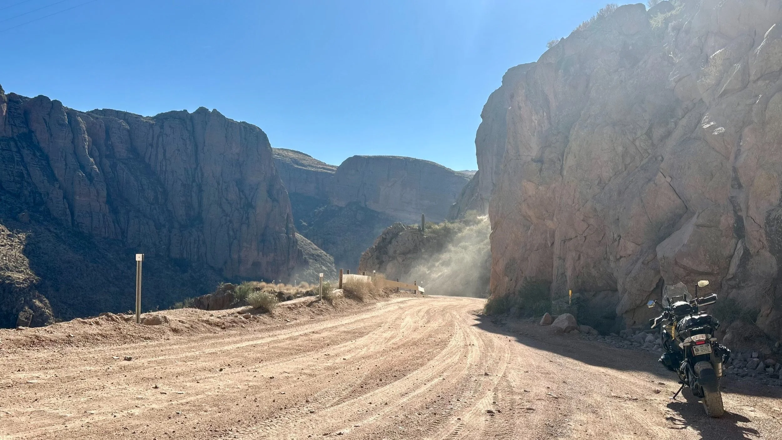
This is where the pavement turns to dirt.

Tortilla Flat (Photo Credit: Schuyler Estes)
Tortilla Flat is a great spot to refresh, hydrate, and have a snack before off-road riding. Turn on satellite communicators and secure loose luggage for the next part of the journey. While the dirt trail is usually well maintained, it is designated a “primitive road” so you’ll want to be prepared for tough terrain. You’ll navigate through cliffside mountain passes as you make the scenic passage to the Roosevelt Dam. Expect elevation changes of 1,000 feet with 15-17 percent slopes on dirt and gravel trails with wooden guard rails.
This is where the ride gets good.
From this point on, steep cliff drop-offs and epic roadside views characterize the trail as it winds steeply through 40 miles of rugged desert mountain wilderness, past reservoir lakes. This route is a road less traveled and not for the faint of heart. It is a journey that outmatches the destination. A part of the Apache Trail between Fish Creek Vista and Apache Lake Marina is now open as a rough road for limited access. It was closed because of significant damage and rock debris from severe flooding in 2019. The Woodbury Fire in June 2019 burned nearly 124,000 acres of the Tonto National Forest. In September 2019, a storm brought about six inches of rain to the fire area, causing major damage to the road, especially between Fish Creek Vista and milepost 227 (near Reavis Trailhead Road), where a rockslide made that part of the road impassable.

Theodore Roosevelt Dam
Photo By Nicholas Hartmann - Own work, CC BY-SA 4.0, https://commons.wikimedia.org/w/index.php?curid=51639491
You’ll know you’ve completed the trail once you reach the Theodore Roosevelt Dam. On the other side of the Dam, you will find Theodore Roosevelt Lake, which is recognized as the largest lake in the entire State of Arizona. Surrounding the lake, there are some great camping options that cater to all types of campers, from novices to seasoned outdoor enthusiasts. Everything from BLM lands and dispersed camping to well-maintained Forest Service Department campgrounds are available, providing you with multiple choices to set up camp for a restful night if you choose to do so.
Continue east on scenic State Route 188 to the old mining town of Globe to make a full circle loop back to Apache Junction. This loop not only offers diverse landscapes but also makes for a fantastic day trip that features a little bit of everything for motorcycle enthusiasts. Another option is to head northwest toward Payson, Arizona, where you’ll have the opportunity to climb to the breathtaking Mogollon Rim, an impressive 200-mile topographical feature that comprises the southern edge of the Colorado Plateau. The “Rim” is widely regarded as a bucket list location for motorcycle travelers exploring the beautiful terrain of Arizona. The Apache Trail offers great paved and dirt roads along with Native American heritage, Wild West history, and desert mountain wilderness. Without a doubt, it is well worth the ride.

Note: Mileages are approximate. Each rider is responsible for checking the current road conditions and assessing their own skills to ensure safety. All routes are provided "as is" without any liability.
Discalimer: Logbook entry content here is original and not AI-written. It consists of my personal accounts after scouting the routes myself. Each route description is submitted for AI detection and plagiarism before being published.
Copyright Protected © 2025 Lost Highways LLC. All rights reserved.