Lost Highways Routes
Back-road travel can be hazardous. Due to the many roads in our routes, we can't always track changing road conditions. Each rider is responsible for checking the current road conditions and assessing their own skills to ensure safety. All routes are provided "as is" without any liability.
-

Perkinsville Road
Total Distance: 50 miles point to point
Estimated Time: 2-3 hours
Max Elevation: 7,300 ft
Min Elevation: 4.600 ft
Terrain: Dirt, Gravel, Pavement
Difficulty: Intermediate
-

Native American Veterans Highway
Total Distance: 159 miles point to point
Estimated Time: 3-4 hours
Max Elevation: 8,042 ft
Min Elevation: 4,155 ft
Terrain: Pavement, Dirt, Volcanic Cinders
Difficulty: Easy
-

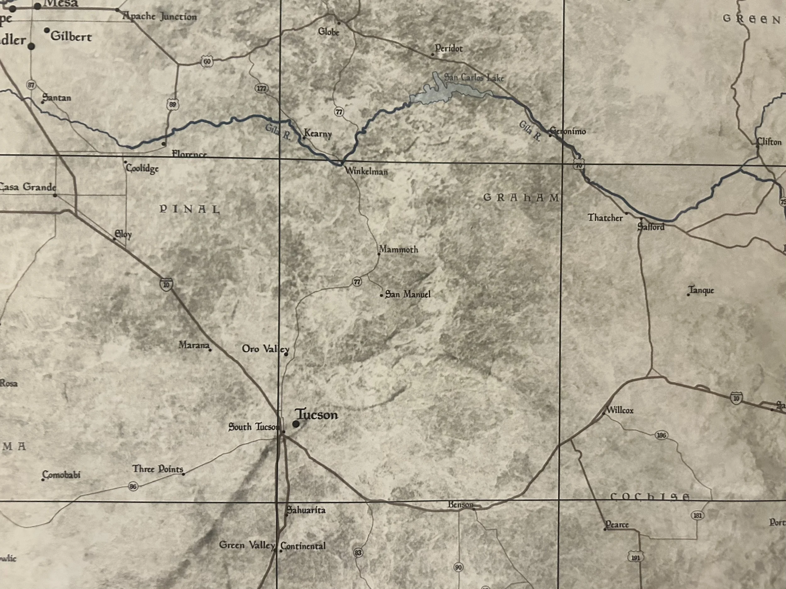
Geronimo Trail
Total Distance: 149 mile loop
Estimated Time: 5-6 hours
Max Elevation: 5,700 ft
Min Elevation: 4,006 ft
Terrain: Pavement, Gravel, Dirt
Difficulty: Intermediate
-

Castle Hot Springs Road
Total Distance: 52 mile loop
Estimated Time: 2-3 hours
Max Elevation: 3,329 ft
Min Elevation: 1,664 ft
Terrain: Pavement, Dirt
Difficulty: Easy
-
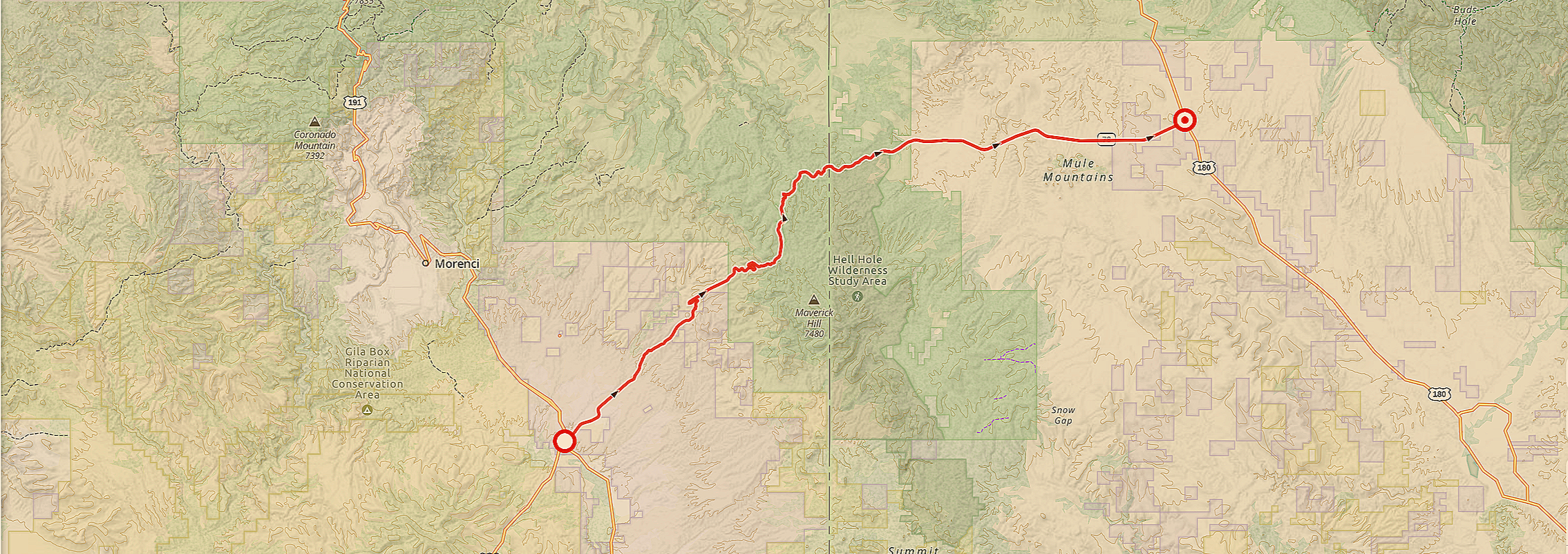
Mule Creek Highway
Total Distance: 70 miles out and back
Estimated Time: 2-3 hours
Max Elevation: 6,293 ft
Min Elevation: 3,632 ft
Terrain: Pavement
Difficulty: Easy
-

Bloody Basin Road
Total Distance: 72 miles point to point
Estimated Time: 3-4 hours
Max Elevation: 4,979 ft
Min Elevation: 2,402 ft
Terrain: Pavement, Gravel, Dirt
Difficulty: Intermediate
-

The Apache Trail
Total Distance: 44 miles point to point
Estimated Time: 2-3 hours
Max Elevation: 3,050 ft
Min Elevation: 1,715 ft
Terrain: Pavement and Dirt
Difficulty: Easy/Intermediate
-
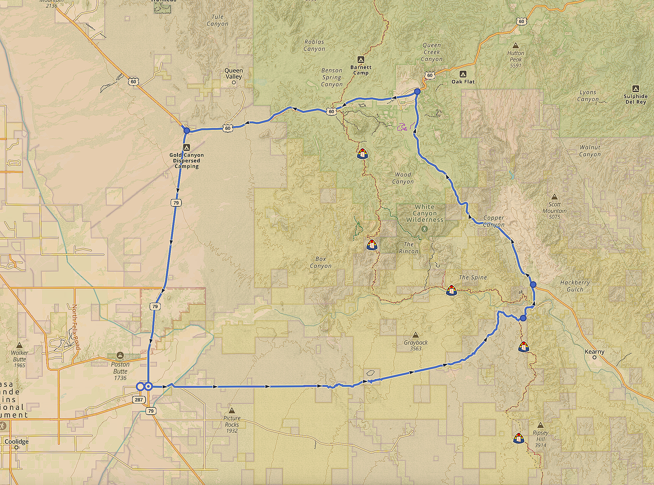
Florence-Kelvin Highway
Total Distance: 32 miles point to point, 75 mile loop
Estimated Time: 2-4 hours
Max Elevation: 3,706 ft
Min Elevation: 1,478 ft
Terrain: Pavement, Gravel, Dirt, Sand
Difficulty: Easy
-
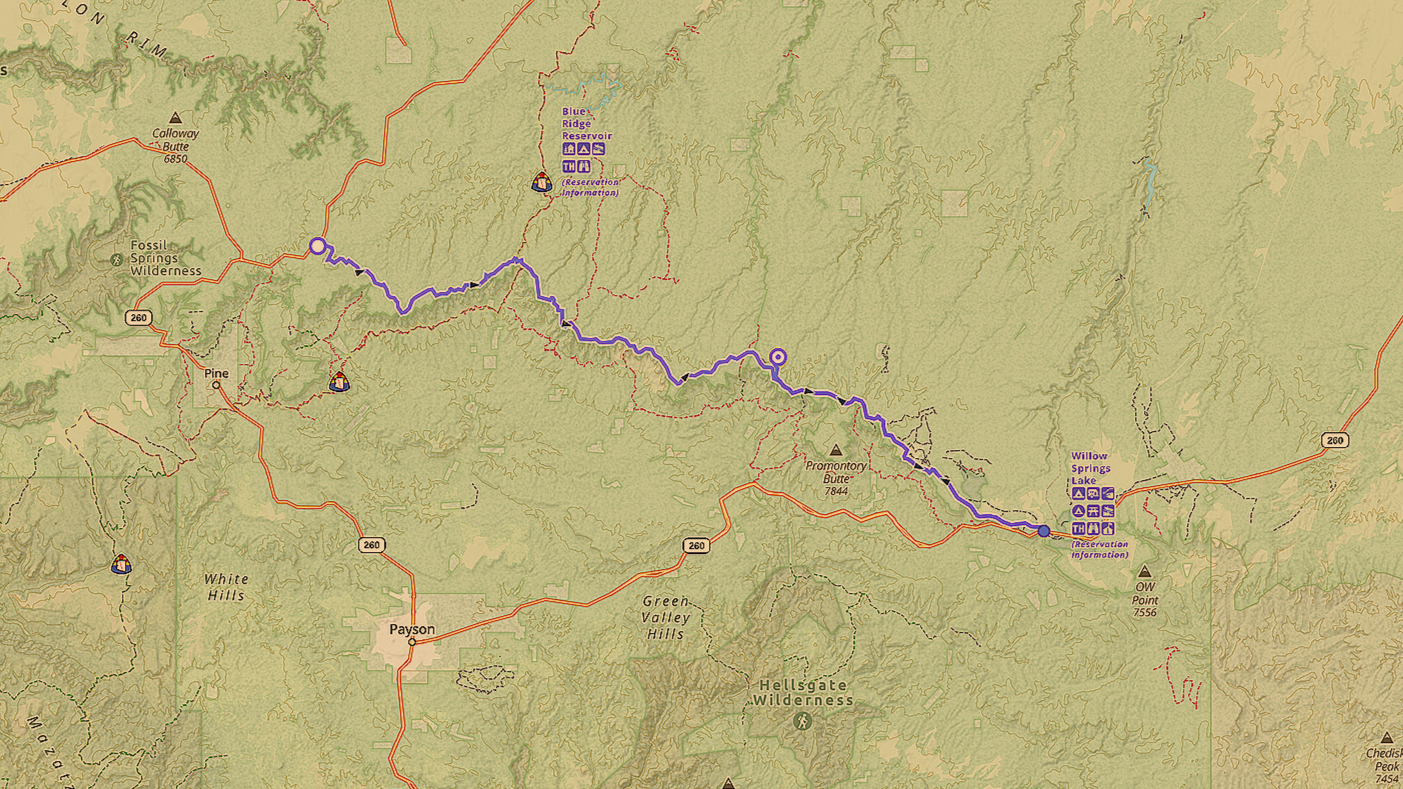
Rim Road
Total Distance: 43 miles point to point
Estimated Time: 3-4 hours
Max Elevation: 7,940 ft
Min Elevation: 7,275 ft
Terrain: Pavement, Gravel, Dirt, Rocks
Difficulty: Easy/Intermediate
-
The Coronado Trail
Coming Soon
-

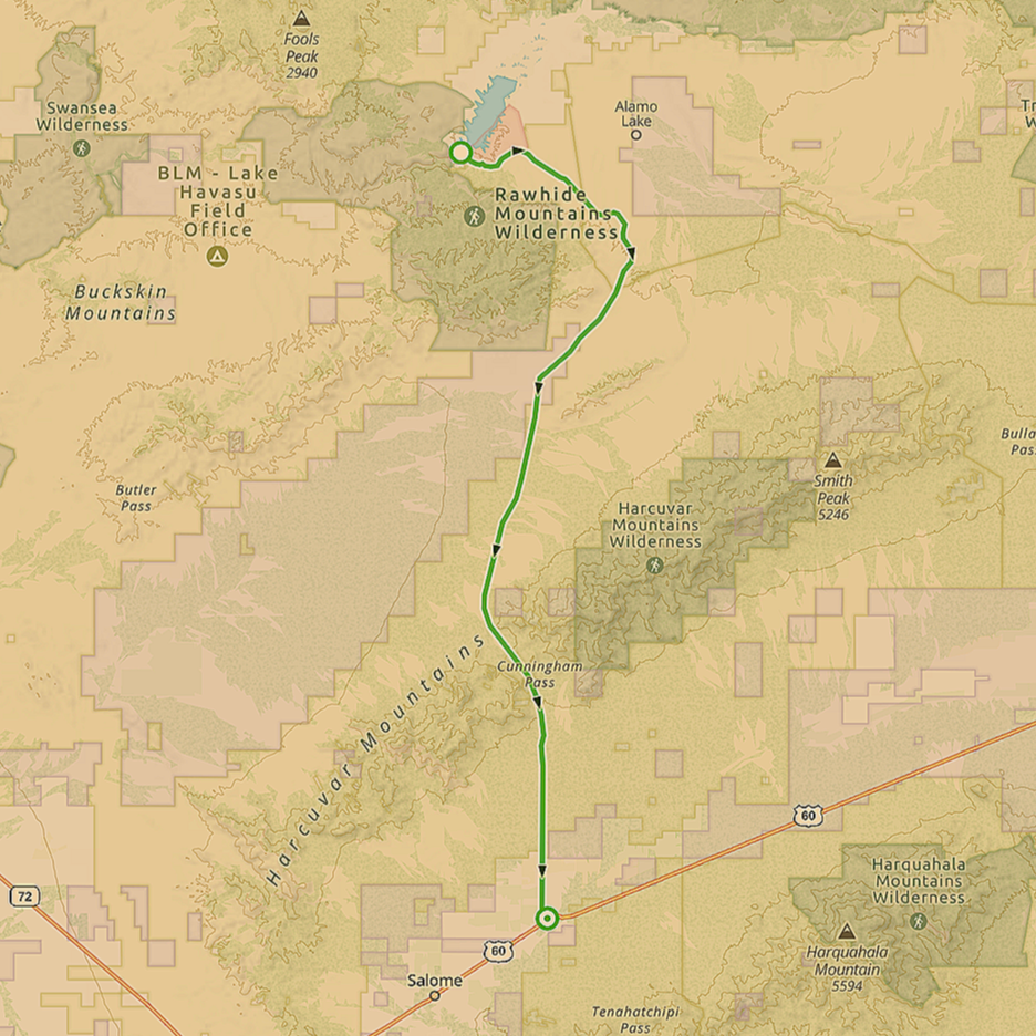
Salome Highway
Total Distance: 60 miles point to point
Estimated Time: 2 hours
Max Elevation: 1,872 ft
Min Elevation: 840 ft
Terrain: Pavement, Dirt, Gravel
Difficulty: Easy
-
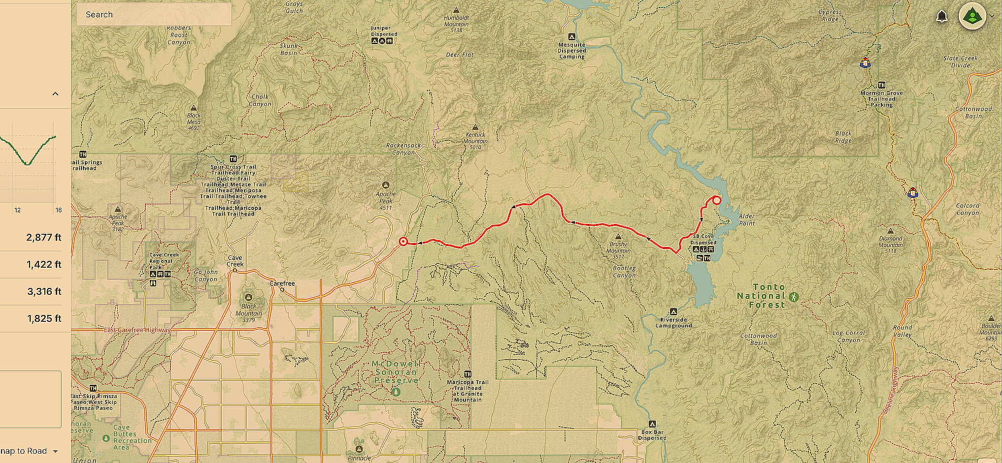
Bartlett Dam Road
Total Distance: 33.6 miles out and back
Estimated Time: 1 hour
Max Elevation: 3,316 ft
Min Elevation: 1,825 ft
Terrain: Pavement
Difficulty: Easy
-
Alamo Road
Total Distance: 72.6 miles out and back
Estimated Time: 2 hours
Max Elevation: 2,583 ft
Min Elevation: 1,105 ft
Terrain: Pavement
Difficulty: Easy
-
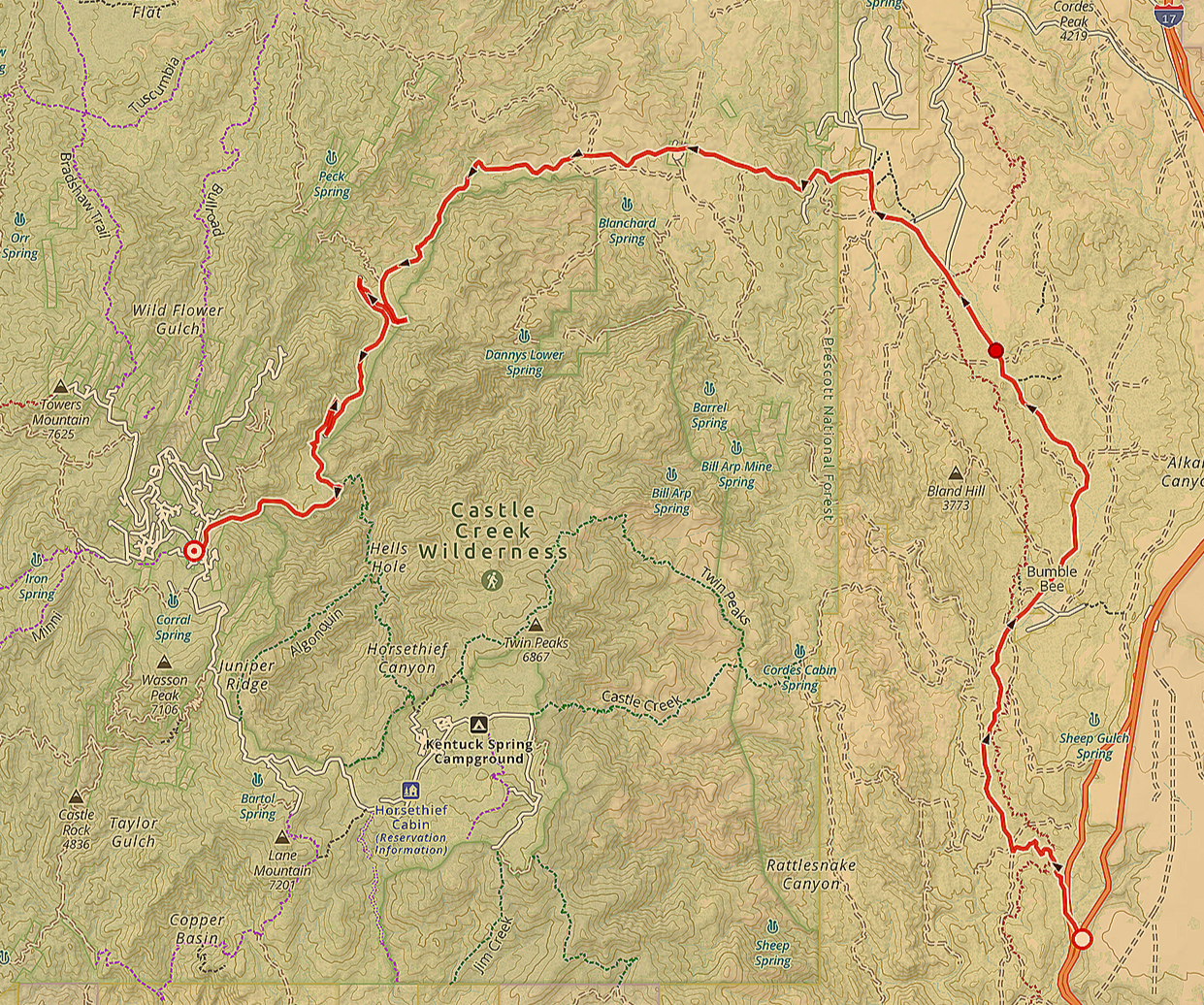
Crown King Road
Total Distance: 56.4 miles out and back
Estimated Time: 2-3 hours
Max Elevation: 5,781 ft
Min Elevation: 2,479 ft
Terrain: Gravel and Dirt
Difficulty: Intermediate
-
Old West Highway
Coming Soon
-
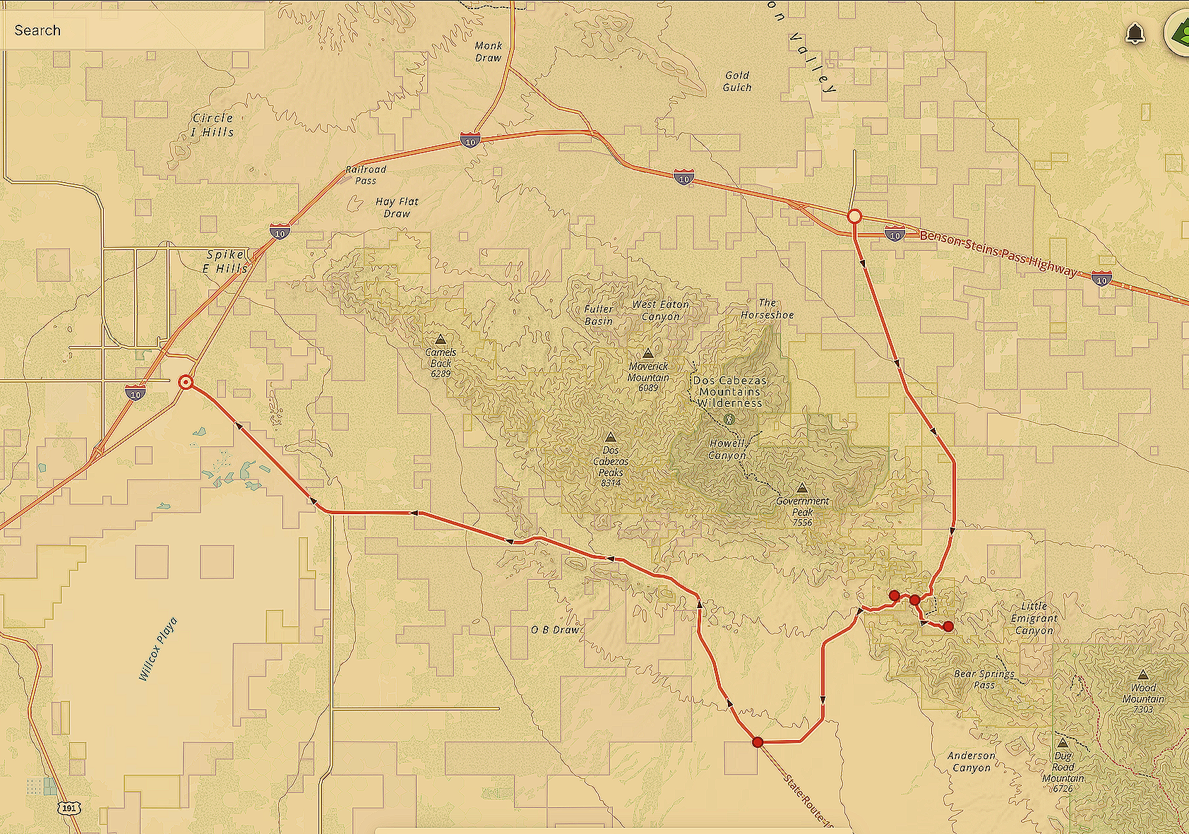
Apache Pass Road
Total Distance: 50 mile partial loop
Estimated Time: 4-5 hours*
*Includes 3 mile trail hike by foot
Max Elevation: 5,235 ft
Min Elevation: 3,760 ft
Terrain: Pavement, Dirt
Difficulty: Easy
-
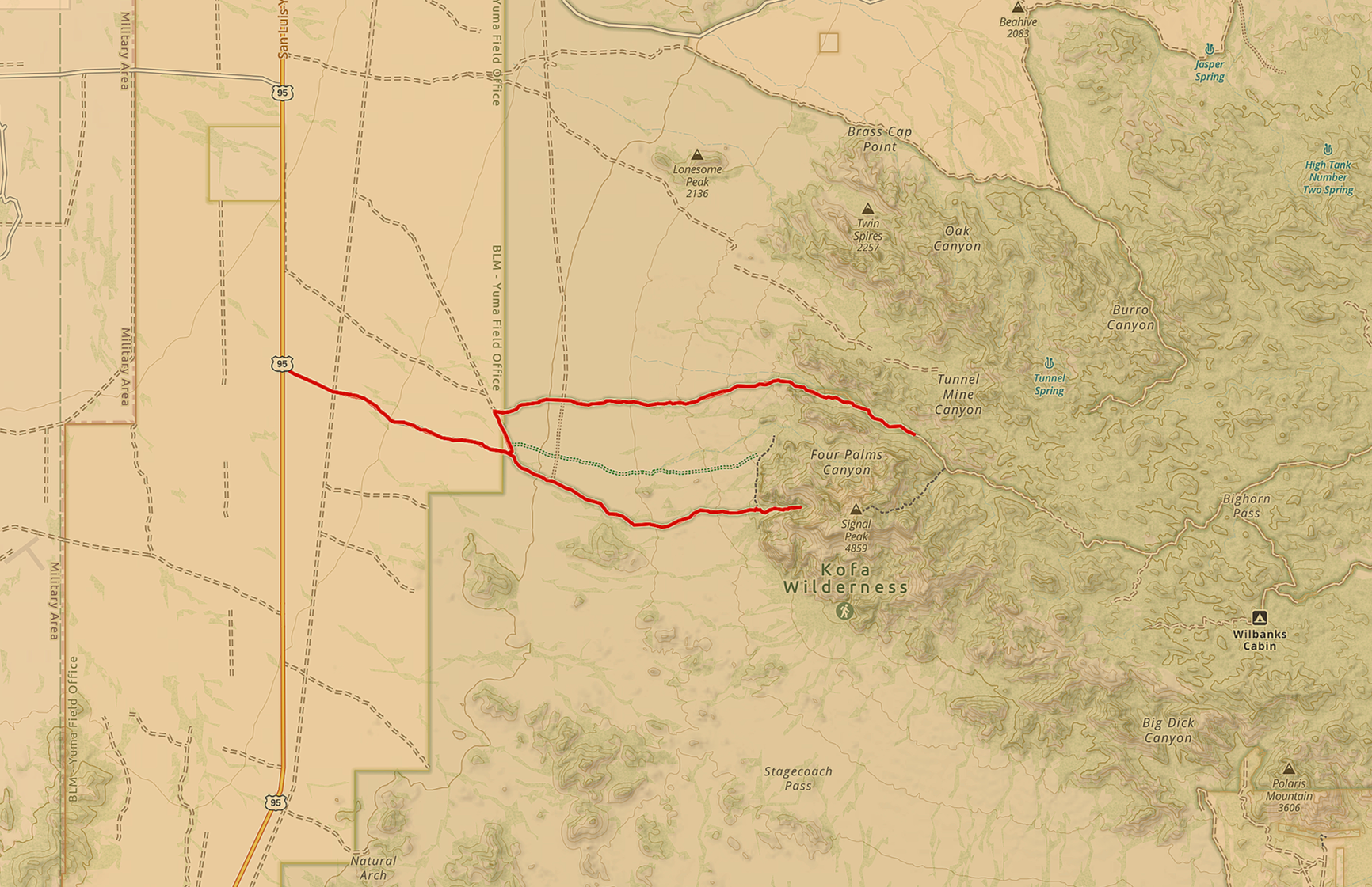
Palm Canyon Road
Total Distance: 69 miles out and back
Estimated Time: 4-5 hours*
*Includes 1.5 mile hike into Palm Canyon
Max Elevation: 2,735 ft
Min Elevation: 1,342 ft
Terrain: Dirt, Gravel, Rocks
Difficulty: Easy/Intermediate
-
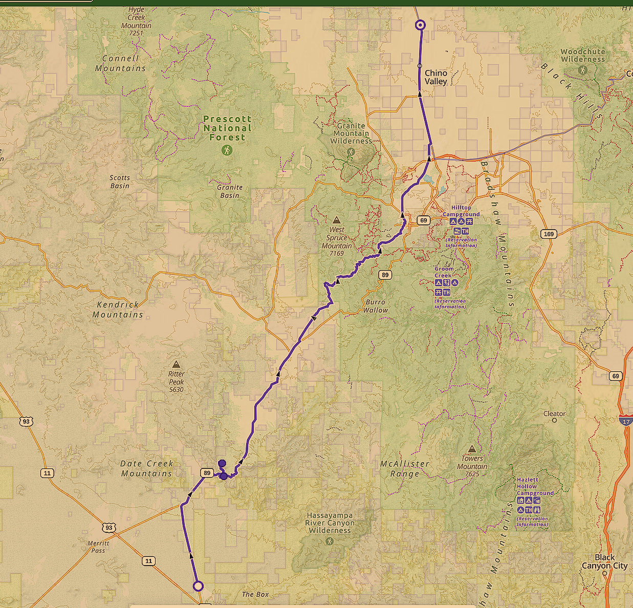
Granite MT Hotshots Memorial Hwy
Total Distance: 77 miles point to point
Estimated Time: 7-8 hours*
(*Includes 7-mile hike)
Max Elevation: 6,795 ft
Min Elevation: 2,563 ft
Terrain: Ride-Pavement / Hike-Steep and Rocky
Difficulty: Ride-Easy / Hike-Moderate
-
Simmons Highway
Coming Soon
-
Young Highway
Currently Scouting