Castle Hot Springs Road
Castle Hot Springs Road is a quiet and somewhat unknown off-pavement trail tucked away in the Bradshaw Mountain range of central Arizona. On this route, you’ll ride through landscapes of the old west where cowboys and cavalries traveled and also through one of the most mineral-rich areas in the world. The old stagecoach trail leads to a historic wellness resort popular with celebrities from the Gilded Age and wealthy business leaders who often vacationed there in winter. A sacred retreat for Yavapai natives as well as U.S. combat veterans during World War II, many sought out therapeutic and spiritual healing at the Castle Hot Springs desert oasis. There is so much natural beauty to take in when riding this old stagecoach trail that every turn will make you want to keep exploring.

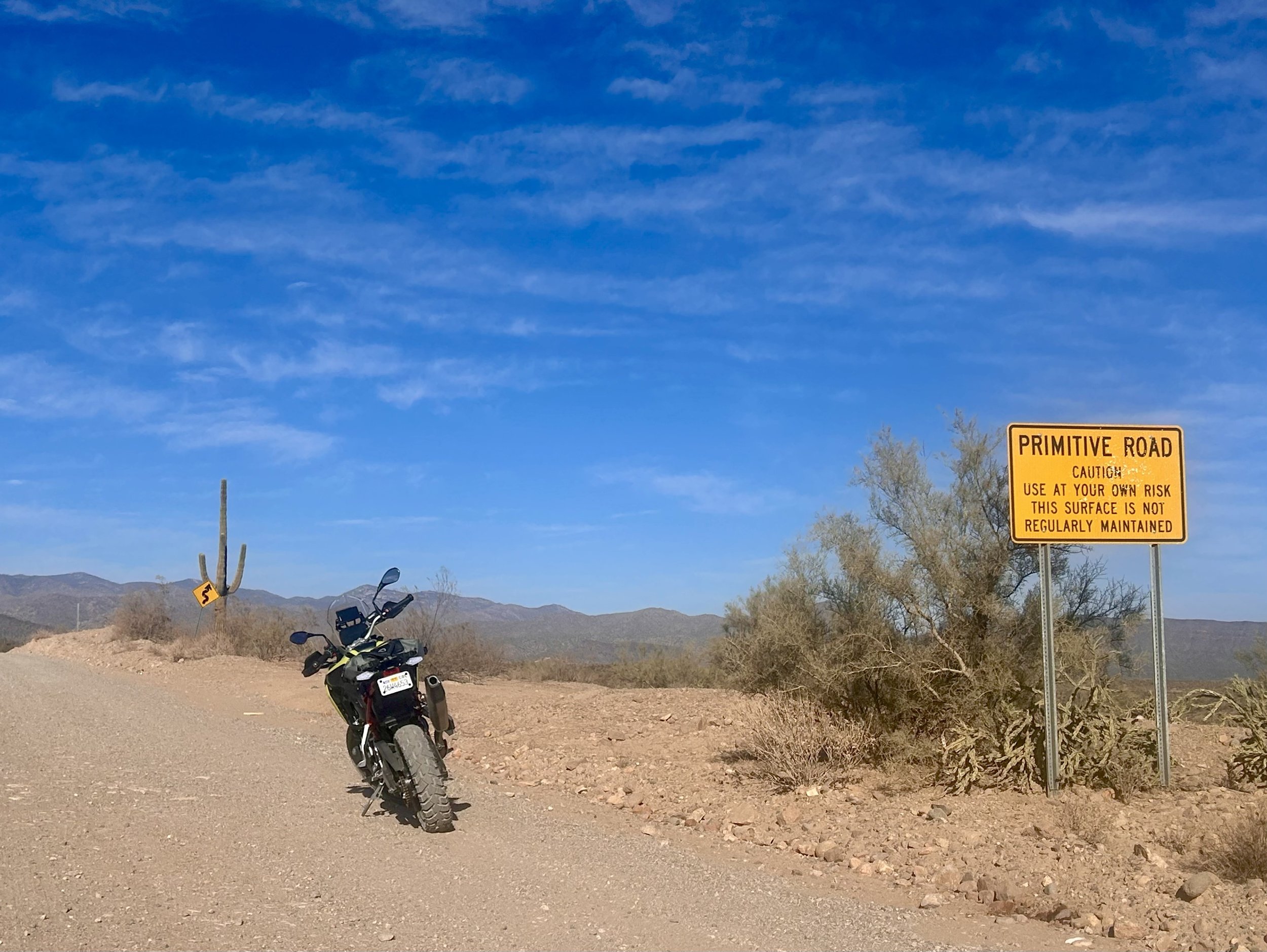
The route runs east to west and can be accessed on either end of Arizona State Route 74, also known as Carefree Highway. From the east, travel north 10 miles on N. Castle Hot Springs Road past the entrance to Lake Pleasant Regional Park until you come to a “T” at the end of the road, then turn left. After a few hundred feet the pavement turns to dirt. As you ride away from the regional park leaving the scenic overlook of Lake Pleasant behind, you will enter the primitive road section of the trail in the Hell’s Canyon Wilderness. At this point you are about 10 miles away from Castle Hot Springs resort. Keep your head on a swivel for wildlife such as desert mule deer, wild burros, javelina and the occasional mountain lion.
As you approach the resort, you’ll see signs posted for “no stopping” and slow speed limits. Please follow these signs to reduce dust on the trail and respect the privacy of the few local residents living on private property nearby. Be sure to look up to the left when passing by the resort entrance to see a U.S. flag planted at the top of Salvation Peak. The longest and most challenging hike in the area, the flag featured at the top of the peak was first put there by servicemen recovering at the Castle Hot Springs during and after World War II. It is said that John F. Kennedy, during his convalescence in 1945, was in the group of servicemen who hiked to the top of the peak to plant the original flag, adding to the trail's history.

Salvation Peak - Image obtained from castle hot springs
Castle Hot Springs is not your ordinary upscale all-inclusive resort. Originally built in 1896, it was Arizona’s first luxury wellness resort with a rich history, attracting wealthy families, including the Roosevelts, Wrigley’s and Rockefellers. The property was destroyed by fires in 1976 and 1996 until it was restored and reopened in 2019. With secluded oasis vibes and rates just over $2,100 a night, staying here is a serious commitment. For the few who do, I would imagine it's an unforgettable experience. For the rest of us, no visitors are allowed, so just keep going on the trail. The best riding and stunning views are right up ahead.

Castle Hot Springs Resort - Image obtained from castle hot springs
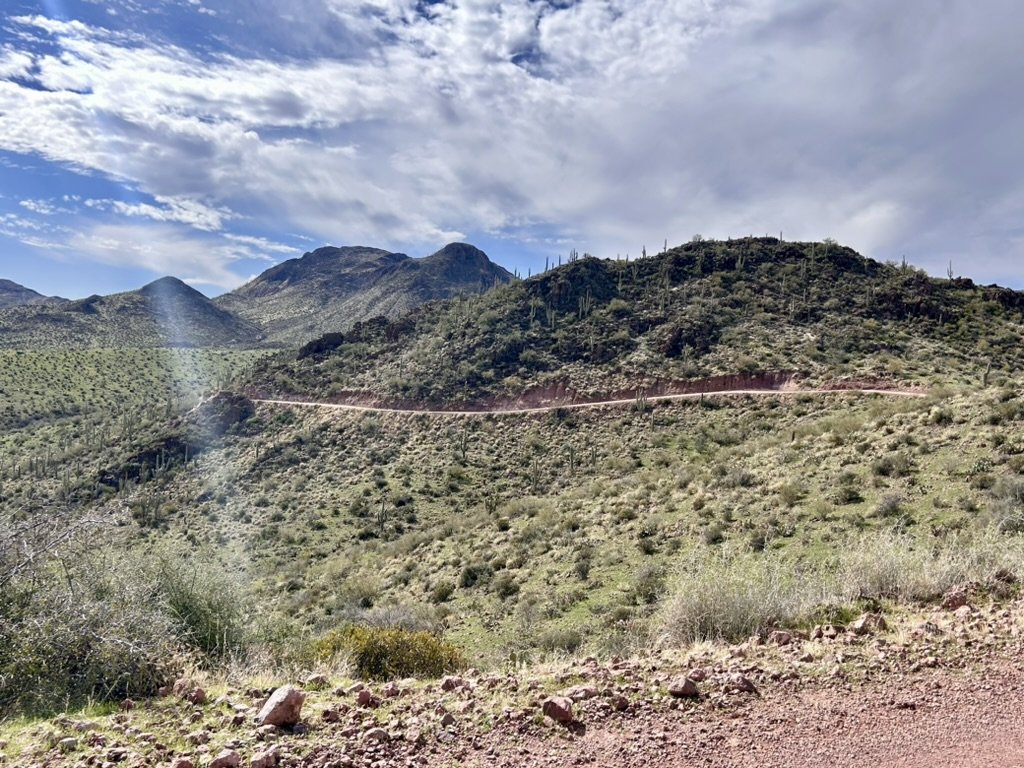
After passing the resort, the route continues on a backcountry rugged trail through the Hieroglyphic Mountains. Continue on winding dirt roads carved out of the sides of the mountaintop. Stay to the right while riding here, as jeeps and side-by-side vehicles may be approaching from the other direction in this area. As you descend to lower elevation the trail turns to red clay soil with shallow water crossings and partially rutted out roads especially after rainy weather conditions. Further up the trail, a road sign pointed north leads to a back way to the unincorporated town of Crown King. This is an extremely challenging route to the historic mining town. Only expert riders should attempt this detour as the alternate and well-maintained route to Crown King can be accessed about 55 miles north of Phoenix by way of Bumble Bee Road.
The total distance for this route from point to point is 36.4 miles, or 52 miles if completed as a loop and takes approximately 2-3 hours. This route is perfect for a half-day outing leaving plenty of time to explore one of the many hiking trails or bring a lunch to enjoy a trailside picnic. The best time of year to ride in this region of Arizona is November to April, and it's considered by most as an easy off-road trail. Do not attempt this trail during summer months due to the high temperatures that can soar over 100 degrees Fahrenheit. Cell service can be spotty most of the time so it’s best to bring along a satellite communicator and navigation device, as well as a tire puncture kit and the necessary tools to do any trailside repairs.
I love the opportunity to stop on the side of this trail, dismount my motorcycle and just listen to the silence and enjoy the views. It's the best part about this route. To obtain elevation profiles, GPS coordinates, and more points of interest for this route and many others you can purchase a “Best Dirt Roads in Arizona - Arizona Adventure Series Map” from Butler Maps. Use the code “losthighways” to get a discount and support our website and the Adventure Rider Community.
To ride Castle Hot Springs Road is an adventure in itself. Every time I ride this trail, I feel the same special connection to its history, to the mountains, its natural surroundings, and to the people who traveled it over time.
Enjoy the adventure and ride safe.
Note: Mileages are approximate. Each rider is responsible for checking the current road conditions and assessing their own skills to ensure safety. All routes are provided "as is" without any liability.
Discalimer: Logbook entry content here is original and not AI-written. It consists of my personal accounts after scouting the routes myself. Each route description is submitted for AI detection and plagiarism before being published.
Copyright Protected © 2025 Lost Highways LLC. All rights reserved.