Mule Creek Highway
Think back to a road you used to travel when you were a kid. Maybe the state highway you went down to go fishing with your dad, or the one you took to a family cottage for the 4th of July weekend. A backroad that few people even knew existed. Each segment, untouched, pure, and timeless, is branded in your memory, one that holds a special place in your heart. This is Mule Creek Highway, a real lost highway that embodies the spirit of the road less traveled. The riding experience unfolds like a story, from the scenic climb through the Big Lue Mountains in Arizona to the wide, rolling prairies of New Mexico. Every turn in the road reveals a new chapter, with rocky, juniper-studded hills and views of 7,000-foot mountain peaks giving way to vast, open skies. It's an unforgettable motorcycle journey.
Also known as State Route 78, Mule Creek Highway is off the beaten path in the far reaches of Greenlee County. It is situated at a junction with one of America's most well-known highways, old U.S. Route 666, "Devil's Highway”. On a side note, the infamous highway was renamed US-191 in 1992 in an effort to move away from a negative connotation and dangerous reputation of a high fatality rate. Now named the “Coronado Trail”, the National Scenic Byway boasts more than 400 sharp turns in a 120-mile stretch, climbing to over 8,000 feet between the towns of Clifton and Alpine in the White Mountains of Arizona. From Clifton, follow US-191 south for nine miles to a rural intersection in the high desert town of Three Way. This marks the start of Mule Creek Highway. The remote desert road leads to the Big Lue Mountain range in the southeast corner of Apache-Sitgreaves National Forest.
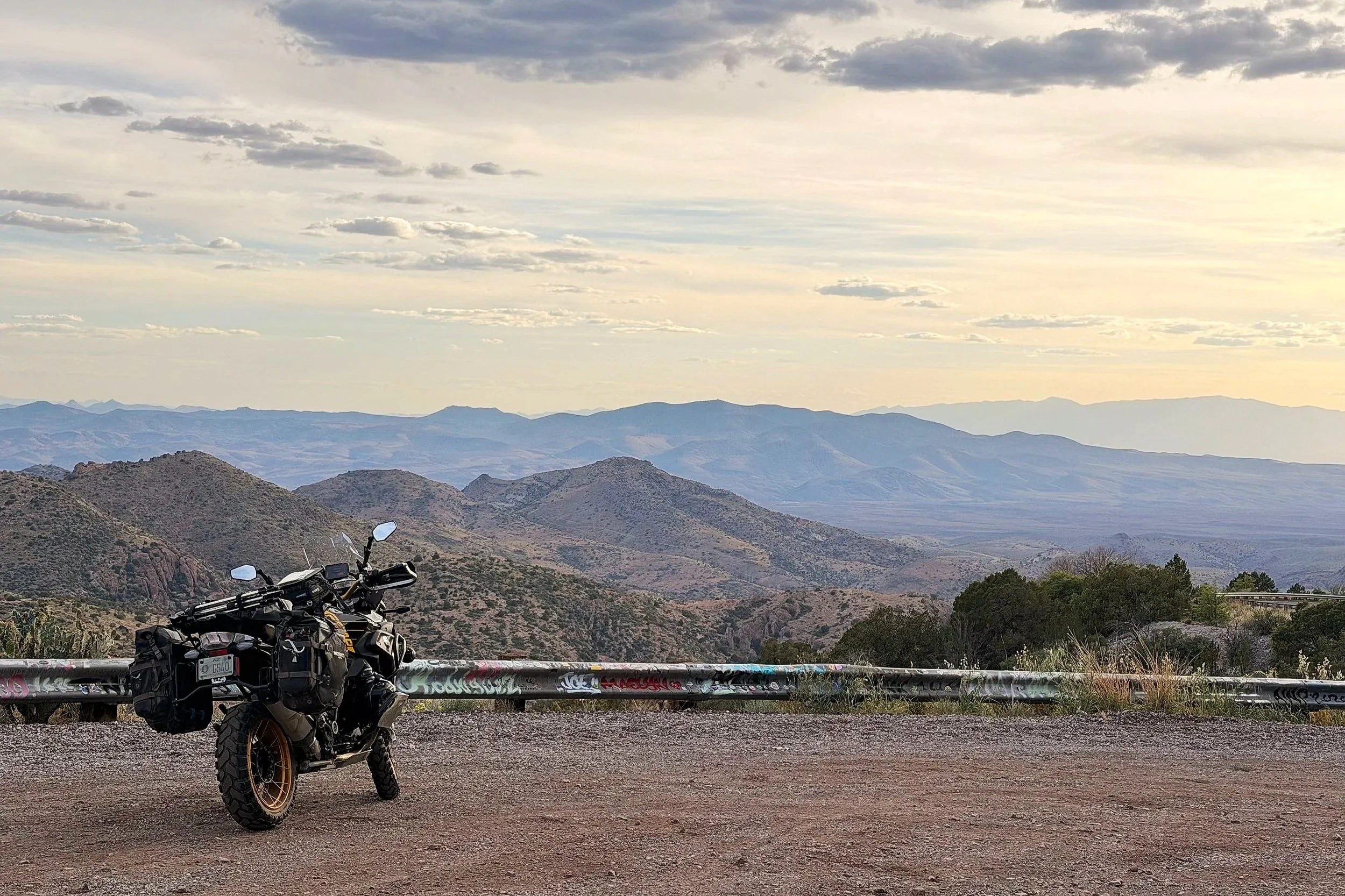
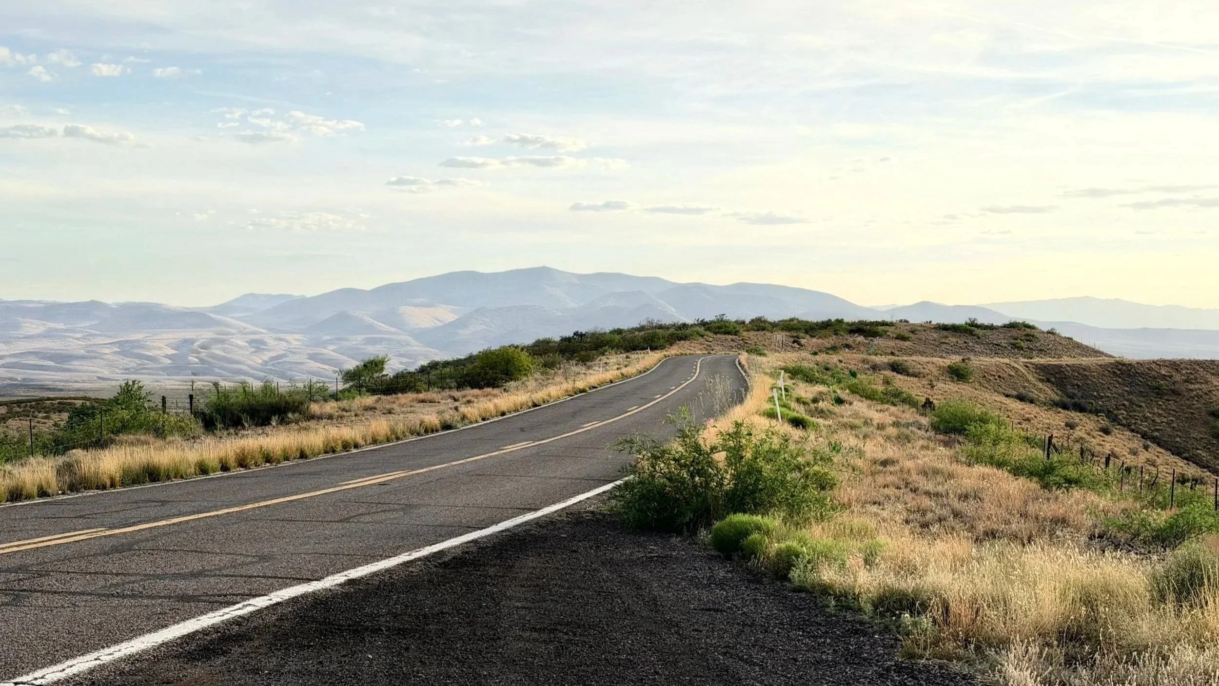
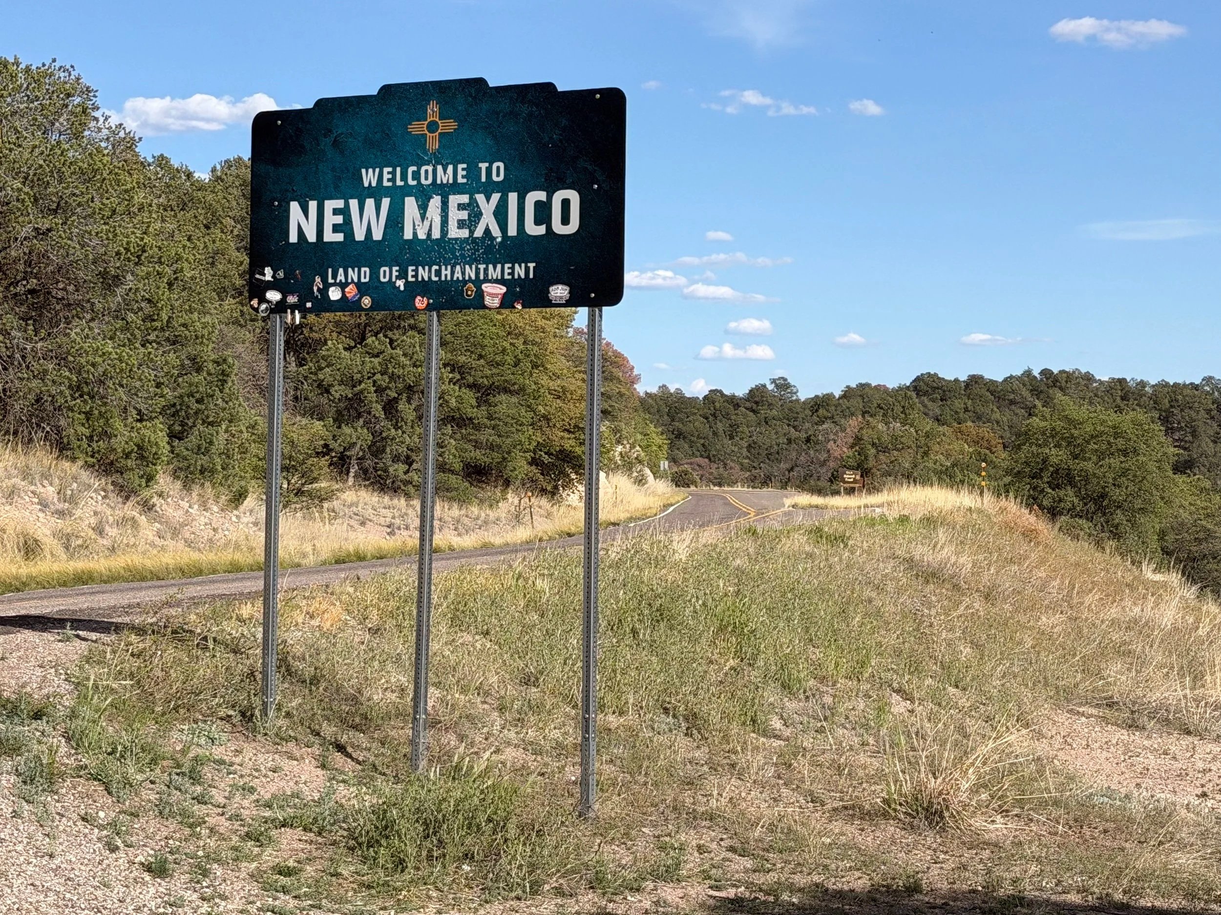
The environment changes after just a few miles, transitioning from a landscape dotted with prickly pear cactus and high-desert vegetation to areas of dense oak-pine forest. A roadside pull-off near Black Jack Campground, located six miles from the New Mexico state line, offers scenic views of Palace Peak and Hells Hole Peak. Continuing east, a couple of things change immediately: the time zone switches to Mountain Time, and you'll leave Apache-Sitgreaves National Forest in Arizona, and enter Gila National Forest in New Mexico. These federal public lands while adjacent to one another are vastly different. Apache-Sitgreaves National Forest is renowned for elevation, ranging from 3,500 feet in Clifton to over 11,000 feet at Mount Baldy Wilderness. It is also home to a large portion of the Mogollon Rim and White Mountains, as well as more lakes, reservoirs, rivers and streams than can be found in any other southwestern forest. Gila National Forest on the other hand, has 3.3 million acres of forested hills, mountains, and range land. It is where Wilderness was born and according to the U.S. Forest Service, was the world's first area of land designated as wilderness.
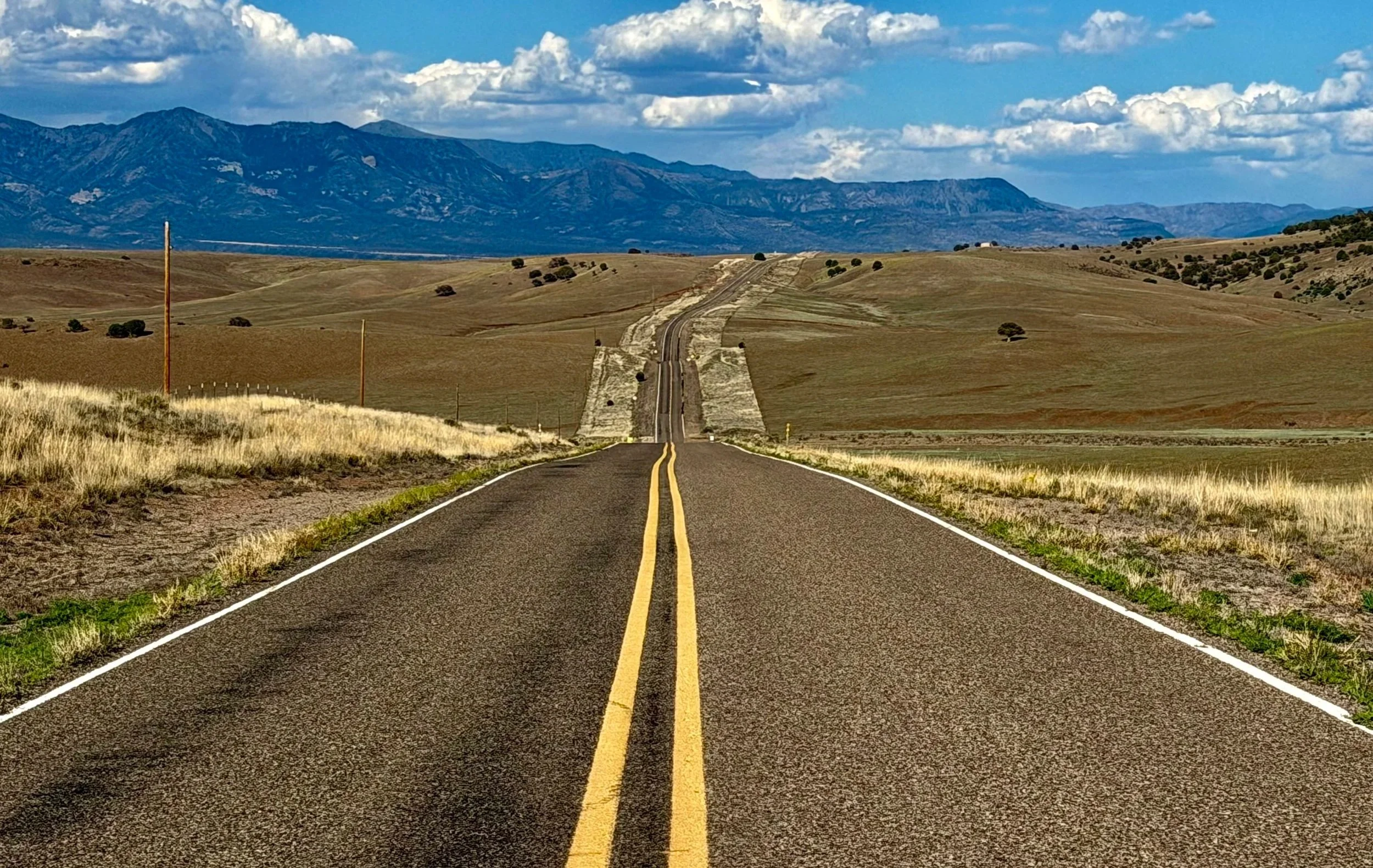
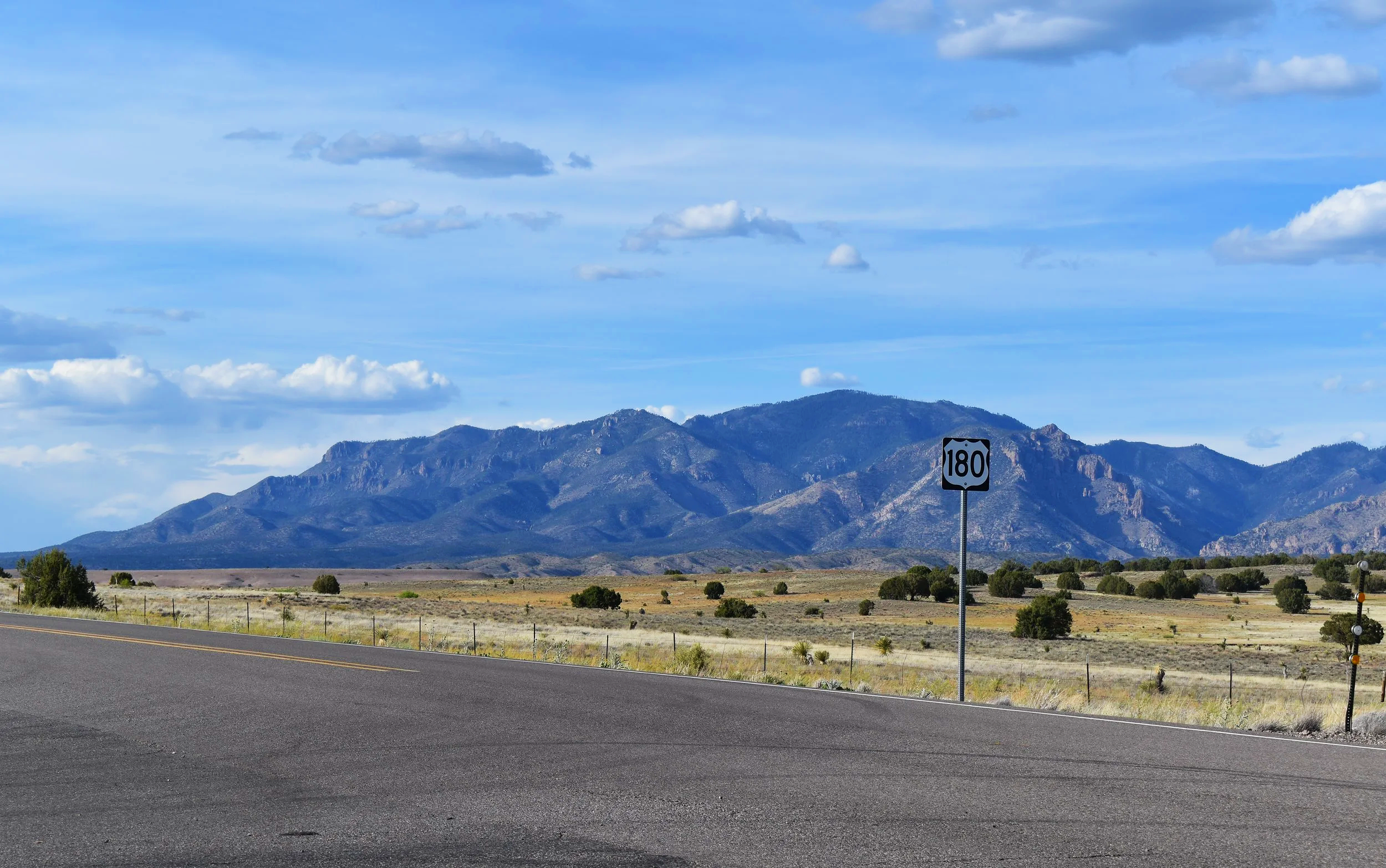
Once a gravel road until the 1960s, Mule Creek Highway takes on a new name in New Mexico: A.M. Curley Traynor Memorial Highway, after the local rancher who paved the remaining section all the way to US Route 180. Emerging from the Gila National Forest and passing through the tiny town of Mule Creek, the landscape transforms into expansive, rolling grasslands, offering scenic views of the Mogollon Mountains to the northeast. A sense of openness takes over on the final 15-mile stretch before this route ends at an interchange with US-180. From here, you can head north to the town of Alpine, known as the “Alps of Arizona.” Or, head south 45 miles to Silver City, a historic “Wild West” mining town where “Billy the Kid” grew up. Another option is to simply return the way you came and experience the remoteness of Mule Creek Highway all over again.

This route measures at 35 miles point-to-point, making it a great option for an out-and-back ride from the nearby towns of Clifton, Morenci, or Safford in Arizona. If you have more time and are looking for a bigger adventure, include US-180 and US-191 for a full loop you won't forget. Consider the time of year and weather when traveling these highways due to dramatic elevation changes and road conditions. Some sections may be impassable due to snow and ice during winter months. Excessive heat can also be dangerous during peak summer months especially at lower elevations. The sweet spot is Autumn and late Spring. And finally, always be cautious of wildlife when traveling through national forests, especially while riding a motorcycle.
Not all roads are created equal, and Mule Creek Highway is no exception. The best part about this highway is that it’s not well known. Many who have ridden it will tell you they experienced complete solitude here. It's a place for isolation and connection, a place to get lost and find yourself. But it won't last long; soon enough, word will get out, traffic will pick up, crowds will follow, and the experience will change. Now is the time. Gear up, mount up, and head out on this lost highway while you can before it's too late.
Ride safe and enjoy the adventure.
Note: Mileages are approximate. Each rider is responsible for checking the current road conditions and assessing their own skills to ensure safety. All routes are provided "as is" without any liability.
Discalimer: Logbook entry content here is original and not AI-written. It consists of my personal accounts after scouting the routes myself.
Copyright Protected © 2026 Lost Highways LLC. All rights reserved.