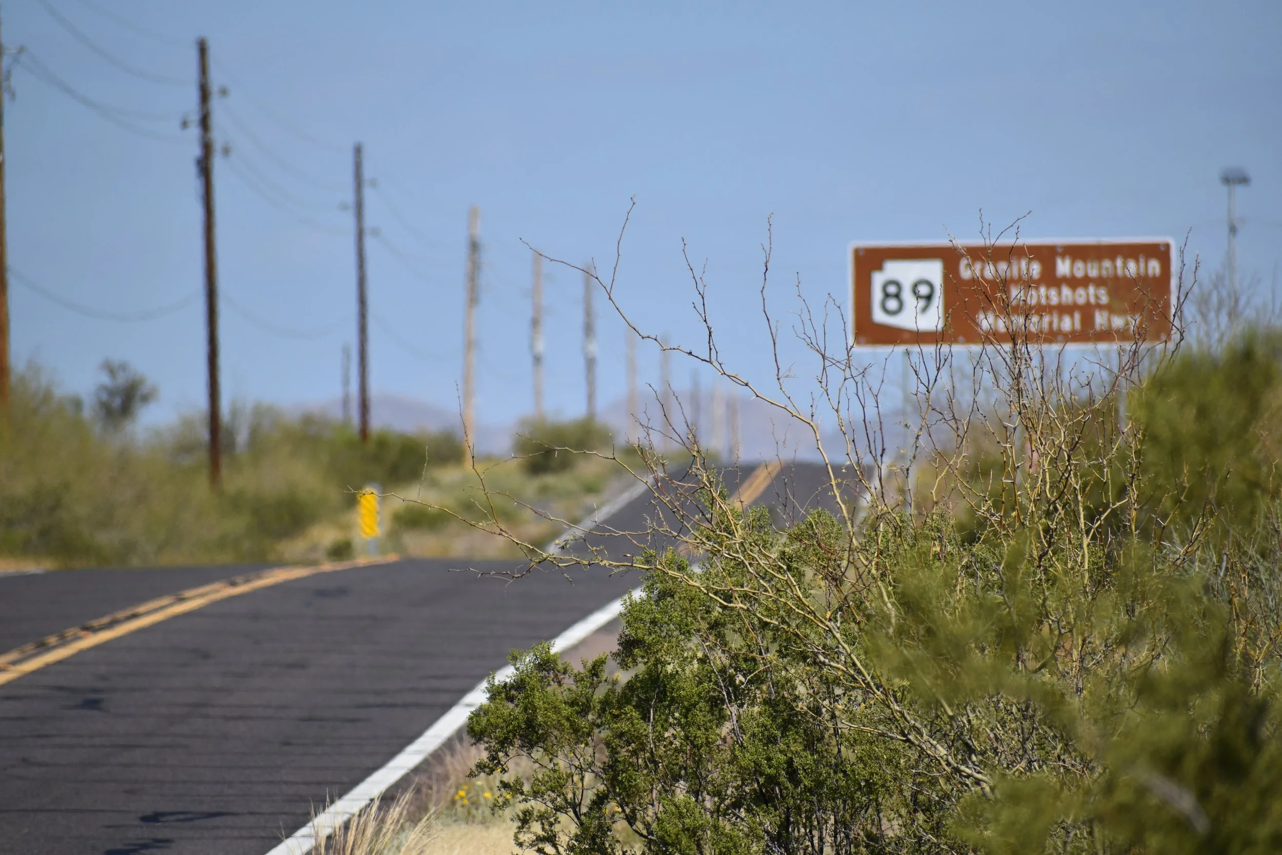
Granite Mountain Hotshots Memorial Hwy
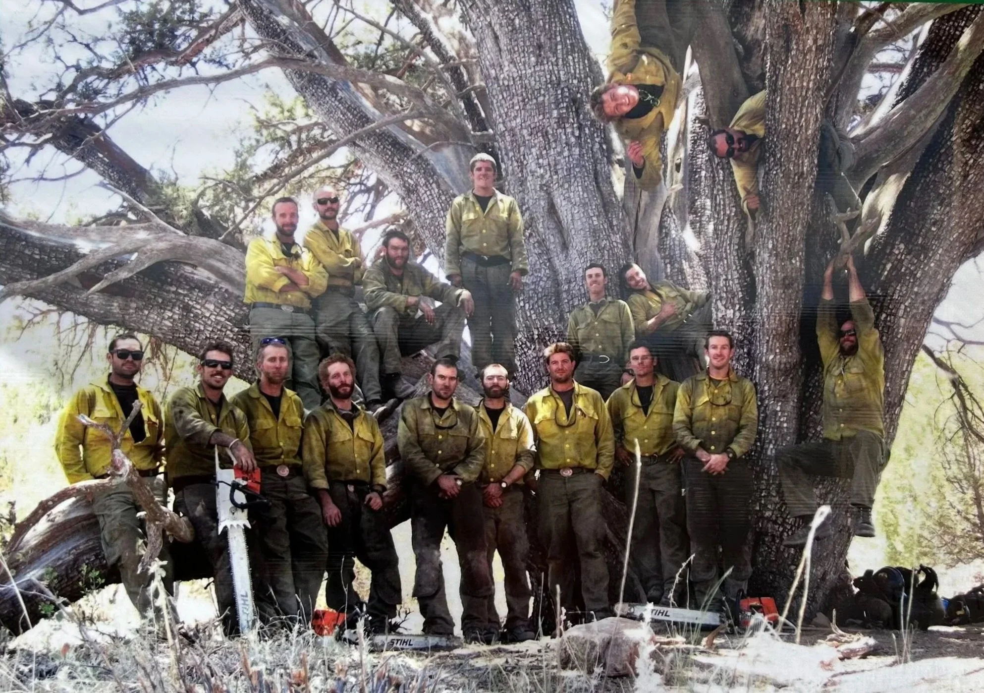
Beyond the winding roads, breathtaking views, and dramatic elevation climbs, the journey on Granite Mountain Hotshots Memorial Highway holds a special significance. The road commemorates 19 brave men who made the ultimate sacrifice to protect their community. It is a story of camaraderie, heroism, and unwavering service. The Interagency Hotshot Crew was a unit within the Prescott Fire Department, dedicated to fighting wildfires. Pictured below in front of a Grandfather Tree (or Giant Alligator Juniper) in Prescott National Forest, they tragically lost their lives while battling the devastating Yarnell Hill Fire in 2013. The massive, 1,000–2,000-year-old juniper tree serves as a memorial to the Hotshots, who saved it during the 2013 Doce Fire. Additionally, a section of State Route 89, between Wickenburg and Chino Valley, was renamed in honor of this elite Wildland Fire crew.
Every mile on this route serves as a lasting tribute to their memory.
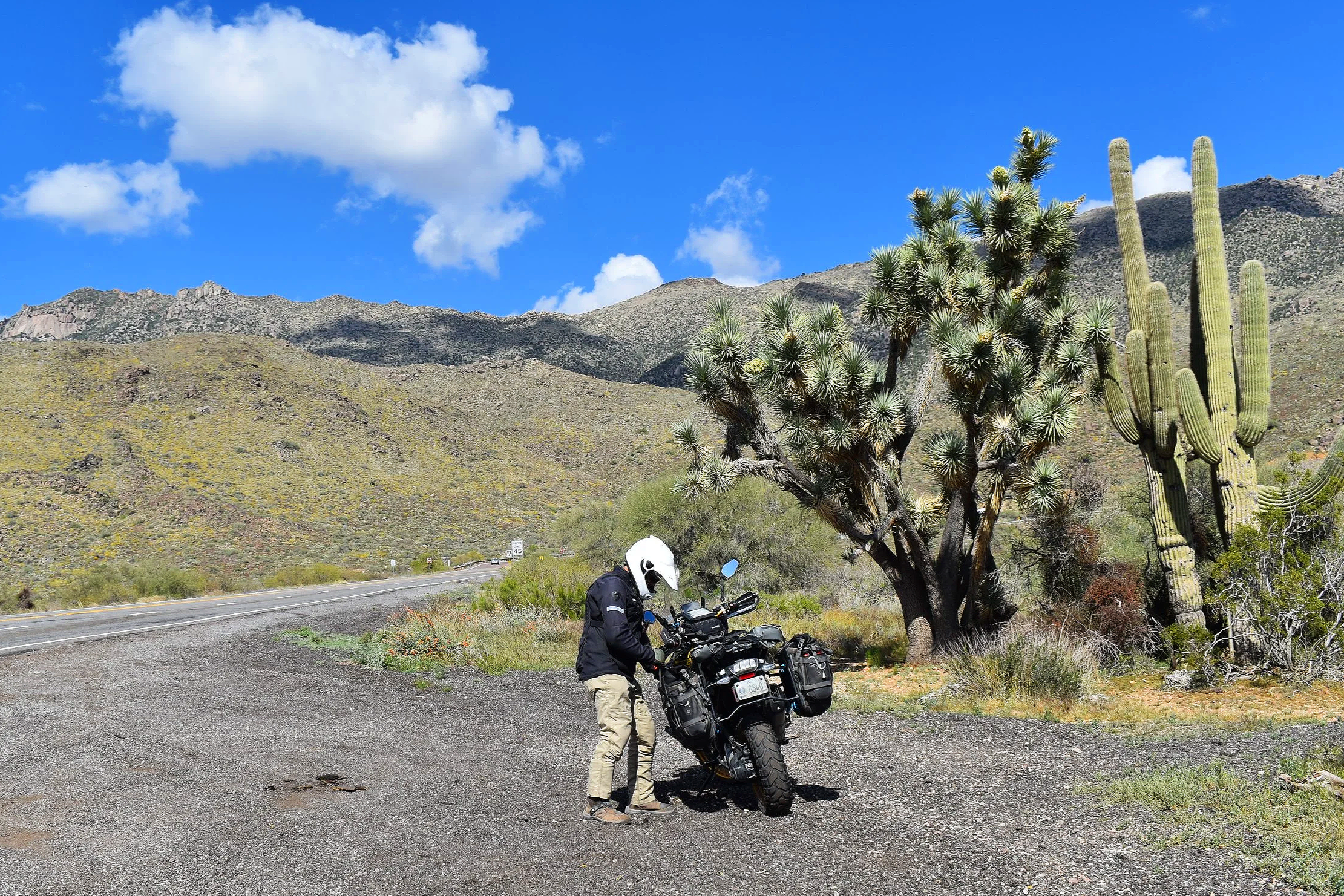
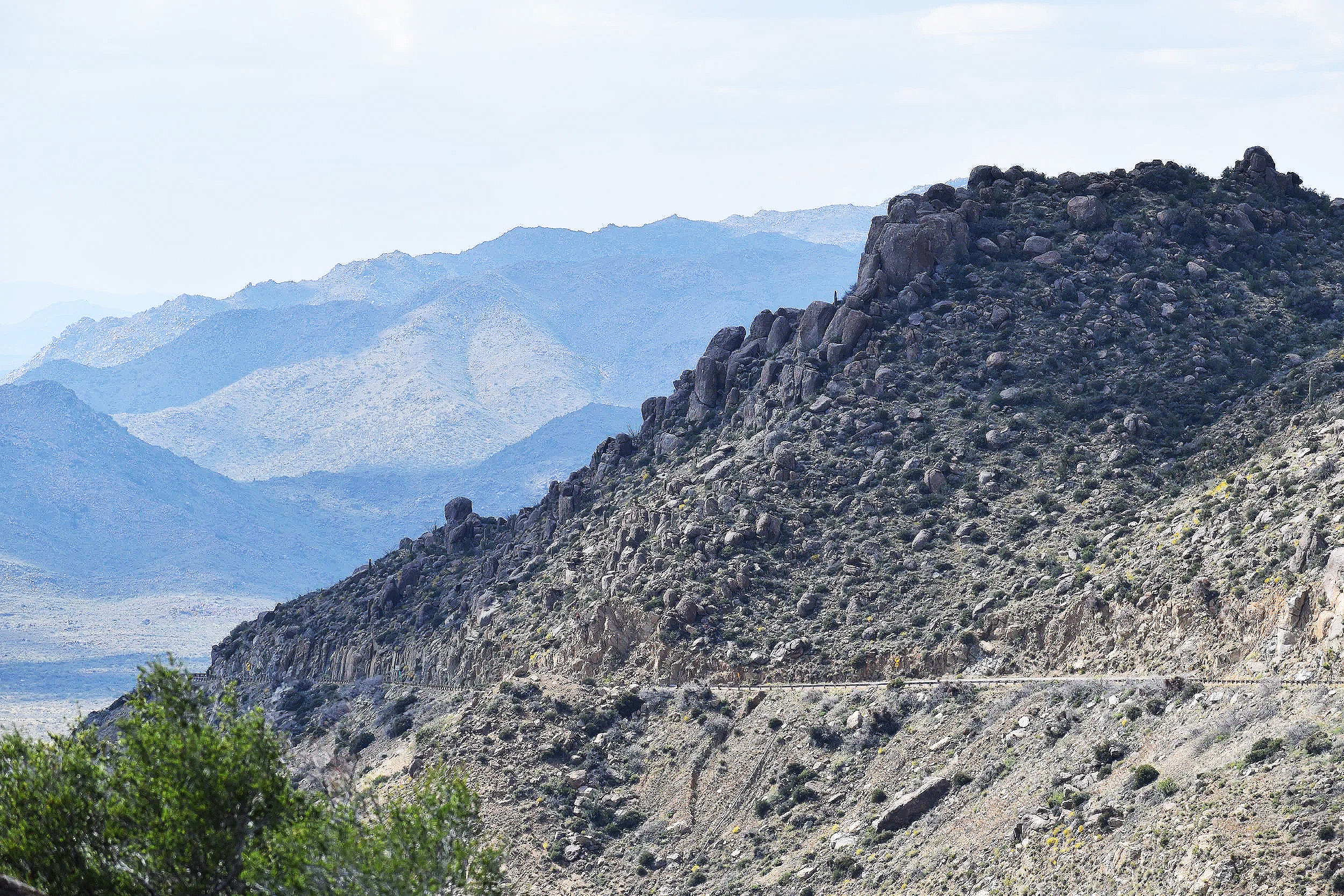
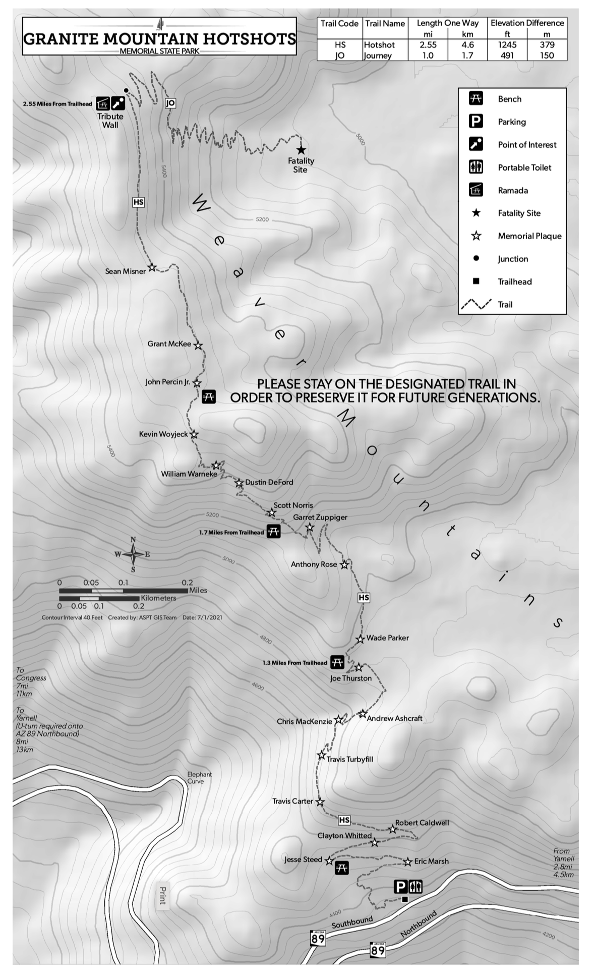
This route begins in central-west Arizona near the old gold mining town of Congress at the base of the Weaver Mountains. Known for its granite boulder-strewn range characterized by a mix of upland Sonoran desert scrub and chaparral, the mountain range peaks at over 6,000 feet. Be sure to secure your gear before heading out on this trip. The initial ascent is dramatic, covering 1,300 feet in just four miles on a twisty mountain pass. Perched on the mountainside is the Granite Mountain Hotshot Memorial State Park where a small parking area is located just off the highway. From the parking area a memorial trail follows the footsteps of the Hotshots crew to the incident site deep within the Weaver Mountains.
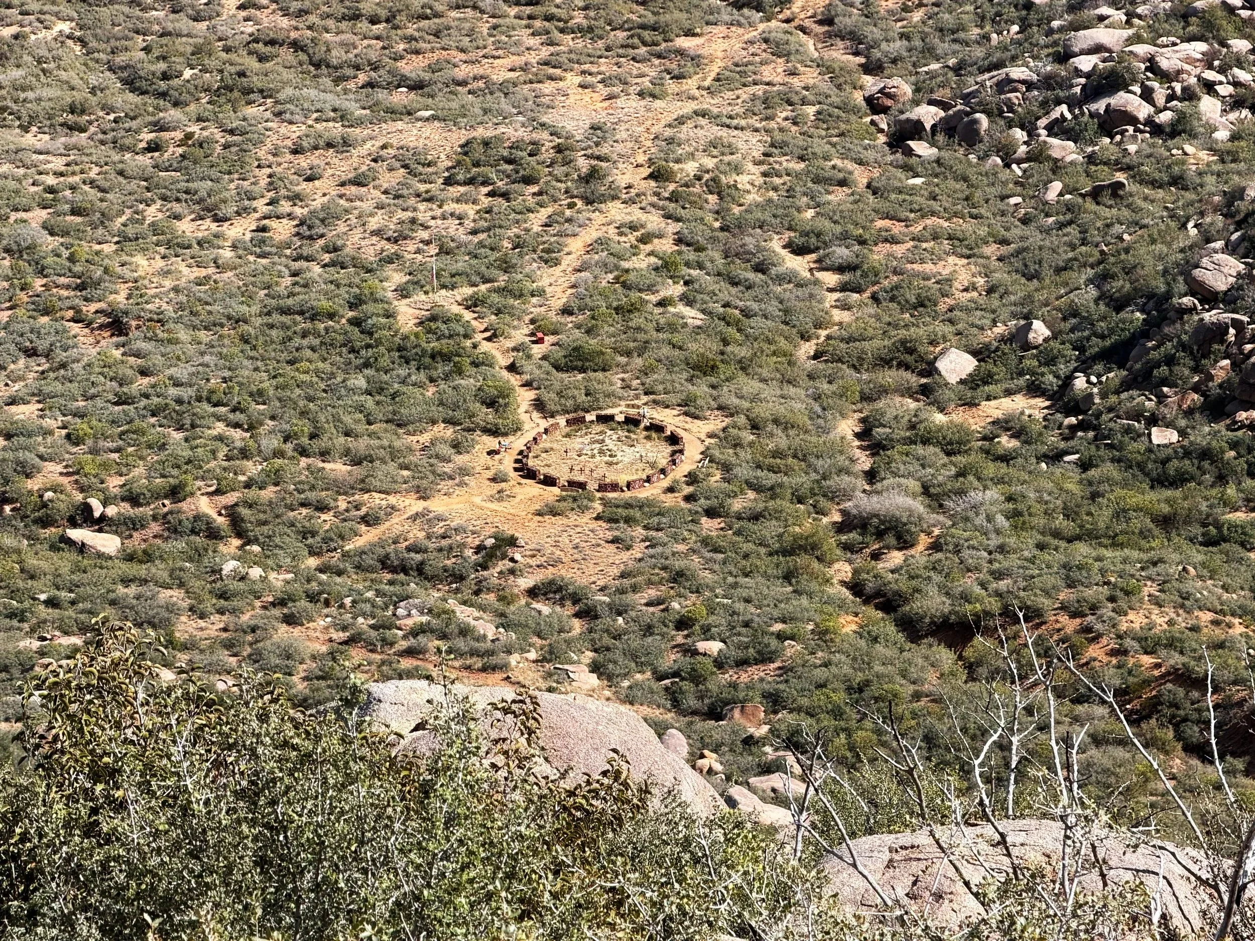
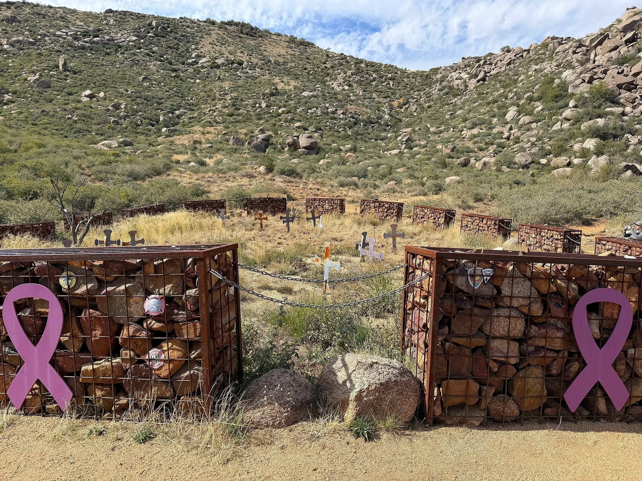
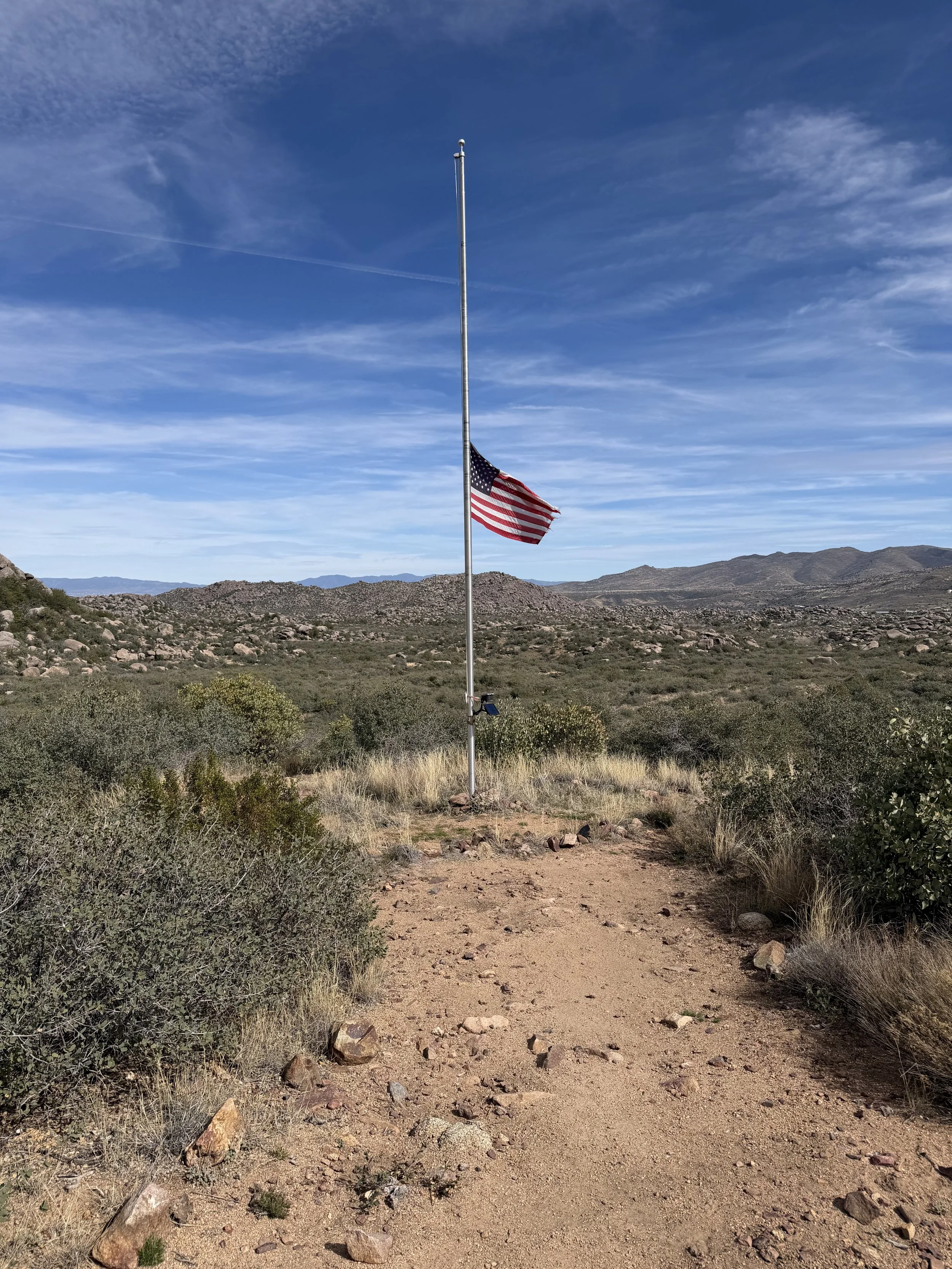
This rugged trail is a difficult and deeply emotional experience, marked by 19 individual granite plaques set into the rocks 600 feet apart in the men's rank order. The challenging 7-mile round-trip hike through the Weaver Mountains leads to an observation deck overlooking a canyon. From there, follow the “Journey Trail” to a solemn memorial where the Hotshots crew lost their lives. The fatality site is encircled by 19 chain-linked structures called gablons, one for each Hotshot. Inside, steel markers show the position where each Hotshot was found. A short distance away, a flagpole flown at half-staff symbolizes the national tragedy and the impact felt to this day by the surrounding communities whose town was nearly destroyed by a lightning-sparked blaze, becoming the deadliest wildfire in Arizona's history. After spending some time here, follow the trail back the way you came to the park entrance.
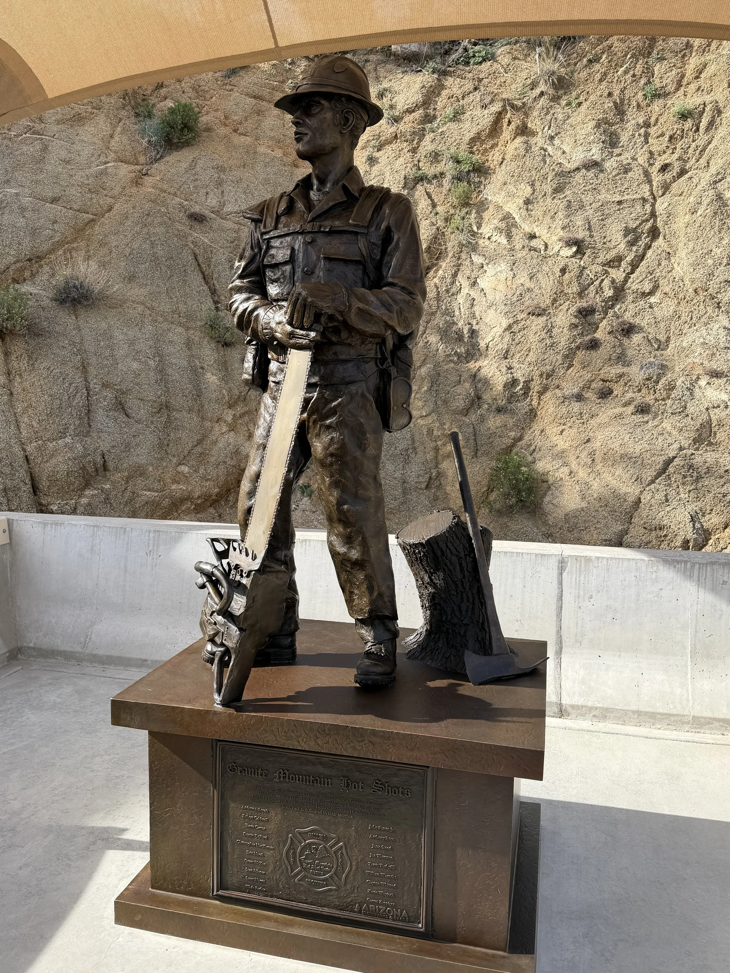
Plan for a 4+ hour hike if you decide to embark on the “Hotshots” and “Journey” trail. There is no water or restrooms available on the trail. It is also highly advised to leave before noon in order to make it back before dark. Whether you choose to hike the trail, part of it, or not at all, stopping at the Memorial State Park trailhead is well worth your time to learn more about wildland firefighting and the highly trained crews who focus on the most challenging parts of fires. The small roadside parking area provides specific trail information and a statue commemorating the Hotshots crew.
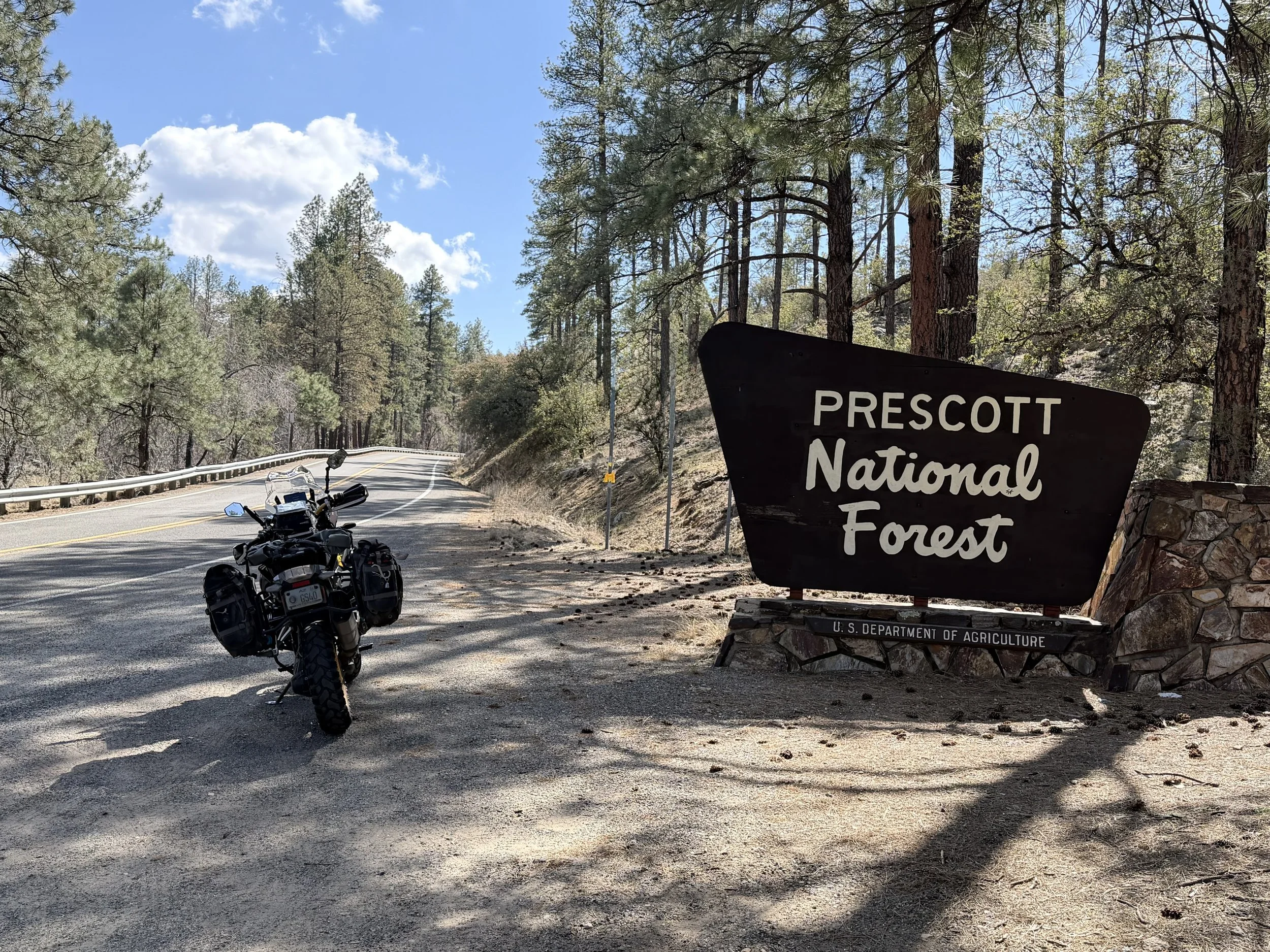
After visiting Granite Mountain Hotshots Memorial State Park, continue up the mountain pass to the small towns of Yarnell and Peoples Valley, where the landscape transforms to wide-open grasslands and rolling hills dotted with horse and cattle ranches. This second section of the route provides a sense of remoteness and solitude over a 50 mile stretch. From there, the elevation climbs to 6,500 feet as you enter Prescott National Forest along the pine tree-lined highway toward Prescott, Arizona's original capital city. The historic “Old West” town features a robust outdoor recreation community, famous Whisky Row saloons, and the Courthouse Plaza, a focal point of downtown Prescott.
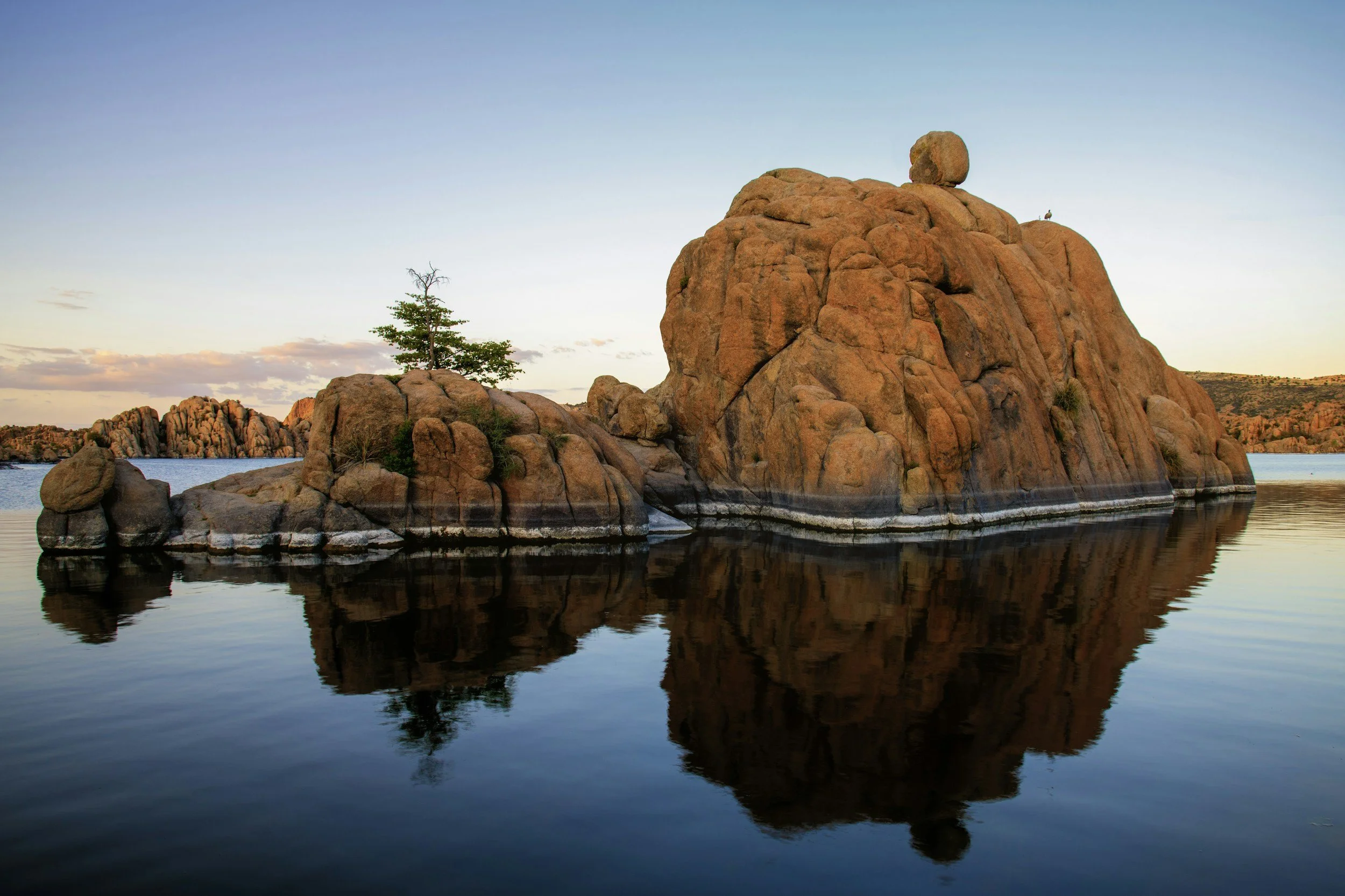
The final stretch on this route passes by the picturesque Watson Lake, commonly referred to as a wonderland of rocks. The Precambrian era Granite Dells, surrounded by billion-year-old boulders, are as picturesque as it gets. It's the perfect capstone to this journey. The small high desert community of Chino Valley marks the end of Granite Mountain Hotshots Memorial Highway. From here, adventure seekers can head off-pavement on Perkinsville Road, a remote, scenic, and historic forest road connecting the towns of Jerome and Williams. Or continue north on State Route 89 to Ash Fork, the flagstone capital of the state and gateway to Historic Route 66.
Watson Lake
Beyond the story of the Granite Mountain Hotshots, the topography along this route is what makes it unique. Connected by National Forest public lands, the landscape transitions from Saguaro cacti and Joshua trees to granite boulder mountain ranges and high-elevation grasslands. This 70-mile point to point scenic route and 7-mile round trip hike resonate with those who travel its path. More than just a highway, it's a complex journey of reflection and gratitude, as well as a thrilling motorcycle ride and memorable hiking experience. The untouched, unspoiled pine forest wilderness of Prescott National Forest is also a treat to explore. While we can never repay our debt to the Granite Mountain Hotshots, taking the time to appreciate the trails, storyboards, murals, and memorial road signs is a small way to honor the memory of an extraordinary Wildland Firefighting Crew.
To learn more about the Granite Mountain Hotshots and Arizona State Parks, visit azstateparks.com/hotshots
Ride safe and enjoy the adventure.
Note: Mileages are approximate. Each rider is responsible for checking the current road conditions and assessing their own skills to ensure safety. All routes are provided "as is" without any liability.
Discalimer: Logbook entry content here is original and not AI-written. It consists of my personal accounts after scouting the routes myself.
Copyright Protected © 2026 Lost Highways LLC. All rights reserved.