Salome Highway
The 1945 western drama film "Salome, Where She Danced" tells the story of a Viennese ballerina fleeing Europe during the Austro-Prussian War. Guided by an American journalist, she finds herself in the Wild West town of Salome, where she falls in love with an embattled Civil War veteran turned outlaw. While the film put the town on the map, the origin of the name is actually connected to the town's founder, not the movie. Dick Wick Hall founded Salome in 1904 and plotted the land with anticipation of the construction of a nearby railroad. The town was named after his business partner's wife, Grace Salome Pratt. The story goes that after getting out of a car barefoot, she appeared to be dancing because her feet were burning in the hot sand. From then on, "Salome, Where She Danced" became the town’s motto, remaining in place for over a century.

A small, unincorporated community, Salome is located approximately 100 miles northwest of Phoenix, situated in the McMullen Valley and nestled between the Harquahala and Harcuvar mountains. This former desert mining town served as a vital transportation corridor along an early U.S. transcontinental highway, connecting Virginia to California. It was also a stop along the original Arizona and California Railroad, a 190-mile short-line route based out of Parker, Arizona. Built in the early 20th century, the railroad officially began operations in 1907. Today, the Arizona and California Railroad carries a variety of cargo including petroleum, steel, and lumber.

The original Arizona and California Railroad in Salome
The journey on Salome Highway begins in the heart of town. This remote, two-lane road connects Salome to the city of Buckeye, winding through rolling hills and peaceful landscapes. It also serves as an interchange between two historic transcontinental routes: U.S. Route 60 and Old U.S. Highway 80. A few miles into the route, look for a sign pointed to "The Little Roadside Chapel." Founded by Paul and Lora Marks, this charming and quaint, tiny, one-room chapel is enclosed by a white picket fence in the middle of the desert. It's a unique stopping place for passersby to collect their thoughts, rest, or offer a prayer before continuing their travels.
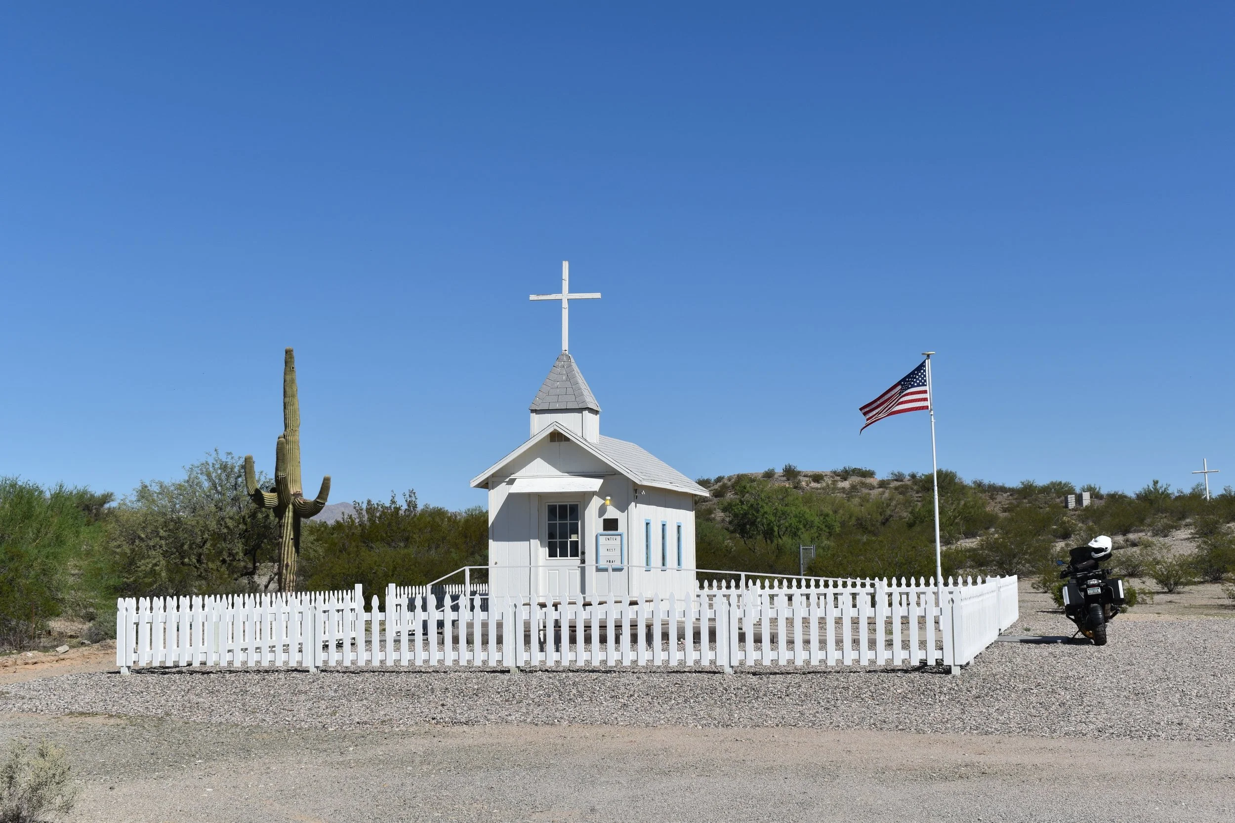
“The Little Roadside Chapel”
The highway ahead meanders through 30 miles of remote desert with scenic mountain views. Be aware, this is open range territory, so stay alert for cattle on the road. This section of the route also offers access to primitive roads for off-road enthusiasts, hikers, and winter-season RV campers. To the north lies the Big Horn Mountains Wilderness, while the Eagletail Mountains Wilderness to the south provides dispersed camping opportunities on public lands managed by the Bureau of Land Management. From a rider's perspective, the travel experience offers long-range views of the Sonoran Desert in western Arizona, a landscape primarily composed of remote desert, with subtle yet dramatic mountain ranges lined with thousands of saguaro cacti, rugged terrain, and chiseled rock formations.

Harquahala Mountains located to the east of Salome Highway
Pavement transitions to dirt and gravel at mile 30, after crossing Interstate 10. The road then winds through an area featuring solar farms and agricultural fields. The graded path is well-maintained and suitable for riders with limited off-road experience. Be mindful of ruts and washouts following heavy rainfall. The dirt road surface switches back to pavement for the final 15 miles of this route.

Pavement turns to dirt at the 30-mile marker
The junction where Salome Highway meets Old U.S. 80 signifies the end of this lost highway. It is here where you'll see acres upon acres of green pastures used for farming, which seem completely out of place in the region. Turn left towards the city of Buckeye in the outskirts of the Phoenix metropolitan area. To continue the adventure, head right on Old U.S. Highway 80 for a stretch of scenic, winding roads leading to the Gillespie Dam Bridge, a 1,660 ft through-truss bridge and historic landmark.
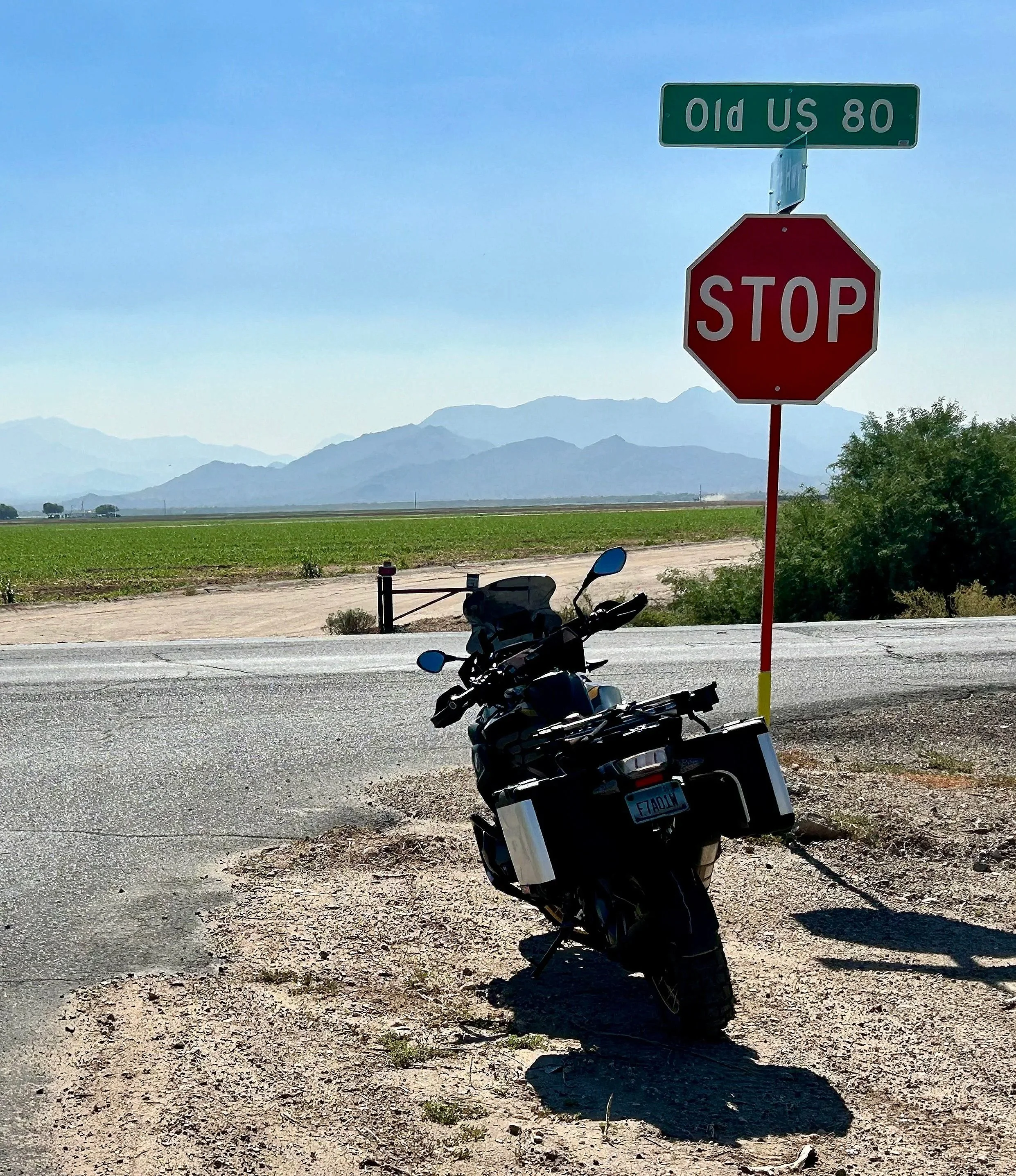
The journey ends at the intersection of Salome Highway and Old U.S. Highway 80.
Salome Highway is 60 miles in length point to point, connecting two historic transcontinental highways. It offers wide, scenic views of remote western Arizona desert. Be careful of extreme summer weather, including monsoons. The elevation is low, so carry plenty of water to stay hydrated, even in winter. Plan fuel stops carefully and bring a satellite communicator if possible. The route reflects the Wild West with its history, desert scenery, and unique landmarks, making you imagine what it was like to travel by horseback or stagecoach long ago. The highway's namesake tells a story beyond a classic western film or the place where Grace Salome Pratt danced; it represents a period of growth, opportunity, and exploration. Enjoy the adventure and ride safe.
Note: Mileages are approximate. Each rider is responsible for checking the current road conditions and assessing their own skills to ensure safety. All routes are provided "as is" without any liability.
Discalimer: Logbook entry content here is original and not AI-written. It consists of my personal accounts after scouting the routes myself. Each route description is submitted for AI detection and plagiarism before being published.
Copyright Protected © 2025 Lost Highways LLC. All rights reserved.