Rim Road
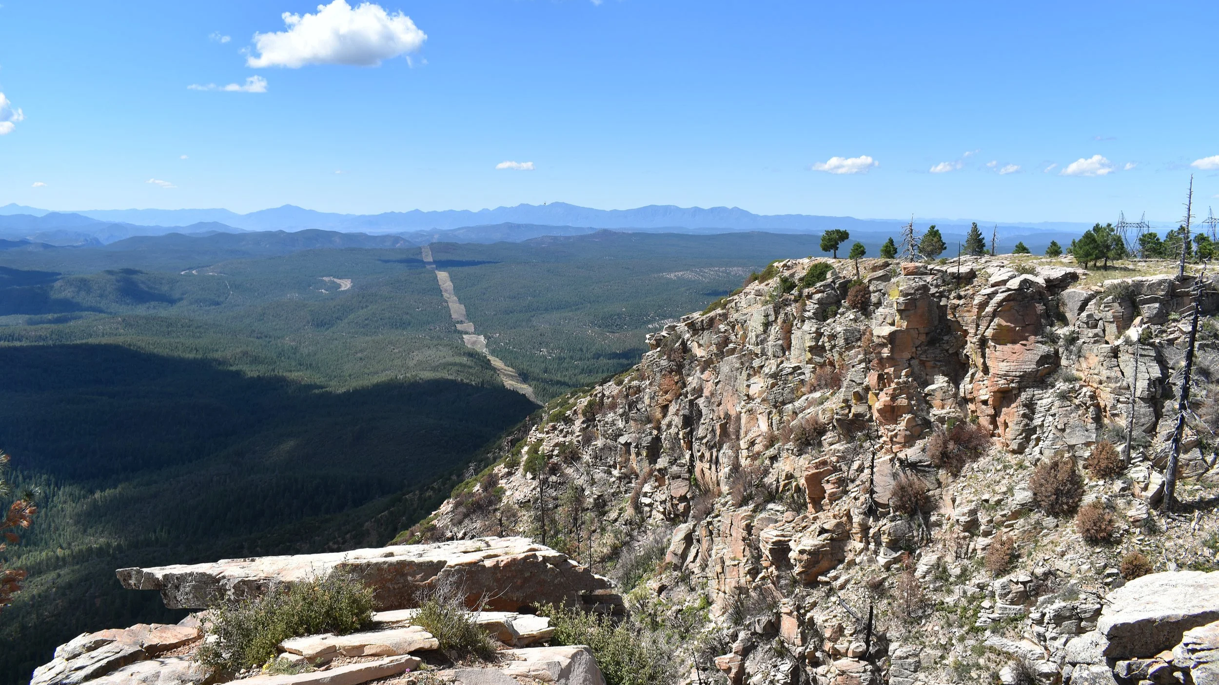
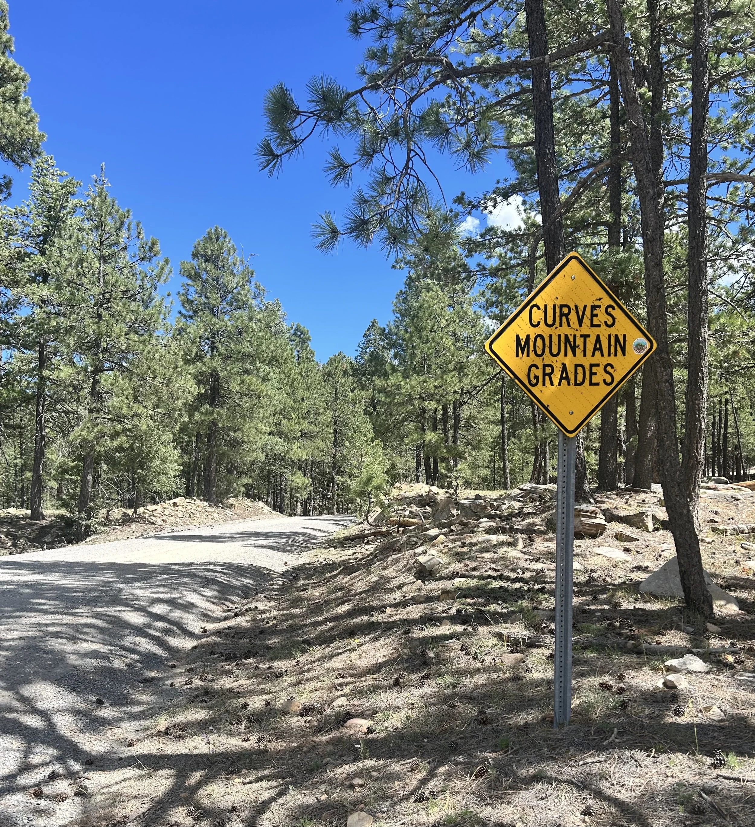
Every trail tells a story, and Rim Road is no exception. There are few geological features quite like the Mogollon Rim. Craig Childs, an American author, naturalist, and wilderness explorer, describes it best as a crest of earth that shaves Arizona across the middle, from the Grand Canyon to New Mexico. At the edge of the crest traversing some of its highest points is Rim Road, a remote trail that follows the Mogollon Rim for 43 miles connecting two national forests while overlooking a third from an elevation of nearly 8,000 feet. The scenic vistas along the way are spectacular and offer far-reaching views across Arizona's desert, national forest lands and canyon country. Also known as Forest Road 300, this route intersects with the Arizona National Scenic Trail and overlaps at certain points with the historic General Crook Trail. The road also makes up part of the Arizona Backcountry Discovery Route, a 750-mile off-road motorcycle route spanning the state from the Mexico border to the Utah border. For the curious explorer, this is a motorcycle route worth every mile, inspiring as much as it is thrilling to ride.

View of Arizona State Route 260 as it winds through national forest lands below the Mogollon Rim.
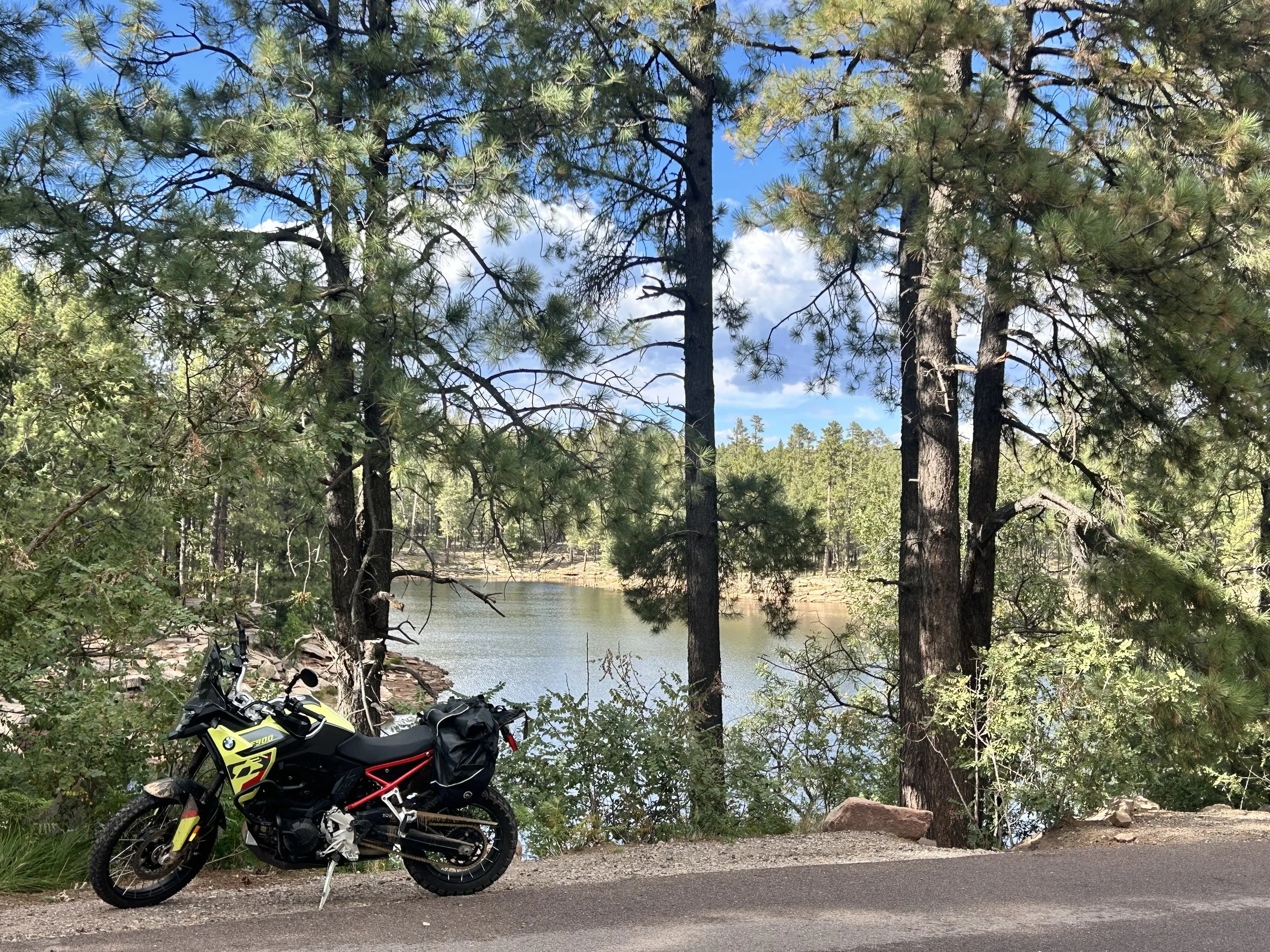
Welcome to Rim Country, where the first thing you'll notice are the trees. From the start of this route, ponderosa pines, evergreens, and aspens line both sides of the narrow, paved road, and continue to do so as the surface changes to gravel and dirt. You'll breathe in the cool mountain air of the Apache-Sitgreaves National Forest while passing by several remarkable scenic lookout points. This area also offers great camping opportunities. Further up the road, you’ll have easy access to Forest Service campgrounds with trails leading to the Rim’s edge and Woods Canyon Lake Recreation Area. Dispersed camping sites are also available as you travel deeper into the forest before entering the rugged section of the trail. In the wilderness, open camping is permitted within 300 feet of the dirt trail.
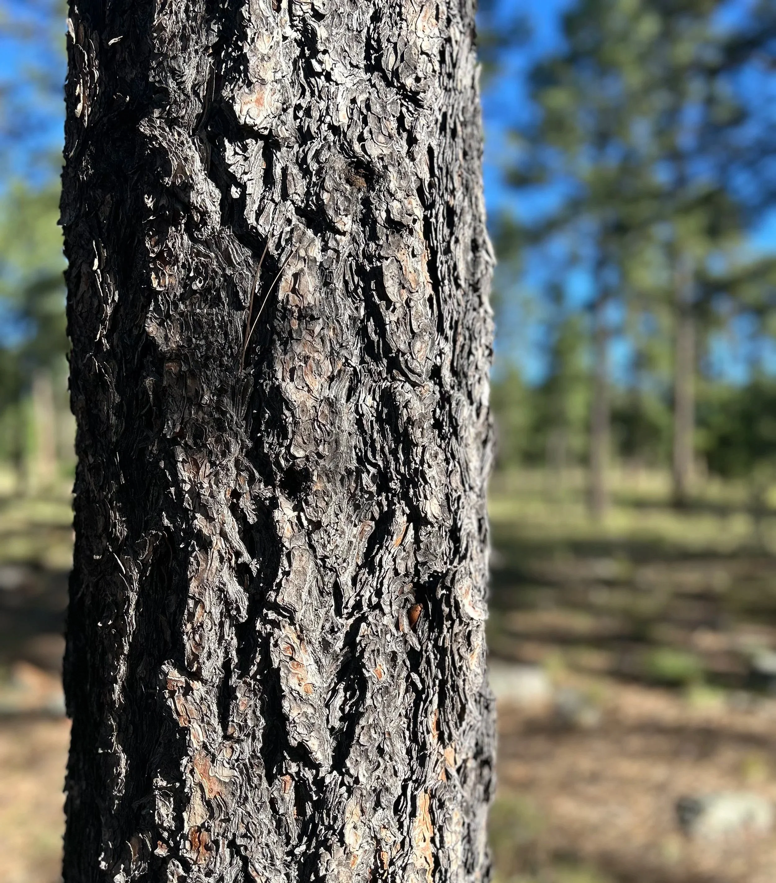
Known for their puzzle-piece-like bark, the ponderosa pines are the dominant tree on the Mogollon Rim, forming the largest interconnected ponderosa pine forest in the world.
Aside from the Mogollon Rim’s geological history, which formed over 30 million years ago, the trail overlaps and intersects with an old wagon route developed by a skilled U.S. Army commander. The General George Crook Trail traces a portion of the 200-mile-long military and civilian supply route used to develop forts during the U.S. Army’s conflicts with Apache groups in the late 1800s. A 25-mile section of the original route follows along the Mogollon Rim and remains accessible for hiking. Well-marked storyboards along the trail help to provide a historical perspective about the path that was traveled by military troops over 125 years ago.
Another noteworthy landmark is the Promontory Lookout Tower. The historic fire tower is situated just off Rim Road approximately 12 miles from the start of the route. It's impossible to miss on the right side of the trail. The tallest in the National Forest, it is listed in the National Register of Historic Places. Continuing on Rim Road for another mile brings you to the turn-off for Bear Canyon Lake. The trailhead leads to a highly rated recreation area, about 3 miles north, along an isolated, rocky trail from the main Rim Road.

Promontory Lookout Tower 34°22'37.2"N 111°01'20.1"W

The trail to Bear Canyon Lake 34°24'21.3"N 111°00'23.3"W
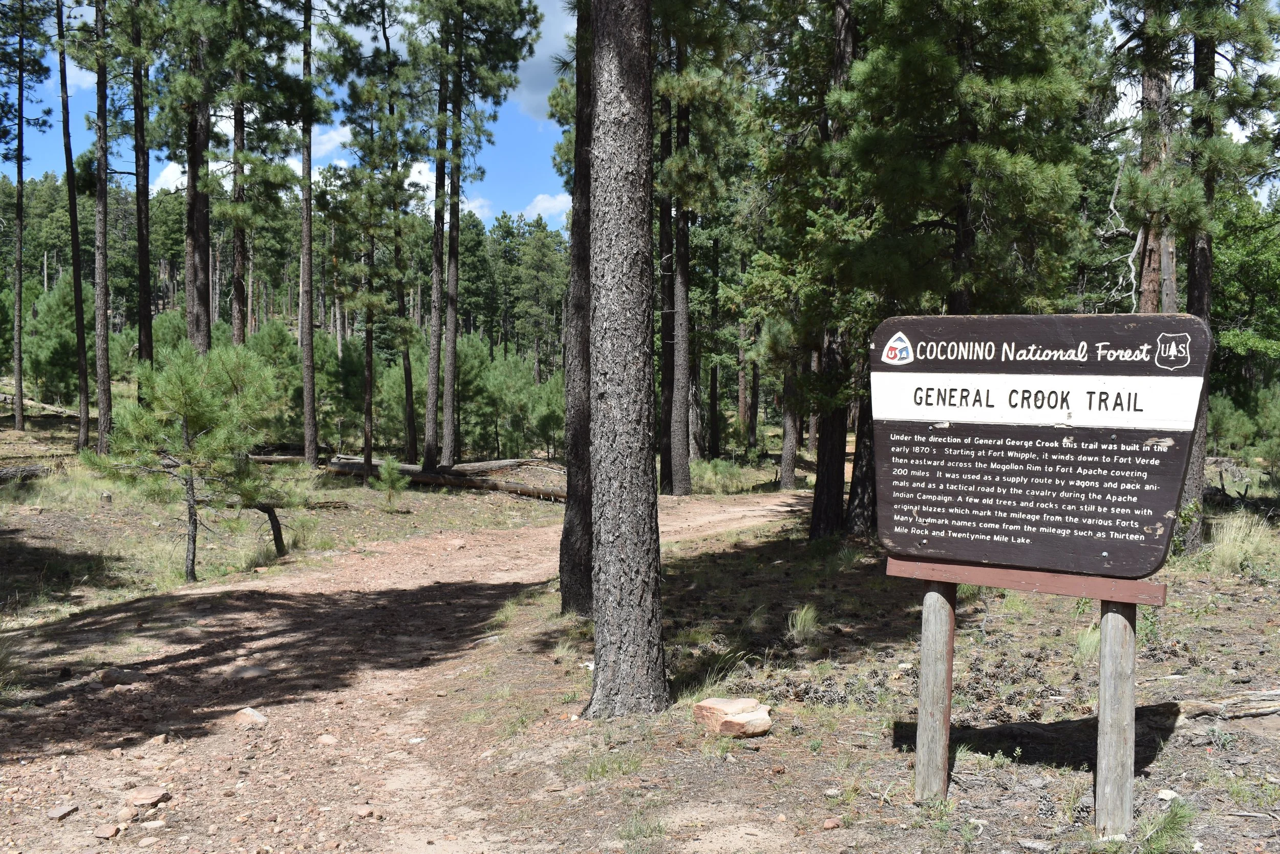
General Crook Trail
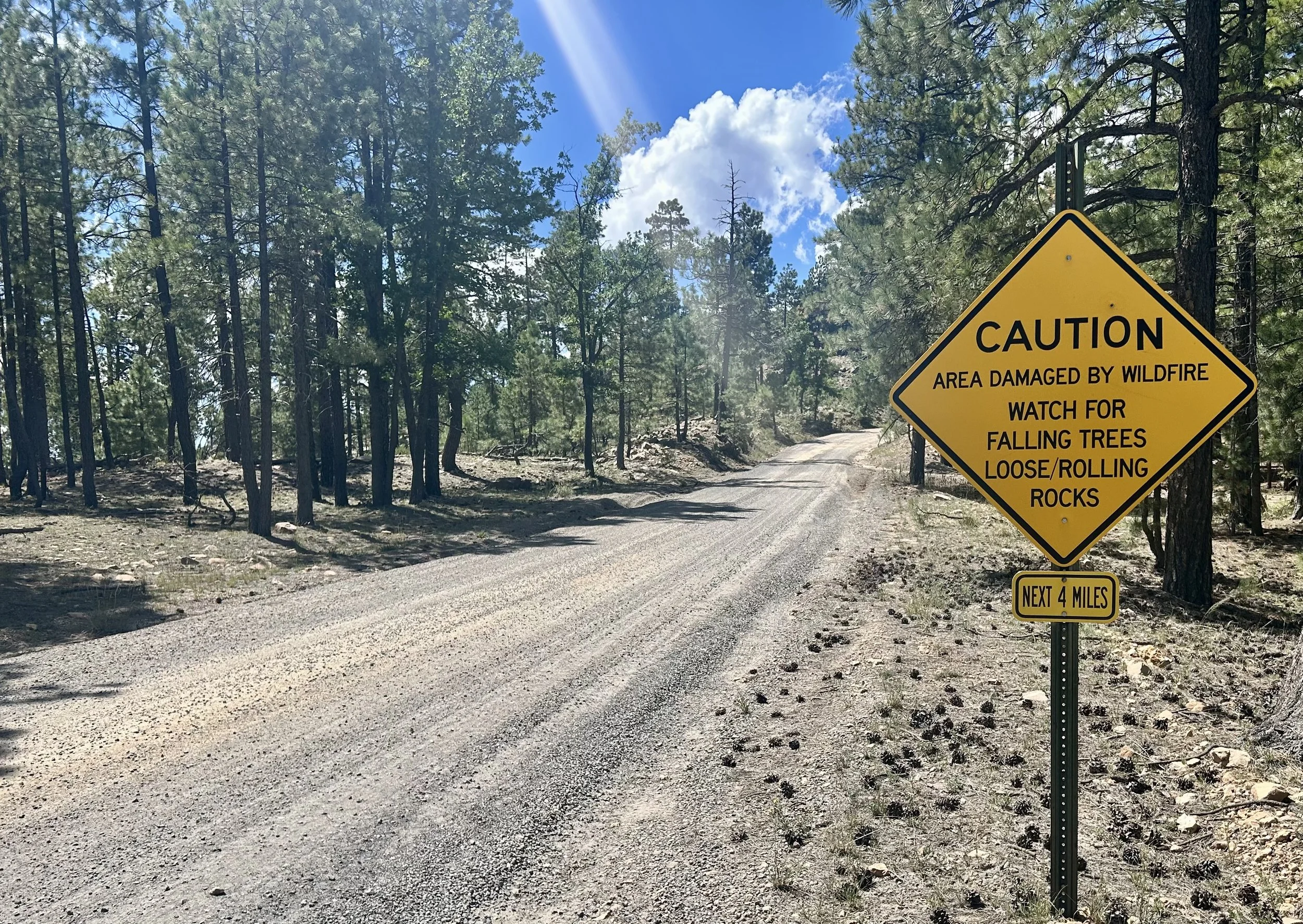
Continue on Rim Road a few miles further to the impressive Horseshoe Vista, also known as the Mogollon Rim viewpoint. At nearly the halfway point on this route, it’s the perfect place to kick your side stand down and dismount your motorcycle to experience the breathtaking views from 7,788 feet. See Apache-Sitgreaves National Forest to the east, Coconino National Forest to the west, and Tonto National Forest to the south, which comprises a large portion of the Sonoran Desert landscape. The second half of the trail winds through a large meadow before entering a fire damaged area caused by a lightening strike 30 years ago. The final stretch of this route is comprised of numerous switchbacks descending on dirt roads before concluding at State Route 87 near the small town of Strawberry. Head north to see the iconic "Standin' on the Corner" statue in Winslow, Arizona. Keep going west on pavement along the Rim toward Verde Valley, or head south to the old west rodeo town of Payson to continue your journey.
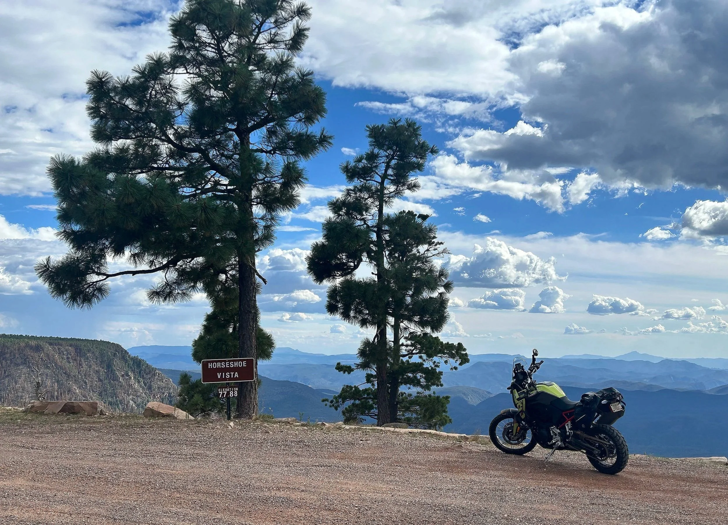
Horseshoe Vista 34°22'50.4"N 111°04'00.4"W
Rim Road (Forest Road 300) is rated by Butler Motorcycle Maps as one of the best dirt roads in Arizona. This route measures 43 miles point to point when traveling east to west from the Mogollon Visitors Center in Forest Lakes to State Route 87 near the town of Strawberry. The riding experience offers a multitude of terrains and landscapes in a remote region of central Arizona. Be mindful of weather patterns and road conditions. The elevation profile is well above a mile, so bring plenty of water and layers for your riding gear. Be sure to leave no trace, check for fire restrictions, and practice safe fire practices. Plan ahead for fuel range capacity and bring a satellite communicator if you have one. Mountains, valleys, lakes, cliffs, trees, rock formations, and more – the Mogollon Rim has it all. It's as mystical as it is wild. Exploring the dramatic landscape along Rim Road will leave you with a deeper connection to and appreciation for one of the most significant natural phenomena in the American Southwest.
Enjoy the adventure and ride safe.
To obtain elevation profiles, GPS coordinates, and more points of interest for this route and many others you can purchase a “Best Dirt Roads in Arizona - Arizona Adventure Series Map” from Butler Maps. Use the code “losthighways” to receive a discount.
Note: Mileages are approximate. Each rider is responsible for checking the current road conditions and assessing their own skills to ensure safety. All routes are provided "as is" without any liability.
Discalimer: Logbook entry content here is original and not AI-written. It consists of my personal accounts after scouting the routes myself. Each route description is submitted for AI detection and plagiarism before being published.
Copyright Protected © 2025 Lost Highways LLC. All rights reserved.