Apache Pass Road
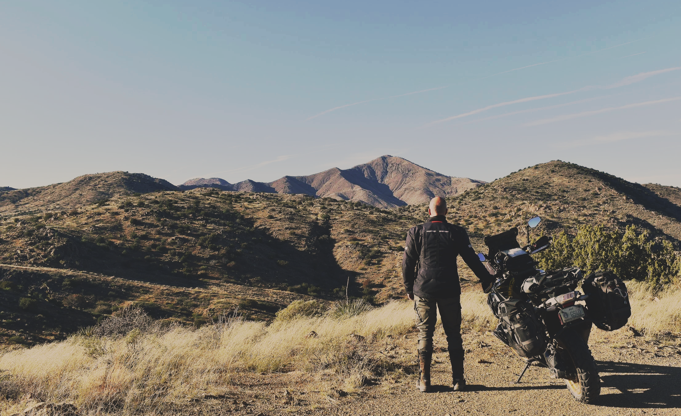
It was a warm December day when I stood in an open field in Southeastern Arizona, surrounded by mountains, the sun shining on my head and face. Century-old, broken military barrack walls cropped up from the ground around my feet, and I imagined for a few moments what it was like to be here over 150 years ago, a time when Chiricahua Apaches fought against American westward expansionism. The origins of this place trace back to early Native American footpaths. Water sources in the area made this passage a strategic route for the Chiricahua Apache people and, eventually, a segment of the Butterfield Overland Mail Route from Saint Louis to San Francisco. Fast forward to the present, only the wind and the echoes of wildlife remain in this remote and isolated territory. This 21-mile mountain pass winds through a lesser-known area of Arizona, between the Chiricahua Mountains to the south and the Dos Cabezas Mountains to the north. Despite its turbulent past, the landscape is incredibly peaceful, making it hard to believe that for 32 years it was key to U.S. Army operations for control of this historic stagecoach line. The road on this journey is Apache Pass, a mountain passage that offers a riding experience through a different time, a period known as the Apache Wars.
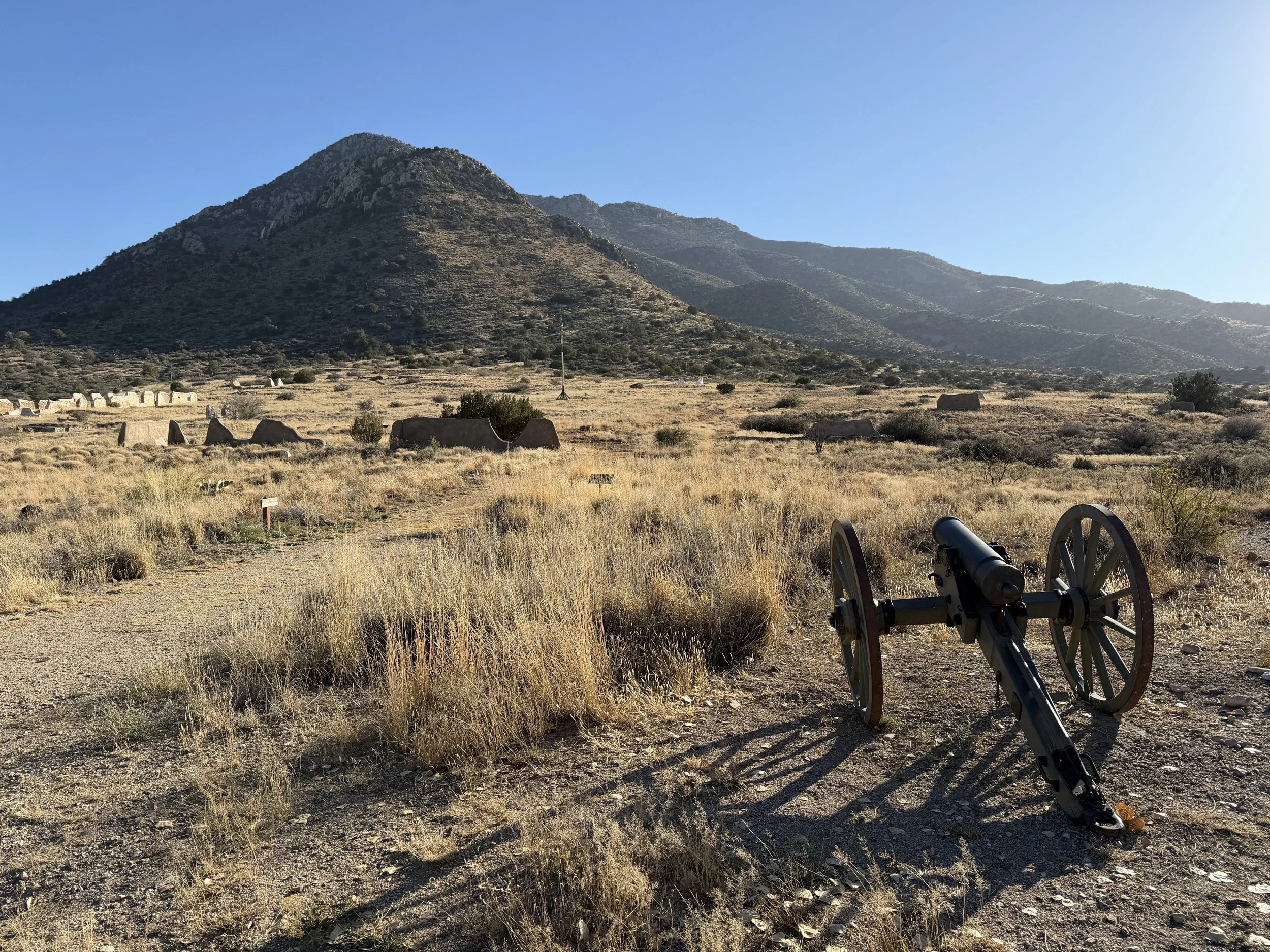
Historic Fort Bowie Site
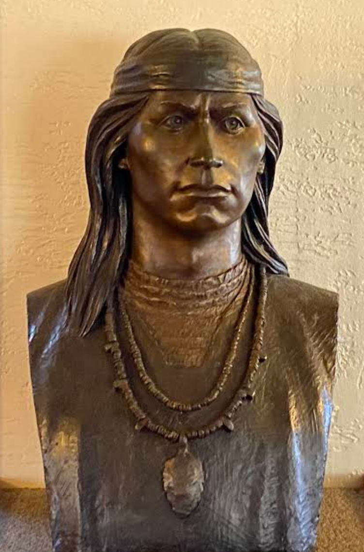
Central to the Indian Wars of the mid-1800s was Cochise, the legendary Chiricahua Apache Chief. Exceptionally formidable, he fought fiercely to protect the homeland of his people, famously stating, "When I was young I walked all over this country, east and west, and saw no other people than the Apaches. After many summers I walked again and found another race of people had come to take it." While most people associate Cochise as a ruthless warrior, few know about the decade of peace he made with Americans before his death. This route traverses the sites of two consequential engagements between Cochise's Apaches and American settlers.
The first conflict, the Bascom Affair in 1861, involved a young Army Lieutenant Bascom who falsely accused Cochise and his band of Chiricahua Apaches of stealing live stock from a local ranch and kidnapping the rancher’s step-son. The confrontation sparked a two-week, bloody back-and-forth that would serve as a prelude for years to come. The second engagement, the Battle of Apache Pass in 1862, started with an Apache ambush on a volunteer Union Army wagon. During the ambush, U.S. volunteer soldiers responded with artillery (mountain howitzers) against the nearly 200-strong Apache warrior group. The battle lasted two days and marked the beginning of a decades long conflict. After the Battle of Apache Pass, the 5th California Volunteer Infantry established Fort Bowie to secure the area and prevent similar attacks in the future.
It wasn’t until 1872, that Cochise agreed to a final truce, leading to peace in the area for 10 years. In return, he negotiated a 3,000-square-mile reservation that included their traditional homeland in Southeastern Arizona. The truce was far from perfect, and after Cochise’s death, discontent grew among the Chiricahua Apache population about their conditions on the reservation. In an effort to squelch the growing resistance, the U.S. Government relocated them to the San Carlos Reservation further north, where many escaped only to be recaptured. Their final surrender occurred not far from Apache Pass, where 134 Chiricahua Apaches, led by Geronimo, were held at Fort Bowie before their exile to Florida. After 32 years, the critical Army outpost was deactivated, and the Apache Wars came to an end. Now a historic site, the remaining structures stand as a reminder of the cultural collision forever changing the course for both Indigenous and American history.
Photo Right: Cochise, leader and Chief of the Chiricahua Apache. Sculpture by Betty Butts in Fort Bowie Historical Visitors Center.
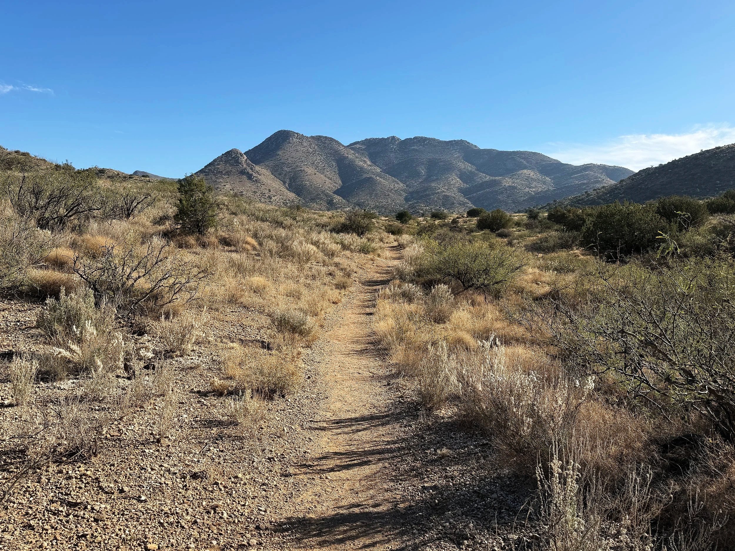
While history sets the stage for this journey, the unique landscape of this part of southeastern Arizona inspires. Known as the "Sky Islands," this mountainous region stretches east into New Mexico and south into northwest Mexico, featuring 55 distinct mountain ranges that appear as scattered islands from above. These dramatic elevation changes, reaching up to 9,000 feet, create a diverse ecosystem of desert shrubs, rock formations, and various pine trees. You'll immediately notice these natural surroundings as you begin your ride on Apache Pass Road. Starting from the small agricultural town of Bowie, pistachio trees line both sides of the remote, two-lane road, where over 4,000 acres of orchards thrive in the area's high desert climate.
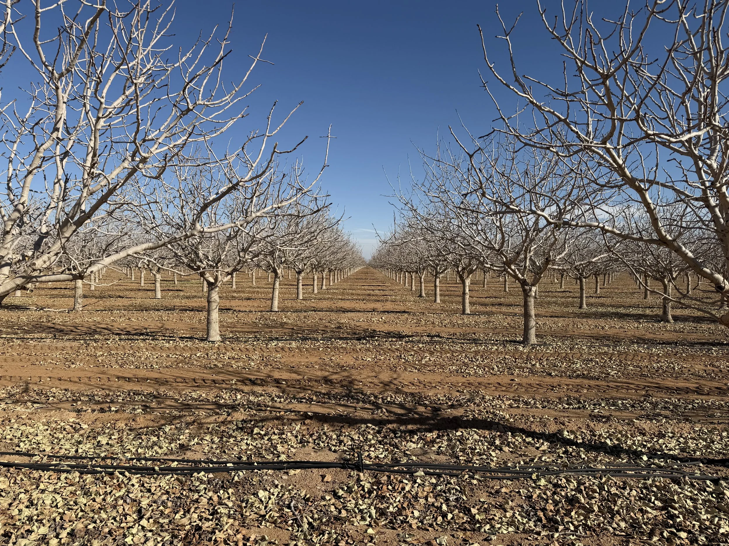
Pistatchio trees along Apache Pass Road
From here, you have two options to reach Fort Bowie National Historic Site, the focal point of this route: one by foot and one by motorcycle. To ride directly to the site, turn left onto Bear Springs Road, which becomes Old Fort Bowie Road. Follow this 3-mile primitive road to the Ranger Station. My preference is to continue several miles farther on Apache Pass Road to the trailhead instead. It's absolutely worth the time to park and hike the easy mile-and-a-half trail that used to be a wagon road leading to the historic Fort Bowie ruins. On the way, you’ll pass through open fields covered in a variety of desert vegetation including Saltbrush, One-seed Junipers, and Englemann prickly pear cactus. Also located on the trail is a replica of a “Wikeup” shelter where the Chiricahua Apache people used to live. At the half way point, you’ll come to the post cemetery where graves of American soldiers and Apaches from that time period are preserved, including Medal of Honor recipient Orisoba Spence and Gernomio’s son Little Robe. A short distance further is the grounds and ruins of Historic Fort Bowie. The walking path loops around the remaining ruins of the nearly 150 year old garrison.
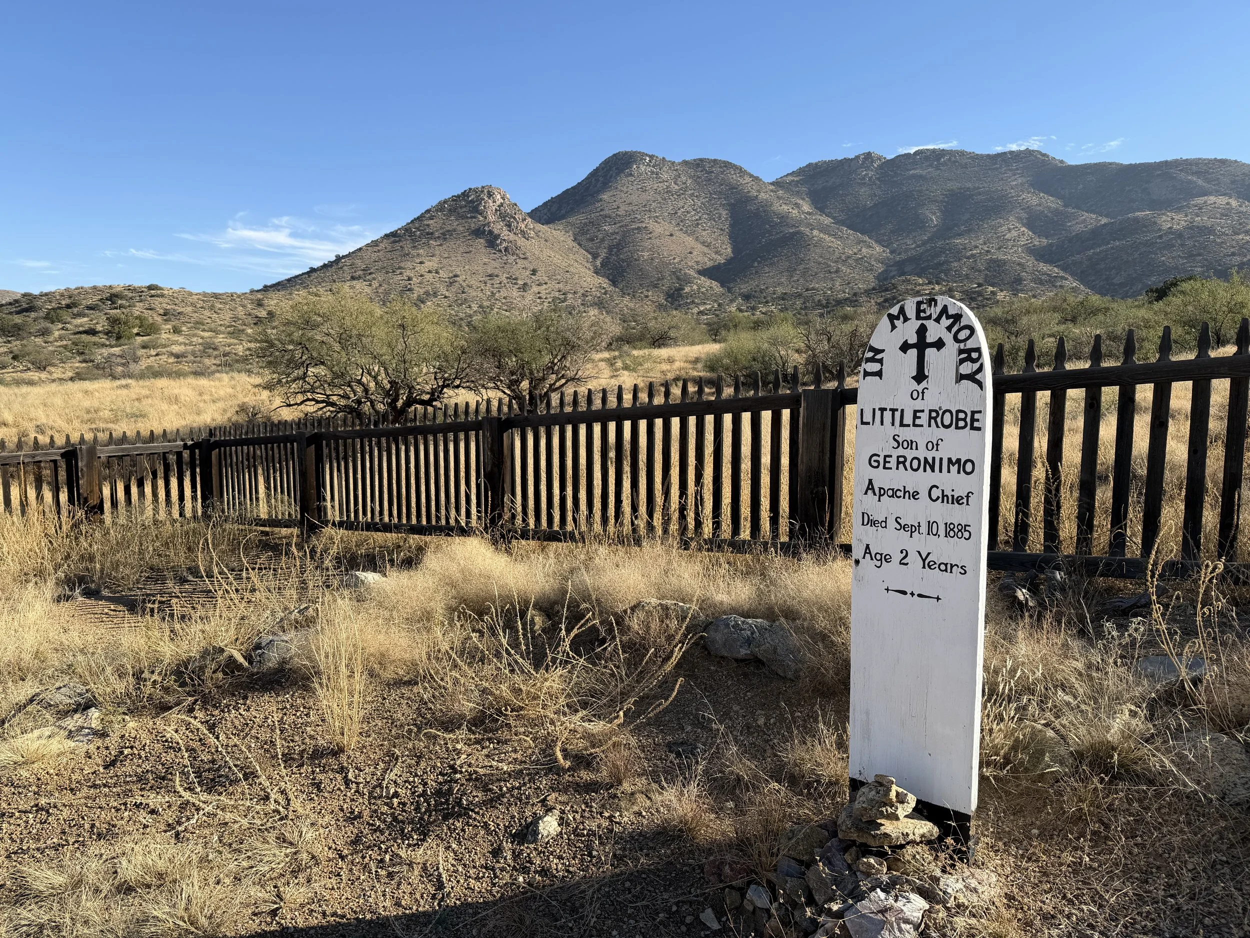
Post Cemetary
Old Wagon Road and hiking trail to Historic Fort Bowie Site
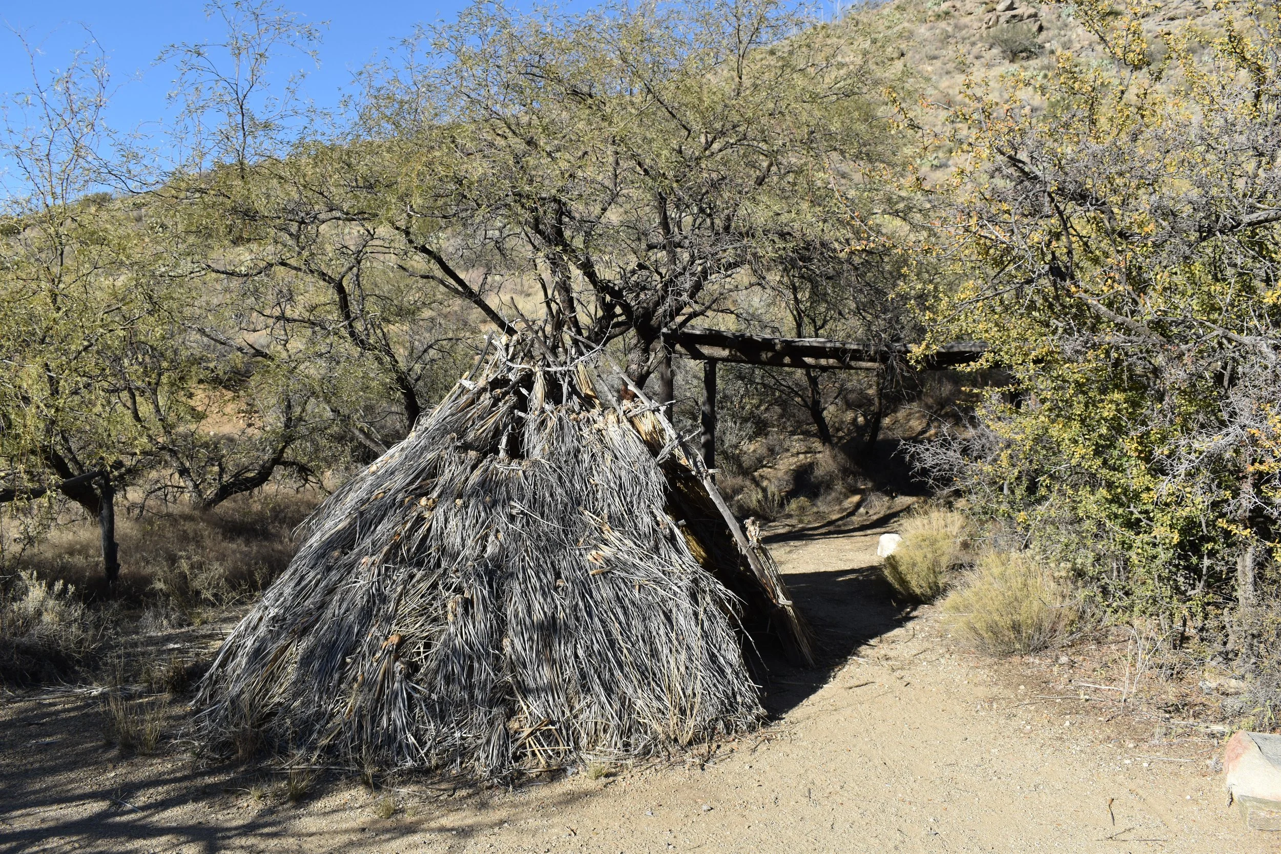
Replica of Chiricahua Apache Wikeup on the trail
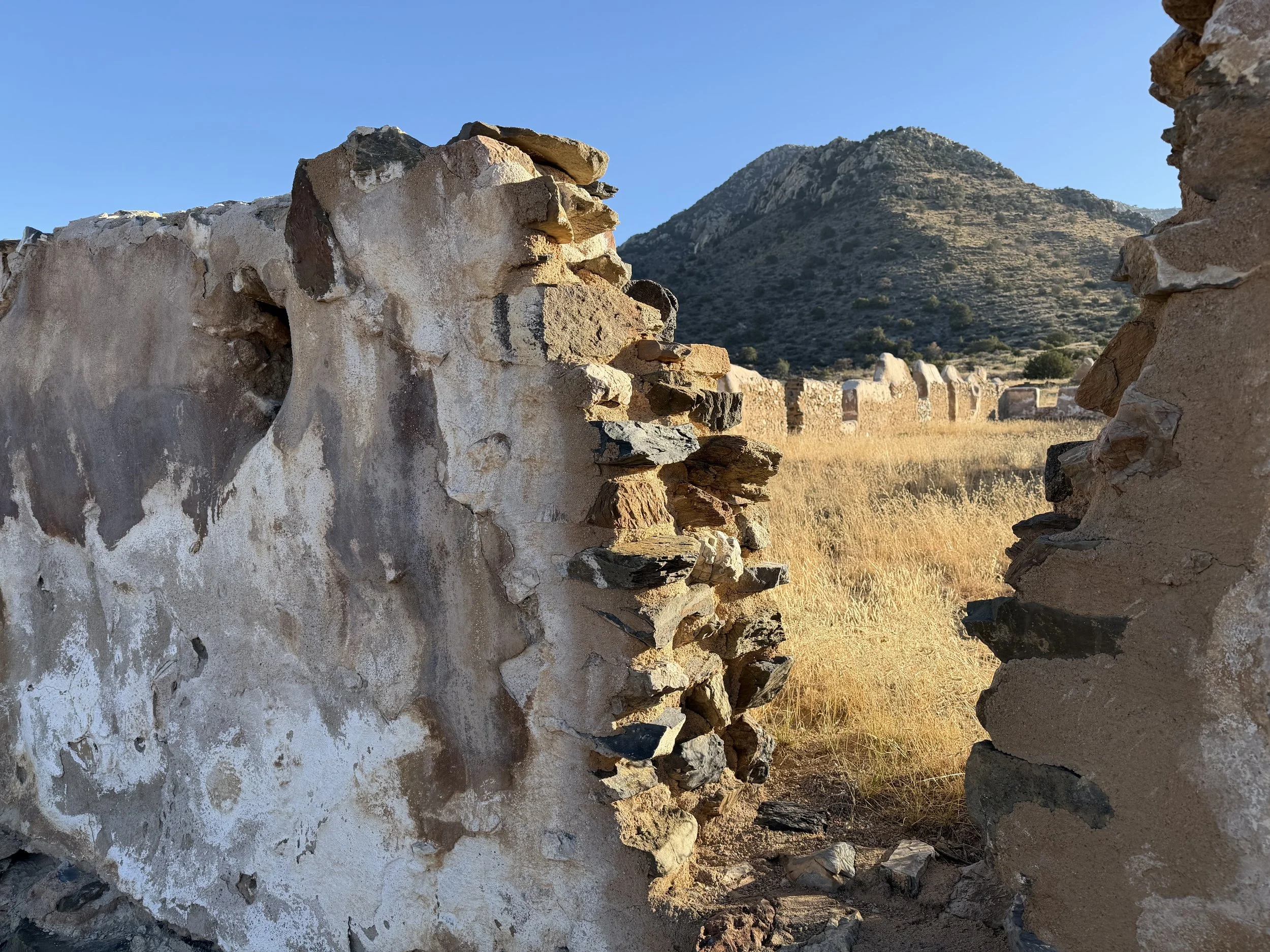
Cavalry Barracks ruins at Historic Fort Bowie
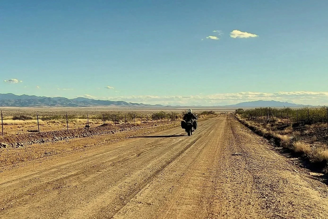
Once you get back to your bike, continue south on Apache Pass Road. The dirt path climbs through the mountain ranges passing by Willow Gulch Canyon, and the Wagon Massacre Site that took place during the Battle of Apache Pass. Keep an eye out for a staging area on the right side of the road near the 14-mile mark; you can walk or ride up the narrow, dirt, and rocky trail to a scenic viewpoint of the Dos Cabezas Mountain Wilderness. Back on Apache Pass Road, continue the next 7 miles on the graded dirt road through wide-open high desert meadows. The road ends at Arizona State Route 186. Turn right to head north through the ghost town of Dos Cabezas, eventually reaching Wilcox, Arizona, which was once a cattle production hub and is now known as the wine grape capital of the state.
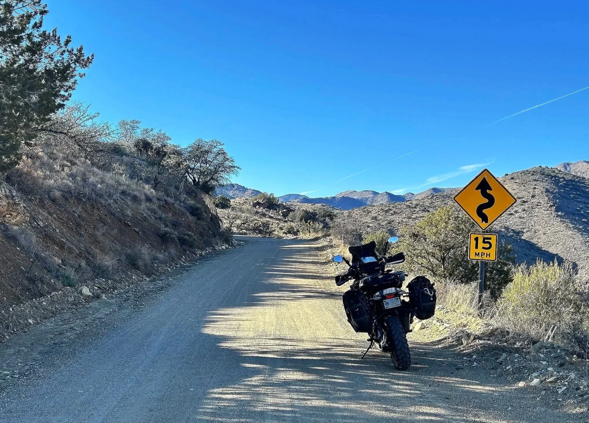
Apache Pass Road near the 13 mile mark
Dos Cabezas Mountains Wilderness viewpoint
This route is 50 miles point to point and is plotted here as a partial loop from the small town of Bowie to Wilcox. Plan on a total trip time of 4 to 5 hours, including the 3-mile out-and-back hike to the Historic Fort Bowie site. Whether it's the historical relevance or the naturalism of this isolated territory, the journey delivers on many levels. From the ghost town of Dos Cabezas to the Sky Islands to the ruins of Fort Bowie, Apache Pass Road compresses a great deal of history and tranquil surroundings into a 21-mile passage. You'll find it hard not to fully connect with the trail’s story. Enjoy the adventure and ride safe.
Note: Mileages are approximate. Each rider is responsible for checking the current road conditions and assessing their own skills to ensure safety. All routes are provided "as is" without any liability.
Discalimer: Logbook entry content here is original and not AI-written. It consists of my personal accounts after scouting the routes myself. Each route description is submitted for AI detection and plagiarism before being published.
Copyright Protected © 2025 Lost Highways LLC. All rights reserved.