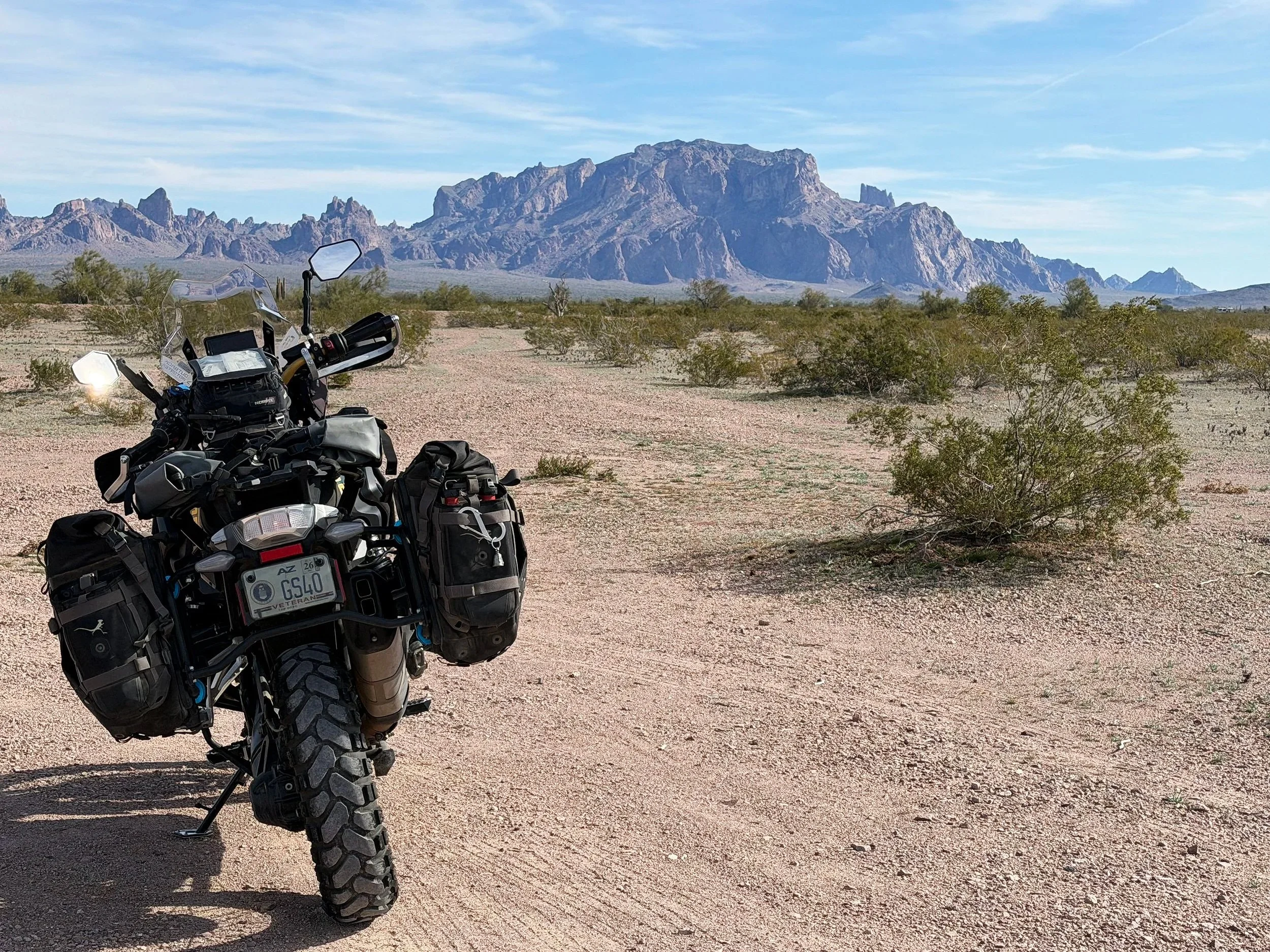
Palm Canyon Road
In a remote corner of southwestern Arizona, over 650,000 acres of desert mountain landscape make up the Kofa National Wildlife Refuge. Established from public lands in 1939 for the protection of desert bighorn sheep, the majority of the refuge is wilderness, and Palm Canyon Road provides one way to access it. There’s more to the story when it comes to Palm Canyon and how it got its name. I'll get to that in a moment, but for now, the natural surroundings manage to both overwhelm and calm the mind. Unlike national parks, which often emphasize public recreation and scenic preservation, refuges prioritize habitat management and species protection. For that reason, Kofa is a special place, and you will likely connect with the environment immediately, just as I did riding and hiking through its narrow gorges and high canyon walls, with dramatic views of volcanic rock formations.
Mount up for this ride, it’ll be a memorable one.
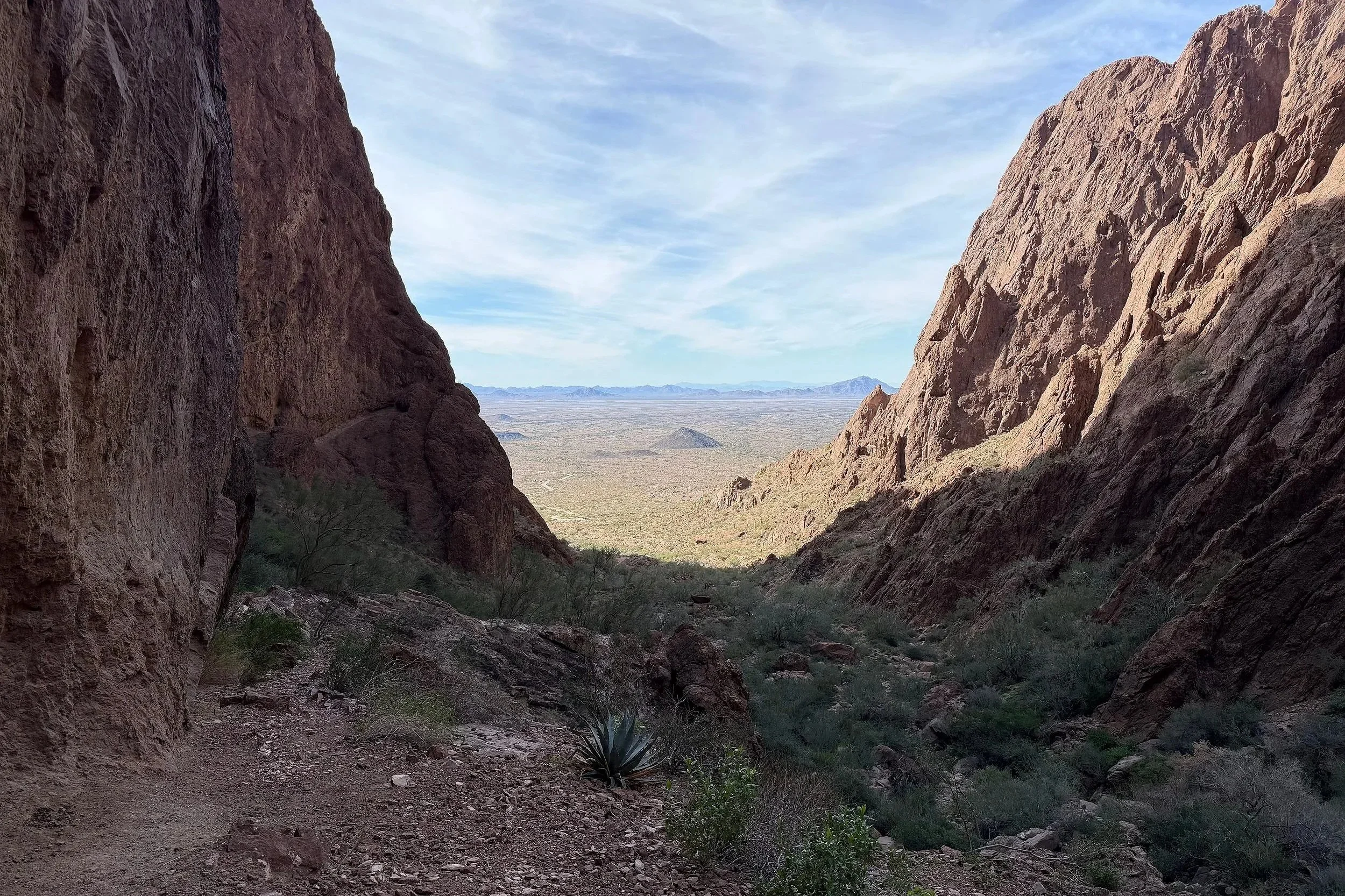
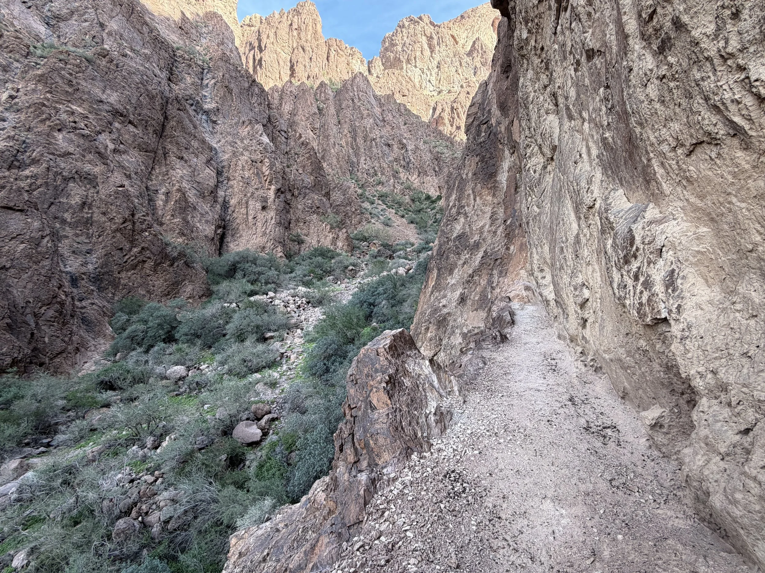
View from inside Palm Canyon Trail looking out to the west.
Palm Canyon is the result of thousands of years of erosion, carving a deep gash in a block of volcanic rock that continues to widen and deepen over time. It gets its name from the native California Fan Palm that grows, seemingly out of place, in the creases of its canyon walls. You can view these obscure trees when hiking into the canyon on Palm Canyon Trail. The trek is a short and moderate 1.5 mile hike that recedes deep into the canyon. To get there, and the inspiration of this logbook entry, is Palm Canyon Road. The wide gravel and hard-packed dirt road is accessible from U.S. Route 95, approximately 20 miles south of Quartzite, a region popular among nomads, RVers and those who seek solitude and isolation.
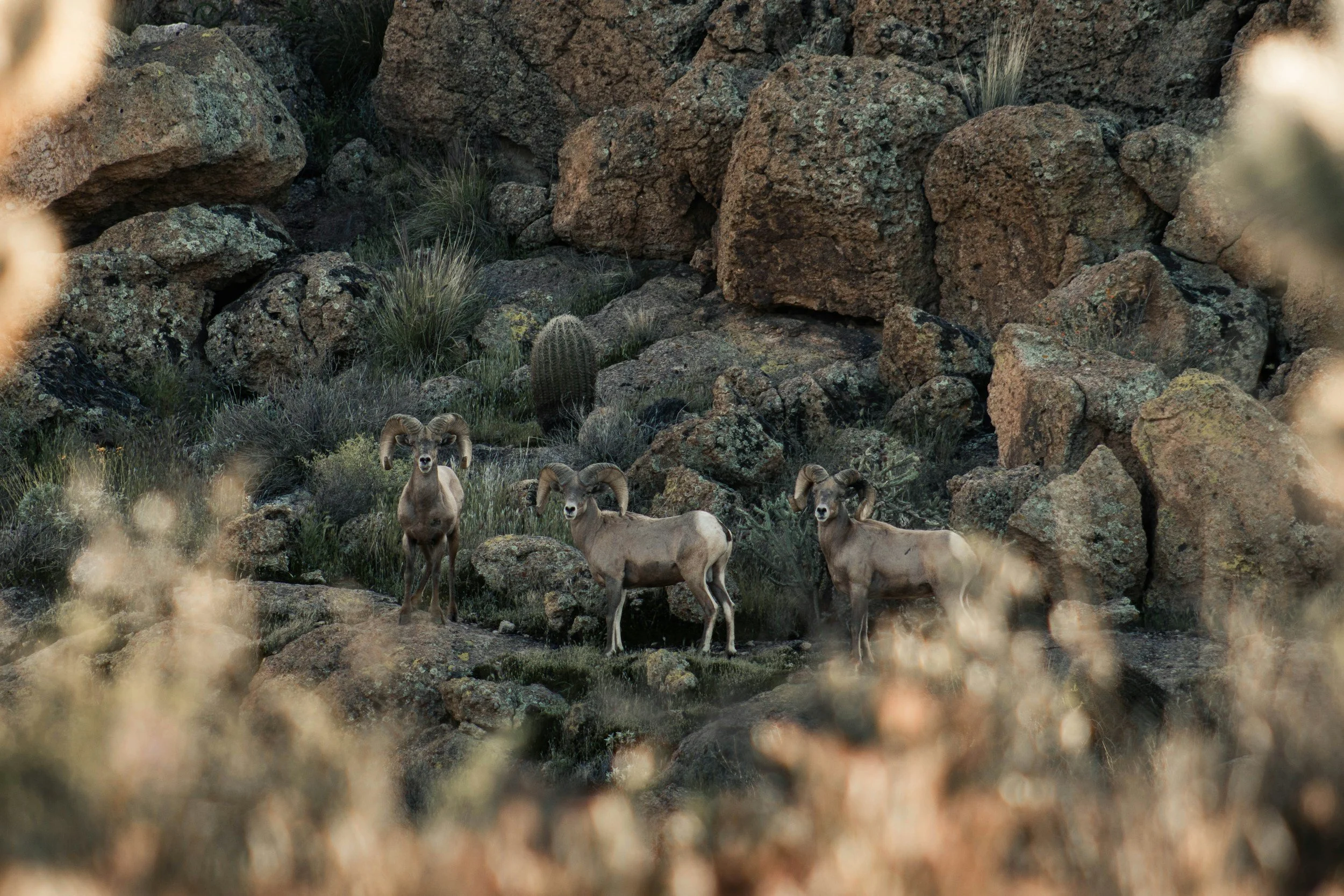
Rare glimpse of a herd of desert bighorn sheep.
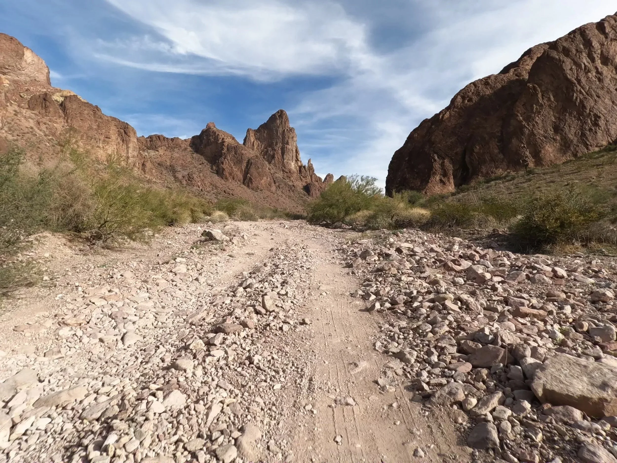
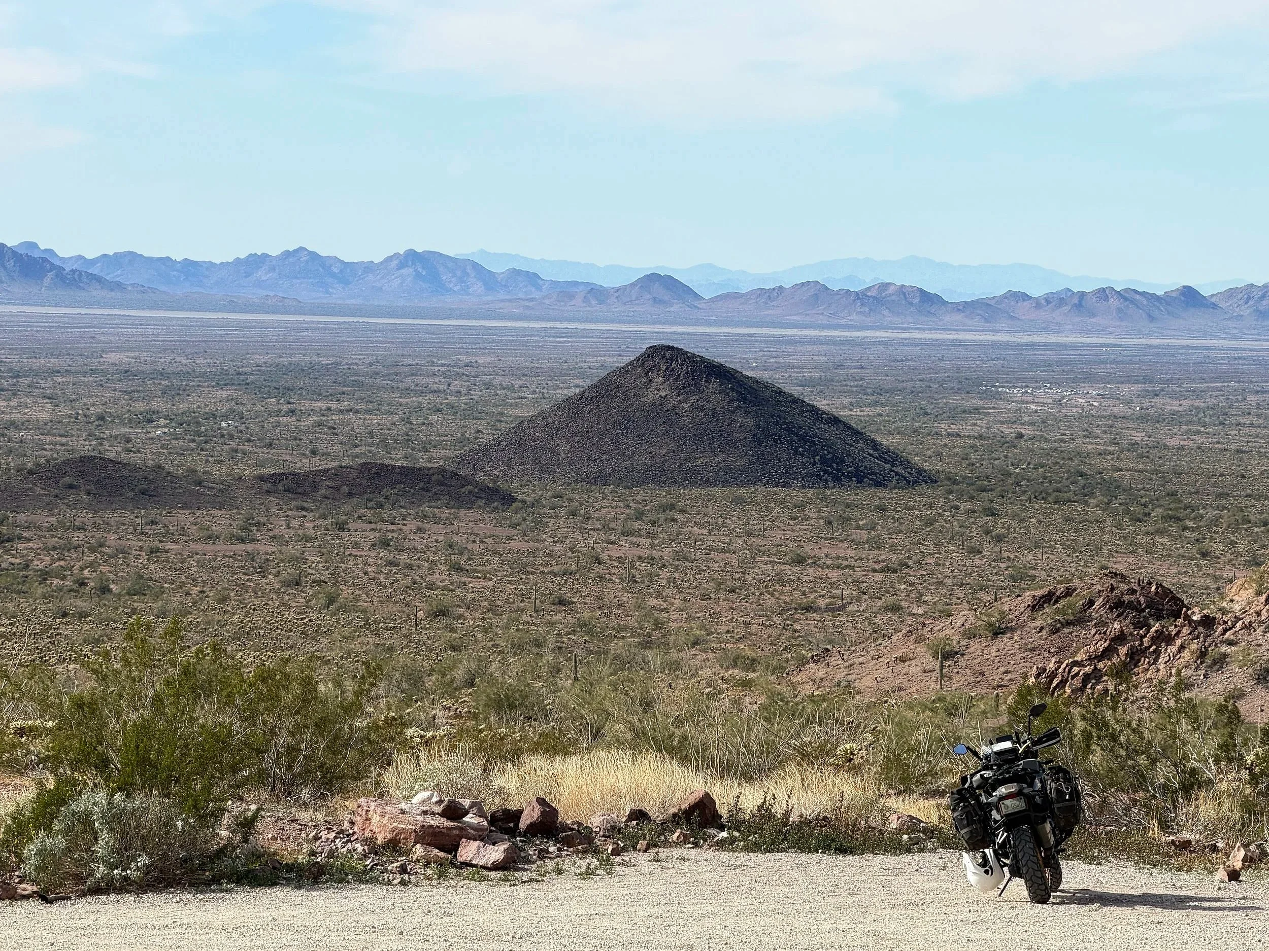
The initial entry onto Palm Canyon Road sets the stage for the adventure ahead, offering spectacular views of the jagged, steep ridges and peaks of the Kofa Mountains. Heading east on Palm Canyon Road, an open desert landscape dotted with saguaros and ocotillos paves the way, offering endless free camping opportunities on Bureau of Land Management public lands. While generally in good condition, be mindful of deep ruts and sandy patches in the road. After 3 miles, you'll officially enter the refuge. This also marks the junction of Palm Canyon Road and Kofa Queen Canyon road, beginning the first leg of this 3-part out ride. Turn left onto Kofa Queen Canyon Road; it initially bends northwest, then veers abruptly east, heading straight into the Kofa Mountains.
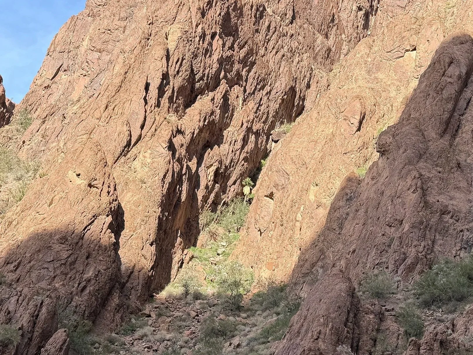
Kofa Mountain Range
Kofa Queen Canyon Road, named after the nearby historic King of Arizona gold mine, is an intermediate level route to a landmark that appears as creepy as it sounds: “Skull Rock.” This 10-mile segment leads deep into the Kofa Mountains as the 2-track rocky trail gets more rugged the further you go. At the 3-mile mark, turn off to the right to a secluded viewpoint of Signal Peak, the highest point in the Kofa Mountains at over 4,800 feet. Back on the trail, continue on Kofa Queen Canyon Road for approximately 2 more miles to Skull Rock. This is where your off-road skills will be tested, especially on a big adventure bike. Be prepared to stand up on the foot pegs the entire time while navigating through long, loose rock gardens. At the 5-mile mark, keep an eye out for a rock formation on the left side of the trail resembling a human cranium with a mouth blacked out from years of campfires stoked inside of it, otherwise known as Skull Rock. Time to dismount, hydrate, grab a snack from your tank bag, or simply absorb the solitude, remoteness, and scenic surroundings before heading back to Palm Canyon Road.
Kofa Queen Canyon Road
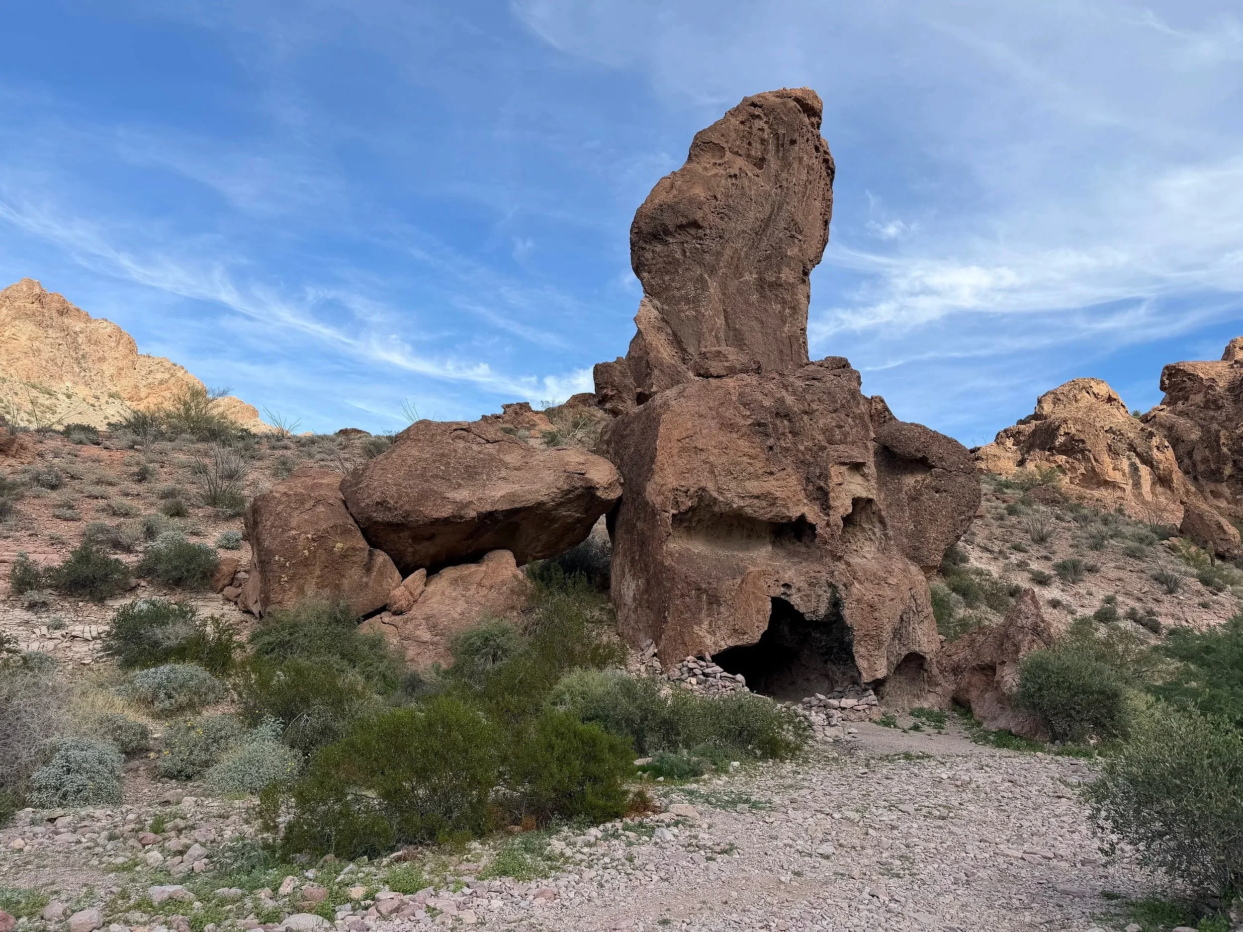
Skull Rock
When you get back to Palm Canyon Road, turn left and ride 6 miles to the Palm Canyon trailhead. A small placard posted at the start of the trail explains how the canyon was formed over millions of years. Time to shed your riding gear and swap out boots for hikers if you have them. Most of the trail is a narrow, easy path that slowly climbs in elevation with a few areas near the end with loose and large rocks. The trek is just over a half of a mile before it vanishes into the edge of the canyon’s wall. As you make your way in, you should be able to see the palms growing out of the crevices on the other side of the canyon. It is unbelievable how the palms can grow in such an obscure place. The trail ends abruptly on the side of the canyon wall leaving nowhere to go except to turn around and take a moment to enjoy the incredible view.
California Fan Palm
The end of the Palm Canyon Trail
After returning to the bike, proceed on Palm Canyon Road back the way you came to the western boundary of Kofa National Wildlife Refuge where a cultural landmark punctuates the end of this route. Known as the “Spiral Labyrinth,” an unknown land artist created a 90-foot diameter spiral with 21 gravel circles on the desert floor, first appearing around 2010. It is located close enough to Palm Canyon Road that you can ride out to it. Finding it, however, can be the most challenging part. A symbol of growth, evolution, and spiritual journey, the spiral also represents life's cyclical nature, signifying change, connection, and continuous flow. In the center of the labyrinth lies an ancient Native American Kokopelli figure, widely regarded as a messenger, storyteller, and symbol of renewal. It is also common to find small keepsakes, messages, and memorial items left in the center of the spiral by others who have found its location. What better way to leave this special place than to spend some time here.
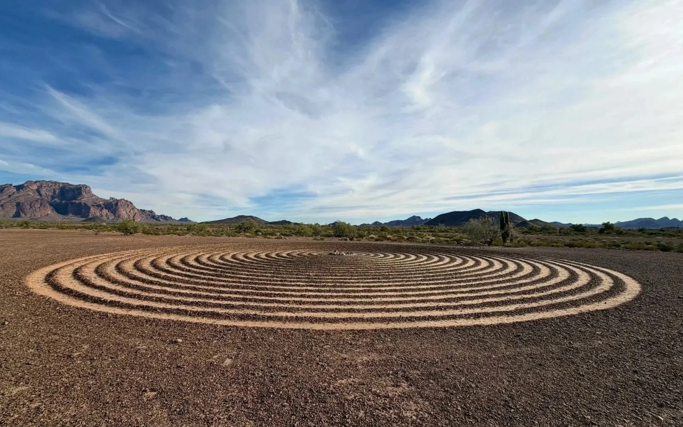
Spiral Labrynth 33.376564, -114.167315.
Kofa National Wildlife Refuge presents a rustic, Patagonian-like riding environment, offering an unforgettable connection to its untamed wilderness. This 3-part immersive route, encompassing Palm Canyon Road, Kofa Queen Canyon Road, and Palm Canyon Trail, stretches 69 miles from Quartzite. Anticipate a 4-5 hour journey to complete the entire route. From expansive mountain ranges to unique California Fan Palms, volcanic rock formations, and the possibility of spotting a herd of Desert Bighorn Sheep, this excursion is truly special and well worth exploring from its rugged trails. Whether you make it a trip in and of itself, camp overnight in its wilderness, or combine it with local routes in the area, such as the Arizona Peace Trail, Alamo Road, or Salome Highway, you will not be disappointed with all this lost highway has to offer. Ride safe and enjoy the adventure.
Note: Mileages are approximate. Each rider is responsible for checking the current road conditions and assessing their own skills to ensure safety. All routes are provided "as is" without any liability.
Discalimer: Logbook entry content here is original and not AI-written. It consists of my personal accounts after scouting the routes myself.
Copyright Protected © 2026 Lost Highways LLC. All rights reserved.