Florence-Kelvin Highway
During the 1870s, stage lines connected the growing settlements and mining areas across the Arizona Territory. Traveling on these rural routes presented risks far greater than those faced by most travelers today. Unpredictable weather conditions, mechanical breakdowns, robberies, and encounters with venomous animals were typical occurrences for commuters. Riding by stagecoach was no easy task. The journey was long, difficult, and uncomfortable, with little protection from the harsh desert elements. Despite the challenges, these routes were vital to westward expansion. While the gold rush of the 1800s drew people to frontier towns in the American West, it was the discovery of silver in the San Carlos Apache Reservation near the Arizona mining town of Globe that marks the origins of the Florence-Kelvin Highway. Today, this remote, scenic, and historic highway traces the original wagon road traveled by stagecoaches over 130 years ago.
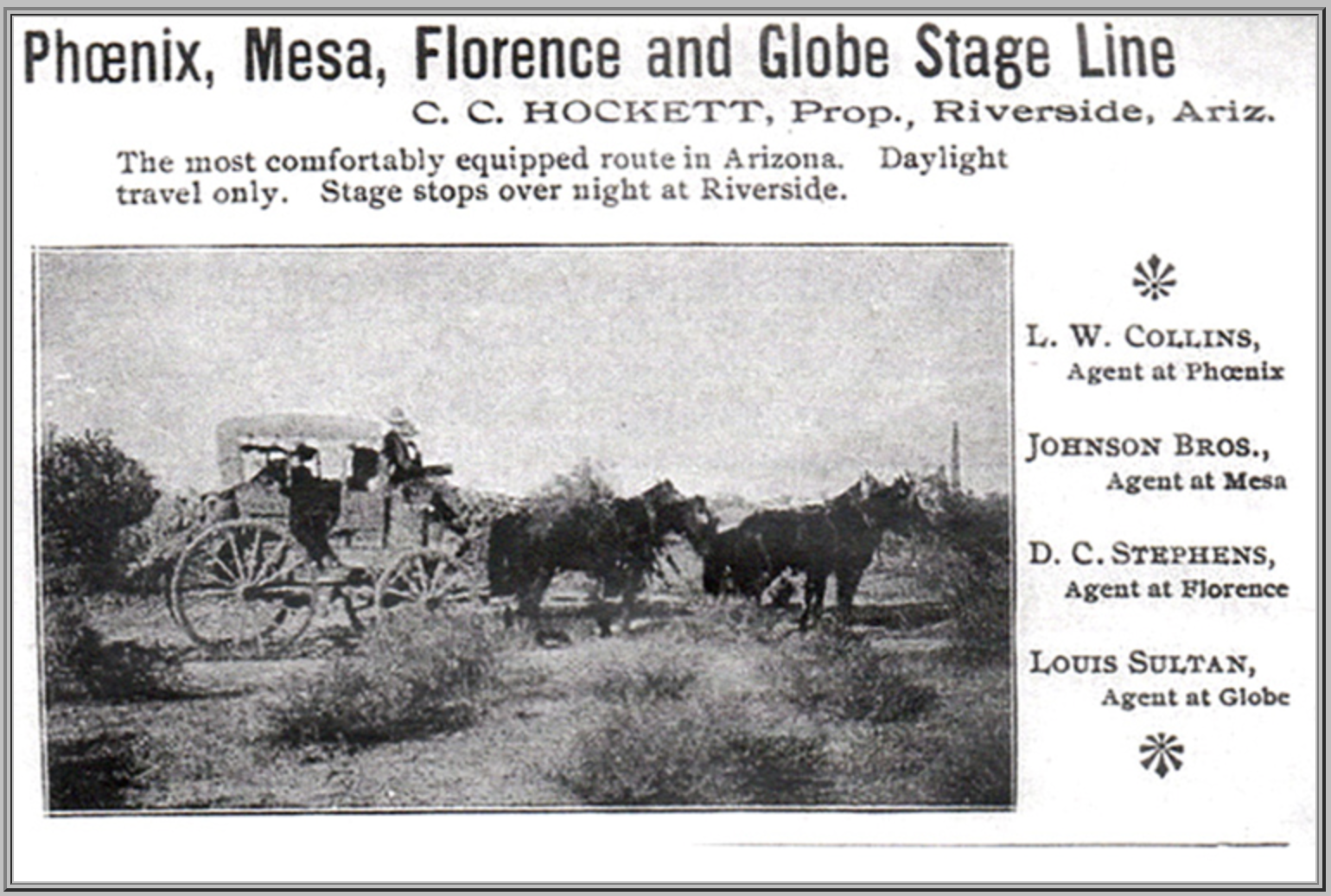
Photo obtained from Pinal County Historical Society Museum
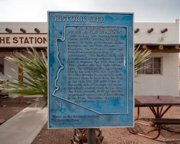
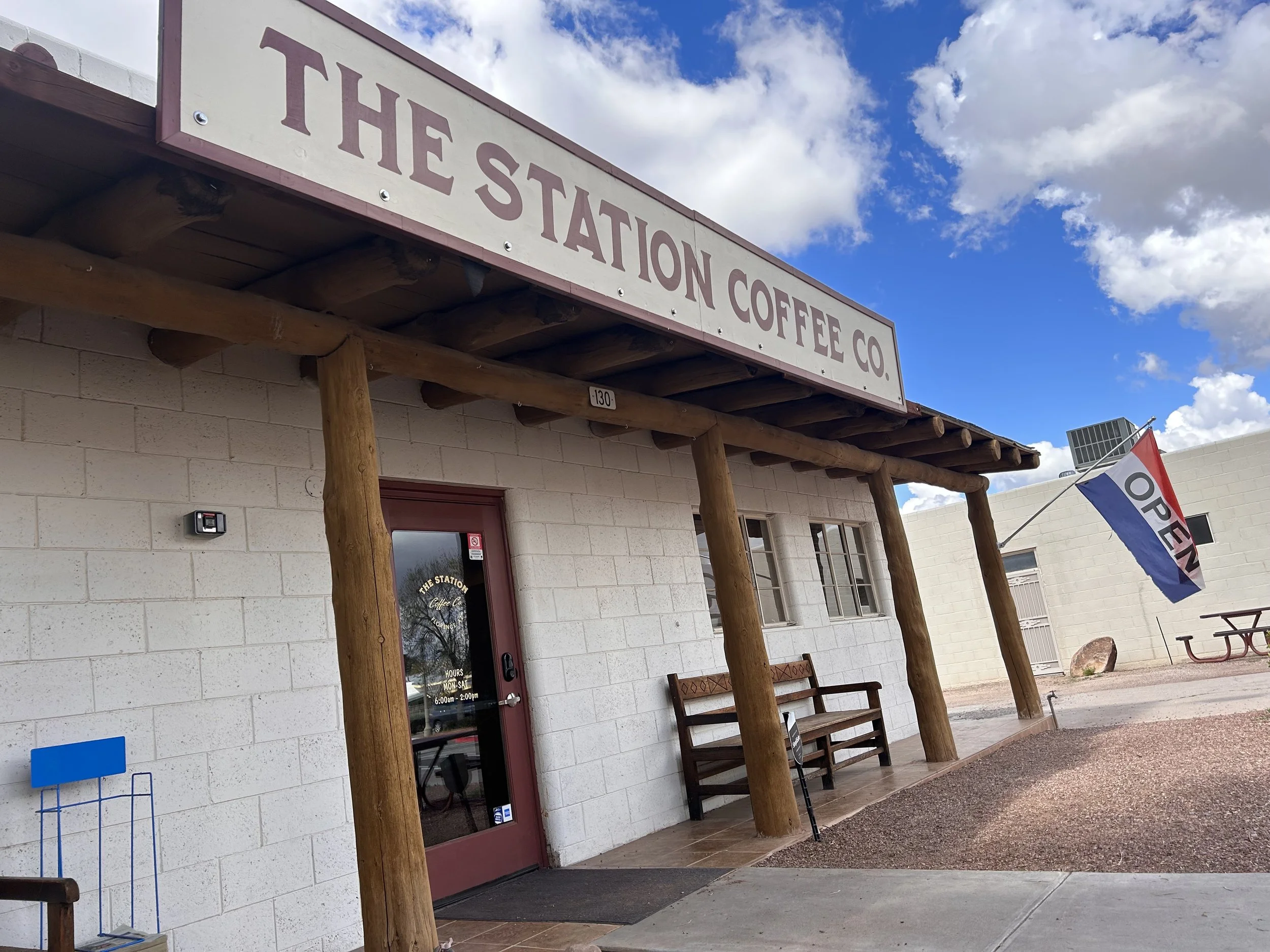
The Florence-Kelvin Highway begins approximately 60 miles east of Phoenix in the town of Florence. The 32-mile passage connects State Route 79 to State Route 177, crossing over the Gila River and through the small town of Kelvin. Established in 1866, Florence is one of Arizona's oldest towns, with a rich history in farming, ranching, and especially silver mining. Today, Florence features 25 historic buildings and sites on the National Register of Historic Places, including the Old 1948 Florence Town Hall, which now operates as a coffee shop. It's the ideal place to top up on fuel and caffeine before heading out on this route.
For the first few miles, the highway is unassuming, but the desert quickly transforms from a wide-open, barren space into a picturesque landscape, covered in creosote bushes, chollas, and ocotillos. The topography, climate, and vegetation in this area remain unchanged since the 1800s. Soon enough, you'll be riding through the vast Sonoran Desert, blanketed with Saguaro cacti to the south as far as the eye can see, while rolling mountains to the east signal the elevation to come. The Sonoran Desert extends across parts of Arizona, California, and Mexico, with approximately 22 million acres located in the southern third of Arizona. The first stretch of road on this route truly offers a unique experience of this remarkable region.

Florence-Kelvin Highway - 32°59'15.2"N 111°12'59.4"W
After 20 miles, you'll encounter rock formations composed of large, stacked boulders – a curious outcrop that seems out of place in the desert landscape. Known as "The Boulders" this quiet and scenic spot offers a vista overlooking rugged mountain ranges in the distance. Turning on to Cochran Road puts you on a sandy path leading to a serene view of the boulders up close, an area often used for off-grid camping. It's well worth the detour. Continuing east on the Florence-Kelvin Highway, the pavement transitions to gravel, and then to dirt for the remainder of the route. This section offers a sense of solitude and remoteness, with long range views of the Tortilla Mountains, a complete contrast to the Sonoran Desert landscape.
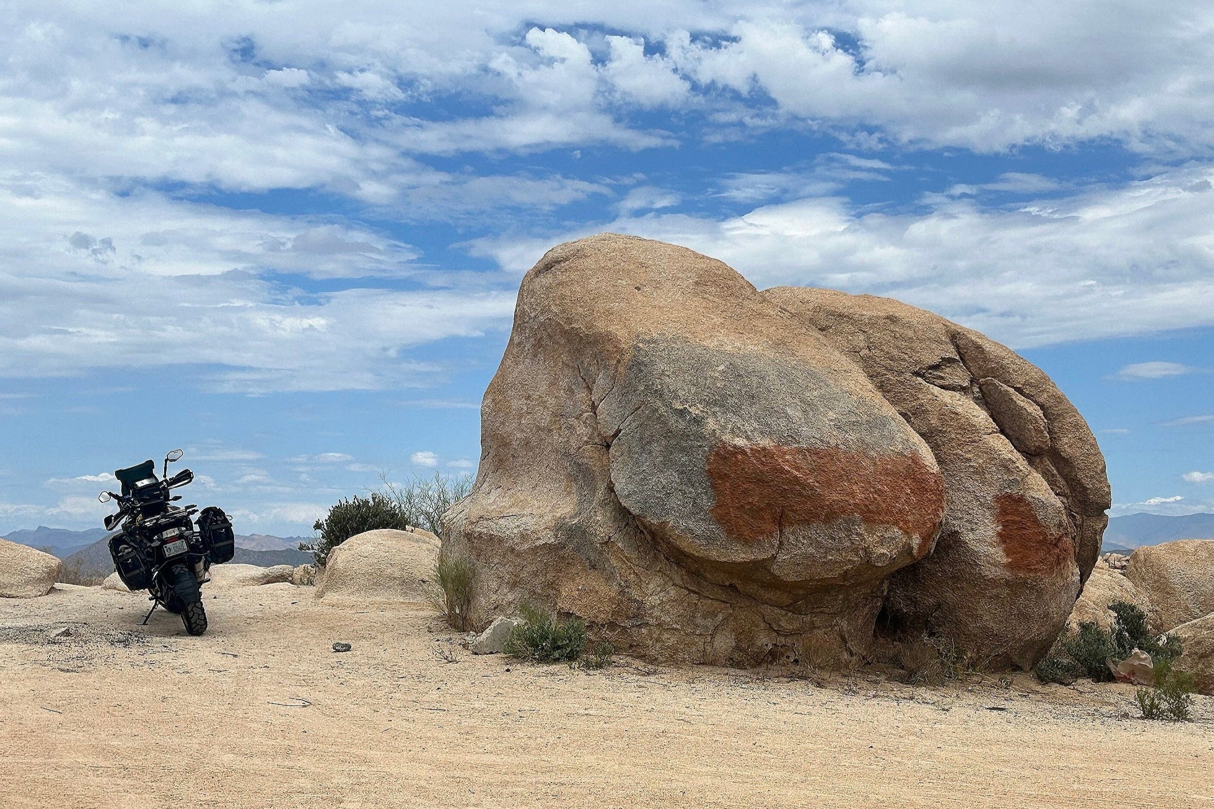
The Boulders - 32°59'19.6"N, 111°06'58.4"W
Follow the dirt road through rugged terrain as you make your way toward the White Canyon Wilderness. Be prepared for sharp curves on loose dirt and sandy trail surfaces. Just before the town of Kelvin, keep a lookout for the trailhead parking area for the Arizona National Scenic Trail on the south side of the road. This non-motorized trail stretches 800 miles across the state, connecting deserts, mountains, forests, canyons, wilderness, history, and communities, from the international border with Mexico to the Arizona state line with Utah.

Florence-Kelvin Highway - 33°02'47.2"N 111°02'46.5"W
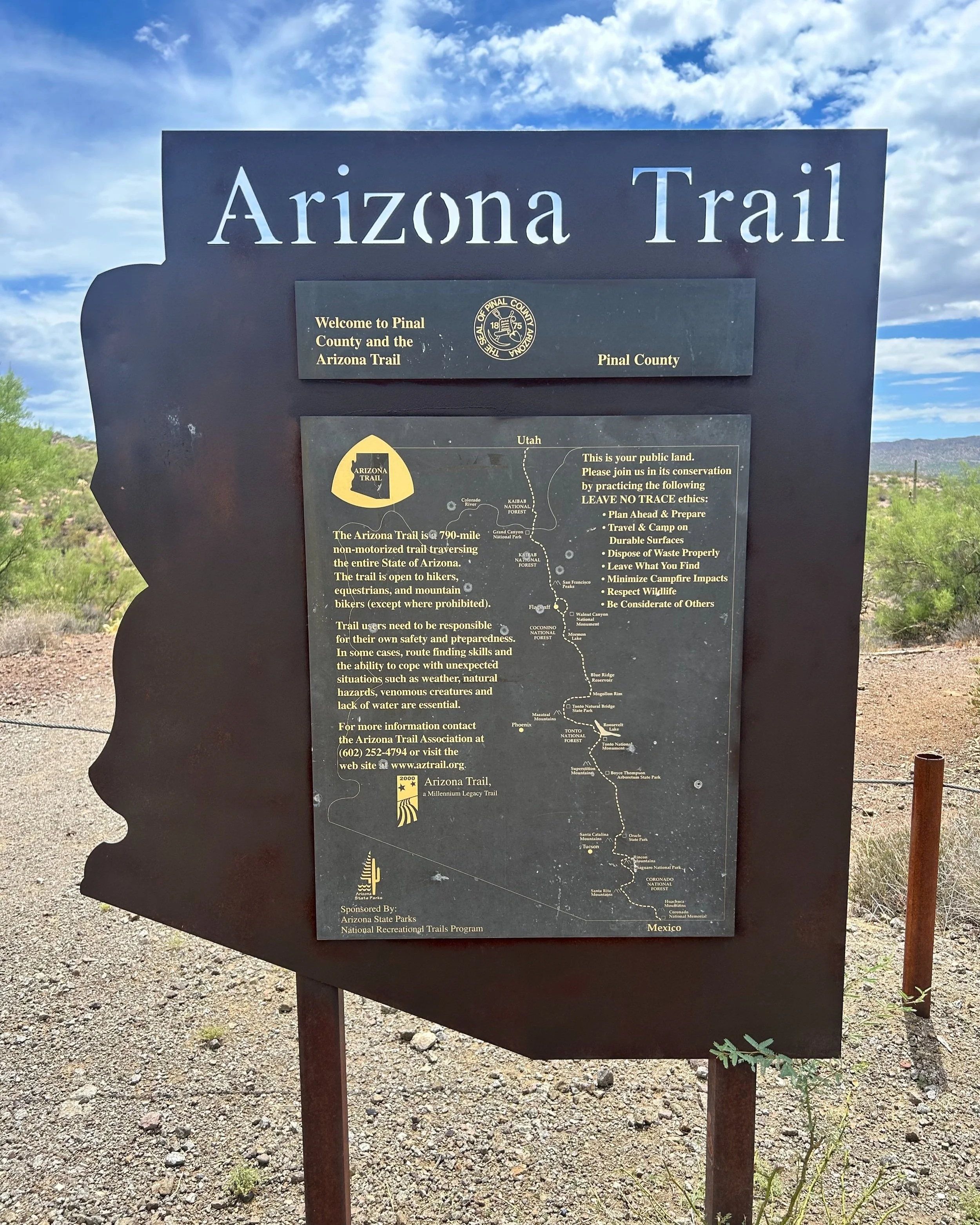
“In 2006, the Arizona trail was designated a State Scenic Trail by the Arizona Legislature, and in 2009 it received National Scenic Trail status by the United States Congress under the Omnibus Public Land Management Act. The Arizona Trail is one of only 11 National Scenic Trails in America and has become one of the premier long distance trails in the country.”
The Arizona Trail Association
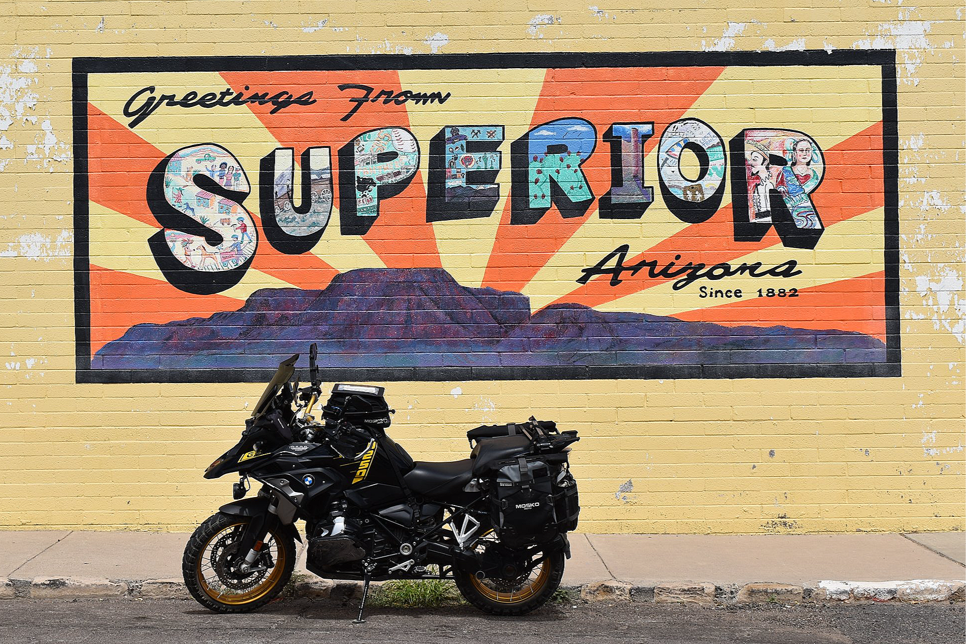
The final section of the Florence-Kelvin Highway crosses the Gila River via the Kelvin Bridge, a short, single-lane concrete bridge, before passing through the unincorporated town of Kelvin and intersecting with State Route 177. Located in the center of a copper corridor, State Route 177 is rated by Butler Motorcycle Maps as one of the “Best Rides in Arizona”. The paved roadway runs through the heart of Arizona’s mining country, connecting the towns of Winkleman and Superior, the oldest town in Pinal County. This entire route, including Florence-Kelvin Highway, can be completed as a loop in 2-3 hours, covering over 70 miles. It's perfect for a half-day out-ride or as part of a longer journey heading south toward Tucson or northeast to Globe. This road is not recommended for travel during summer months, as daytime temperatures can peak above 100 degrees. Winter months also pose risks due to hazardous conditions on State Route 177, including snow, ice, and freezing temperatures. So, plan your trip for spring or fall for the best riding experience.
The Florence-Kelvin Highway offers a historical perspective, allowing you to appreciate a time when travelers relied on horses and wagons for transportation. This road provides a unique opportunity to experience the Sonoran Desert, rugged mountain wilderness, and a thrilling ride on one of Arizona's most sought-after paved roads for motorcyclists. To obtain elevation profiles, GPS coordinates, and more points of interest for this route and many others you can purchase a “Best Dirt Roads in Arizona - Arizona Adventure Series Map” or “Best Paved Roads in Arizona” from Butler Maps. Use the code “losthighways” to receive a discount.
Enjoy the adventure and ride safe.
Note: Mileages are approximate. Each rider is responsible for checking the current road conditions and assessing their own skills to ensure safety. All routes are provided "as is" without any liability.
Discalimer: Logbook entry content here is original and not AI-written. It consists of my personal accounts after scouting the routes myself. Each route description is submitted for AI detection and plagiarism before being published.
Copyright Protected © 2025 Lost Highways LLC. All rights reserved.