Perkinsville Road
Perched on a mountainside in the Black Hills of Arizona sits the old mining town of Jerome. The panorama from the historic copper town offers a scenic view of the Mogollon Rim, a 200-mile-long escarpment marking the southwest boundary of the Colorado Plateau before dropping 2,000 feet into the Sonoran Desert. To the north lies the nearly 13,000-foot San Francisco Peaks volcanic mountain range. It's from this vantage point where the journey on Perkinsville Road begins. Steep cliffside drop offs with no guard rails, a historic bridge built during the Great Depression, and a 27-mile remote stretch of pavement through endless Ponderosa Pines in the Kaibab National Forest are just a few highlights on this unique motorcycle adventure route.

Jerome, Arizona in 1899 - Photograph from the Arizona State Library
Jerome-Perkinsville Road was originally built in the early 1900’s for the purpose of transporting beef and copper smelter. The discovery of copper deposits in Jerome at the turn of the century led to a population boom, reaching 15,000 residents—the town's highest recorded number—fueled by mining production. As a result, the small ranch town of Perkinsville to the north became a critical juncture for the Wilderness Route of the Verde Canyon Railroad. The short-line railway connected a copper processing plant in Clarkdale to the copper mines in Jerome. After the mines closed in the 1950s, Jerome took on a new identity as “America’s Largest Ghost Town”. Today, it’s a thriving destination town filled with shops, wineries, and art galleries with a mix of haunted and eclectic vibes.

With an elevation ranging from 4,600 feet to over 7,300 feet, this route showcases a variety of climates, scenic vistas, and a dramatic, captivating landscape. When starting out from Jerome, turn onto Jerome-Perkinsville Road at the Fire Station in the historic downtown area. Make a brief stop on the side of the road to admire the view of the Little Daisy Estate. The century-old 25,000 square foot private luxury mansion was constructed during World War I by Jimmy “Rawhyde” Douglas, the son of a Canadian mining engineer, and is still in operation today as a historical landmark and to host special events. About a mile further up the road, turn right at the Gold King Mine entrance to continue on Jerome-Perkinsville Road. Gold King Mine Ghost Town is a low-key tourist destination with dilapidated buildings, an old gold mine and a large collection of vintage and old rustic vehicles from the early 1900’s.
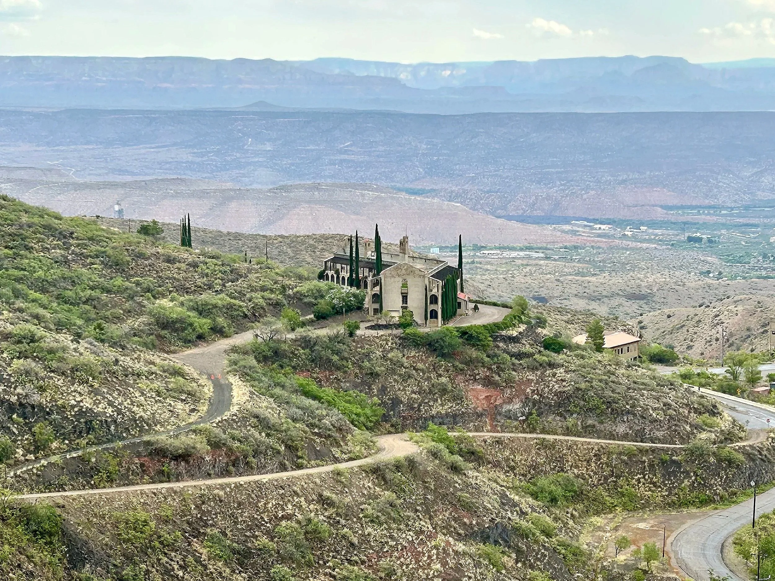
The Little Daisy Estate, built in 1918. GPS Coordinates: 34.754423211690884, -112.11437966831302
A sense of remoteness hits you immediately after passing the mine as you carve through the mountainous region and into the Prescott National Forest, leaving civilization far behind. This is where the pavement turns to a red dirt trail and winds along the contour of the mountains. The first part of this route has beautiful views and, on clear days, offers a high lookout over Sedona's red rocks. The dirt road transitions to gravel as you climb elevation and emerge from the mountains.

GPS Coordinates: 34.756306922234806, -112.13107096065374

Vista Overlook on Perkinsville Road. GPS Coordinates: 34.78387584509663, -112.15261039604675
Heading toward the town of Perkinsville, which is more of a ranch than a town, the surroundings change to yellow grasslands and scattered juniper trees. Watch out for roaming cattle on the trail. The primitive road can be impassable both during winter months and the summer monsoon season, when unpredictable storms and heavy rain can lead to washed-out roads, deep ruts and muddy road conditions. Due to the remoteness of this section, it's best to postpone the ride if the forecast is unfavorable to avoid getting stuck in the mud.

GPS Coordinates: 34.888369534921914, -112.19859033669334
The landscape transitions to wide-open pastures just before the Perkinsville Bridge. At the 17-mile mark, take the Perkinsville Bridge over the Verde River. The historic bridge was constructed in 1936 and is one of only two bridges built in Arizona during the Great Depression. On the other side of the bridge, you’ll find a fork in the road. Going right leads to the all but abandoned town of Perkinsville. Go left to continue on Perkinsville Road for another 8 miles on dirt and gravel trails until the surface transforms into a smooth, two-lane, paved scenic road through the Kaibab National Forest.
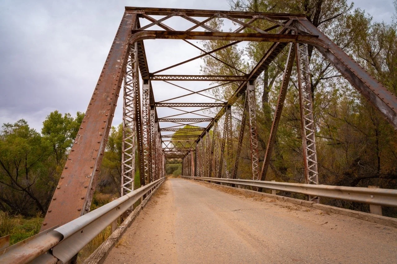
Perkinsville Bridge. GPS Coordinates: 34.89565574018262, -112.20557293622699
The last section of the journey is a quiet roadway at an elevation of 7,300 feet, through a forest of ponderosa pines, with numerous backroad offshoots to dispersed camping areas. After 25 miles of beautiful high-country scenery, you’ll arrive in the heart of Williams, Arizona, known as the "Gateway to the Grand Canyon". Perkinsville Road turns into Fourth Street and intersects with Route 66 in the Willams downtown area, offering a nostalgic Americana atmosphere. This marks the end of the route and the perfect place to grab coffee and a pastry at Brewed Awakenings to contemplate the road ahead. You'll have the option of retracing the same route back to Jerome or taking Interstate 40 east to Flagstaff, west to Kingman, or continue north to the South Rim of the Grand Canyon.
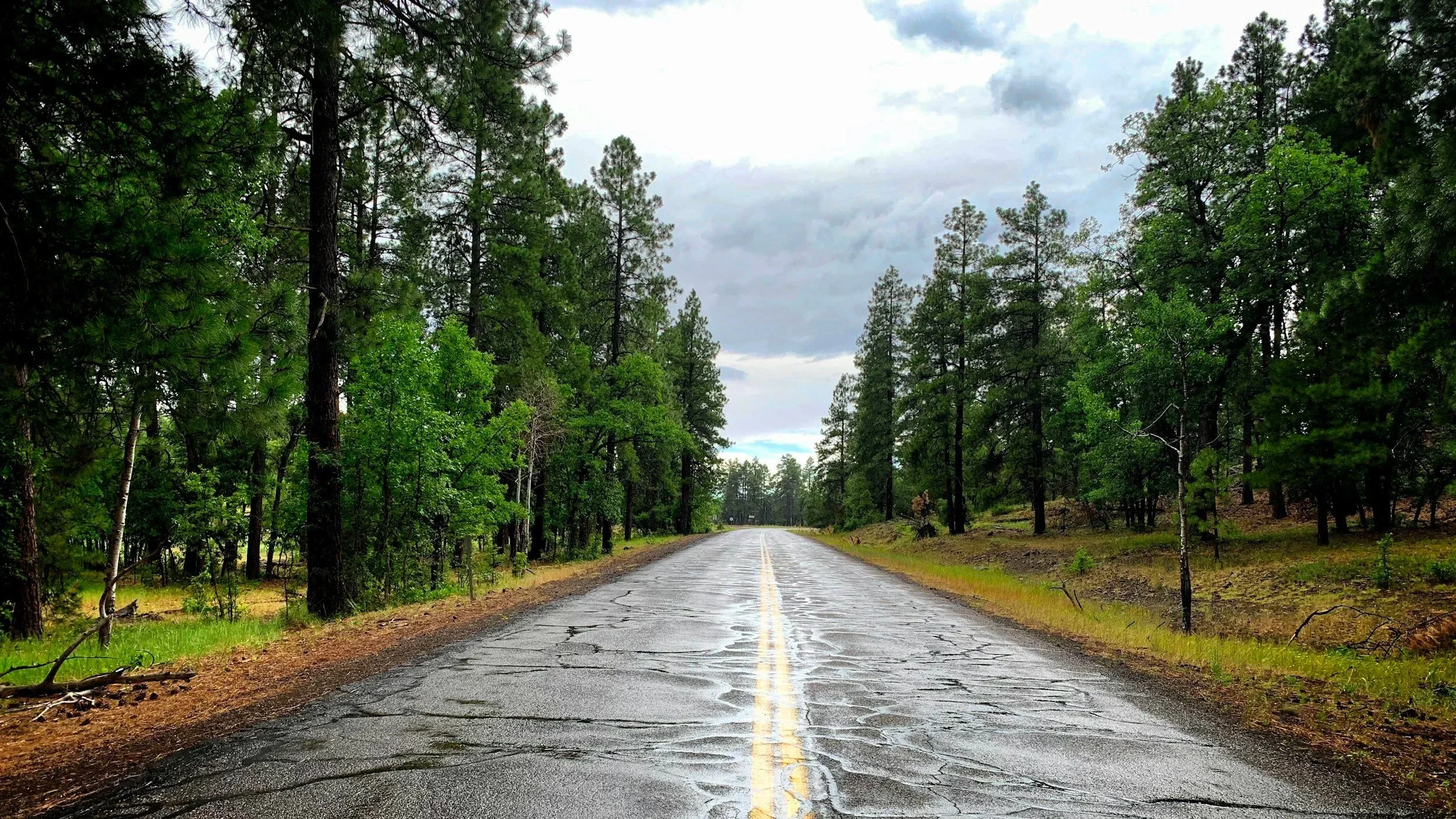
Dirt gives way to pavement as S. Perkinsville Road extends 27 miles, connecting to Historic Route 66 in Williams, AZ.
GPS Coordinates: 34.986874044951385, -112.24484483965142
Perkinsville Road is rated by Butler Motorcycle Maps as one of the best dirt roads in Arizona. The riding experience offers a multitude of terrains and landscapes in a remote region, traveling from Yavapai County in the central part of the state to Northern Arizona high country. Be mindful of weather patterns and road conditions. The elevation profile is above a mile, so bring plenty of water and layers for your riding gear. It will be an experience you won't forget, and along the way you'll retrace steps of a historic passage traveled by pioneers from the copper mining era of the late 1800s and early 1900s.
Enjoy the adventure and ride safe.
To obtain elevation profiles, GPS coordinates, and more points of interest for this route and many others you can purchase a “Best Dirt Roads in Arizona - Arizona Adventure Series Map” from Butler Maps. Use the code “losthighways” to receive a discount.
Note: Mileages are approximate. Each rider is responsible for checking the current road conditions and assessing their own skills to ensure safety. All routes are provided "as is" without any liability.
Discalimer: Logbook entry content here is original and not AI-written. It consists of my personal accounts after scouting the routes myself. Each route description is submitted for AI detection and plagiarism before being published.
Copyright Protected © 2025 Lost Highways LLC. All rights reserved.